Maps of Dolní Měcholupy

Orientační plán hlavního města Prahy s okolím

Ober Miecholup - c2099-1-001 - Kaiserpflichtexemplar der Landkarten des stabilen Katasters
1 : 2880
Ober Miecholup - c2099-1-002 - Kaiserpflichtexemplar der Landkarten des stabilen Katasters
1 : 2880
Hostiwarz (Hostiwarze) - c2250-1-004 - Kaiserpflichtexemplar der Landkarten des stabilen Katasters
1 : 2880
Hostiwarz (Hostiwarze) - c2250-1-005 - Kaiserpflichtexemplar der Landkarten des stabilen Katasters
1 : 2880
Hostiwarz (Hostiwarze) - c2250-1-003 - Kaiserpflichtexemplar der Landkarten des stabilen Katasters
1 : 2880
Hostiwarz (Hostiwarze) - c2250-1-006 - Kaiserpflichtexemplar der Landkarten des stabilen Katasters
1 : 2880
Hostiwarz (Hostiwarze) - c2250-1-001 - Kaiserpflichtexemplar der Landkarten des stabilen Katasters
1 : 2880
Hostiwarz (Hostiwarze) - c2250-1-002 - Kaiserpflichtexemplar der Landkarten des stabilen Katasters
1 : 2880
Orientační plán král. Hl. města Prahy

Petrowitz (Petrowice) - c5734-1-001 - Kaiserpflichtexemplar der Landkarten des stabilen Katasters
1 : 2880
Petrowitz (Petrowice) - c5734-1-002 - Kaiserpflichtexemplar der Landkarten des stabilen Katasters
1 : 2880
Orientierungsplan der Hauptstadt Prag
Jiřík, Rudolf
Hlavní město Praha s okolím

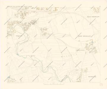
Unter Miecholup (Dolno Mecholupi) - c1341-1-002 - Kaiserpflichtexemplar der Landkarten des stabilen Katasters
1 : 2880
Unter Miecholup (Dolno Mecholupi) - c1341-1-001 - Kaiserpflichtexemplar der Landkarten des stabilen Katasters
1 : 2880
Unter Miecholup (Dolno Mecholupi) - c1341-1-003 - Kaiserpflichtexemplar der Landkarten des stabilen Katasters
1 : 2880
Jižní Město. - Háje Orientační plán 1. souboru
1 : 3500
Auto-Praha : automobilní plán Velké Prahy a příručka pro automobilisty
1 : 50000
Orientační plán hlavního města Prahy s okolím

Orientační plán hlavního města Prahy s okolím
1 : 5000
Orientační plán Hlavního města Prahy
Umgebung von Prag
Umgebung von Prag IV.

Výškopisný plán hlavního města Prahy s okolím

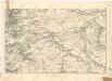
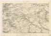
Bataille de Prague
1 : 62300 Praha (Česko) Therbu Coentgen, Heinrich Hugo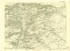
III. vojenské mapování 3953/3
1 : 25000
Bez titulu: Jihovýchodní okolí Prahy

[Praha a okolí]
Praha-oblast (Česko)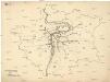
[Praha - projekt podzemní a nadzemní dráhy].
Praha (Česko) Poláček, K. Wallenfels, F.