Maps of Holešovice
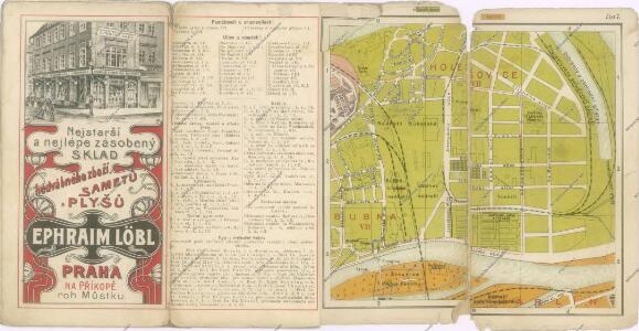
Wltžkův nejnovější orientační plán Prahy a nejbližšího okolí
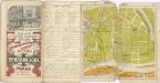
[Holešovice]
Holešovice (Praha, Česko) Srp, Jan Trávníček, František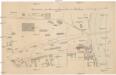
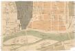
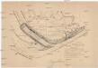
Situation des Eisenwalzwerkes in Bubna
Bubny (Praha, Česko) Brož, Josef Grefnetter, Josef Farský
Polohopisný plán Bubenče, Holešovic - Buben, pak částí Dejvic a Libně
[Praha-Holešovice]
Holešovice (Praha, Česko)
Holeschowitz - c1960-1-001 - Kaiserpflichtexemplar der Landkarten des stabilen Katasters
1 : 2880
Holeschowitz - c1960-1-005 - Kaiserpflichtexemplar der Landkarten des stabilen Katasters
1 : 2880
Holeschowitz - c1960-1-003 - Kaiserpflichtexemplar der Landkarten des stabilen Katasters
1 : 2880
Holeschowitz - c1960-1-004 - Kaiserpflichtexemplar der Landkarten des stabilen Katasters
1 : 2880
Holeschowitz - c1960-1-006 - Kaiserpflichtexemplar der Landkarten des stabilen Katasters
1 : 2880
Holeschowitz - c1960-1-002 - Kaiserpflichtexemplar der Landkarten des stabilen Katasters
1 : 2880
Polohopisný plán VII. části Prahy
Polohopisný plán VII. části Prahy

Polohopisný plán VII. části Prahy
1 : 4000
Polohopisný plán VII. části Prahy
1 : 4000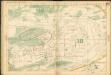
Auto-Praha : automobilní plán Velké Prahy a příručka pro automobilisty
1 : 50000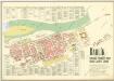
Karlín

Karolinenthal - c3051-1-002 - Kaiserpflichtexemplar der Landkarten des stabilen Katasters
1 : 2880
Karolinenthal - c3051-1-001 - Kaiserpflichtexemplar der Landkarten des stabilen Katasters
1 : 2880
[Pražské výstaviště]
Holešovice (Praha, Česko)
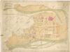
Město Karlín německý Karolinenthal v Čechách

Hynkův správný plán zemské jubilejní výstavy v Praze r. 1891
Holešovice (Praha, Česko) Šimáček, Josef Lutz Alois Hynek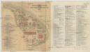
Situace Jubilejní výstavy obvodu obchodní a živnostenské komory v Praze 1908
Praha 7 (Česko) Planografie Ant. Vítek Junr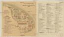
Situace Jubilejní výstavy obvodu obchodní a živnostenské komory v Praze 1908
Praha 7 (Česko) Planografie Ant. Vítek Junr
Plán Všeob. zemské jub. výstavy v Praze 1891

Jubilejní výstava obvodu Obch. a živnostenské komory v Praze roku 1908
1 : 2260 Holešovice (Praha, Česko)
Situační plán Všeobecné zemské jubil. výstavy v Praze 1891
Holešovice (Praha, Česko) Böttinger, Josef Líčka, Josef
Definitivní plán zemské jubilejní výstavy
1 : 3400 Praha (Česko) A. Beinwart
Plán všeob. zemské jub. výstavy v Praze 1891
Holešovice (Praha, Česko) M & M. Wltžek