Maps of Somerset
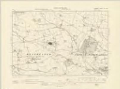
Somerset LXX.NW - OS Six-Inch Map
1 : 10560 Topographic maps Ordnance Survey Ordnance Survey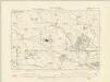
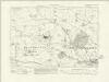
Somerset LXX.NW - OS Six-Inch Map
1 : 10560 Topographic maps Ordnance Survey Ordnance Survey
Somerset LXX.NW - OS Six-Inch Map
1 : 10560 Topographic maps Ordnance Survey Ordnance Survey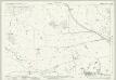
Somerset LXX.1 (includes: Ash Priors; Bishops Lydeard; Halse; Norton Fitzwarren) - 25 Inch Map
1 : 2500 Topographic maps Ordnance Survey Ordnance Survey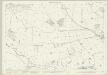
Somerset LXX.1 (includes: Ash Priors; Bishops Lydeard; Halse; Norton Fitzwarren) - 25 Inch Map
1 : 2500 Topographic maps Ordnance Survey Ordnance Survey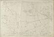
Somerset LXX.1 (includes: Ash Priors; Bishops Lydeard; Halse; Norton Fitzwarren) - 25 Inch Map
1 : 2500 Topographic maps Ordnance Survey Ordnance Survey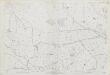
Somerset LXX.1 (includes: Ash Priors; Bishops Lydeard; Halse; Norton Fitzwarren) - 25 Inch Map
1 : 2500 Topographic maps Ordnance Survey Ordnance Survey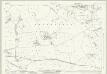
Somerset LXX.5 (includes: Bishops Lydeard; Halse; Milverton; Norton Fitzwarren; Oake) - 25 Inch Map
1 : 2500 Topographic maps Ordnance Survey Ordnance Survey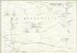
Somerset LXX.5 (includes: Bishops Lydeard; Halse; Milverton; Norton Fitzwarren; Oake) - 25 Inch Map
1 : 2500 Topographic maps Ordnance Survey Ordnance Survey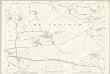
Somerset LXX.5 (includes: Bishops Lydeard; Halse; Milverton; Norton Fitzwarren; Oake) - 25 Inch Map
1 : 2500 Topographic maps Ordnance Survey Ordnance Survey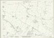
Somerset LXX.2 (includes: Bishops Lydeard; Kingston St Mary; Norton Fitzwarren; Staplegrove) - 25 Inch Map
1 : 2500 Topographic maps Ordnance Survey Ordnance Survey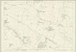
Somerset LXX.2 (includes: Bishops Lydeard; Kingston St Mary; Norton Fitzwarren; Staplegrove) - 25 Inch Map
1 : 2500 Topographic maps Ordnance Survey Ordnance Survey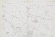
Somerset LXX.2 (includes: Bishops Lydeard; Kingston St Mary; Norton Fitzwarren; Staplegrove) - 25 Inch Map
1 : 2500 Topographic maps Ordnance Survey Ordnance Survey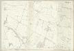
Somerset LXX.2 (includes: Bishops Lydeard; Kingston St Mary; Norton Fitzwarren; Staplegrove) - 25 Inch Map
1 : 2500 Topographic maps Ordnance Survey Ordnance Survey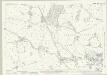
Somerset LXX.6 (includes: Bishops Hull Without; Bishops Lydeard; Norton Fitzwarren; Oake) - 25 Inch Map
1 : 2500 Topographic maps Ordnance Survey Ordnance Survey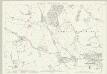
Somerset LXX.6 (includes: Bishops Hull Without; Bishops Lydeard; Norton Fitzwarren; Oake) - 25 Inch Map
1 : 2500 Topographic maps Ordnance Survey Ordnance Survey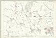
Somerset LXX.6 (includes: Bishops Hull Without; Bishops Lydeard; Norton Fitzwarren; Oake) - 25 Inch Map
1 : 2500 Topographic maps Ordnance Survey Ordnance Survey
ST12 - OS 1:25,000 Provisional Series Map
1 : 25000 Topographic maps Ordnance Survey Ordnance Survey
Lydiard St. Laurence
1 : 21120 This drawing covers part of Somerset. The narrow ridge of the Quantock Hills, depicted on the left by brushwork interlining, runs north west from Taunton Deane Vale for 19km to the Bristol Channel coast. At the top of the sheet, white rocks are indicated along the coastline of Bridgewater Bay. Woodland, heathland, formal parkland and arable land are distinguished by symbols.
Taunton (Hills) - OS One-Inch Revised New Series
1 : 63360 Topographic maps Ordnance Survey Ordnance Survey
Taunton (Outline) - OS One-Inch Revised New Series
1 : 63360 Topographic maps Ordnance Survey Ordnance Survey
Minehead - OS One-Inch Map
1 : 63360 Topographic maps Ordnance Survey Ordnance Survey
Cary's Improved Map of England and Wales
Cary, George, & Cary, John London : G. & J. Cary
An accurate map of Dorset Shire divided into hundreds
1 : 222000
An improved map of the county of Somerset
1 Karte : Kupferdruck ; 51 x 68 cm Bowen; Hinton sold by I. Hinton at the Kings Arms in St. Pauls Church Yard
Somersettensis comitatvs
1 Karte : Kupferdruck ; 36 x 48 cm Valck; Schenk apud G. Valk et P. Schenk
Somersettensis comitatvs
1 Karte : Kupferdruck ; 37 x 48 cm Blaeu Joan Blaeu
Dorset, Sheet 34 - Bartholomew's "Half Inch to the Mile Maps" of England & Wales
1 : 126720 Topographic maps Bartholomew, John George John Bartholomew & Co
An accurate map of Dorset Shire, divided into its hundreds
1 : 180000