Maps of Northumberland
Northumberland XVII.NW - OS Six-Inch Map
1 : 10560 Topographic maps Ordnance Survey Ordnance Survey
Northumberland (Old Series) XVII.1 (inset XVII.5) - 25 Inch Map
1 : 2500 Topographic maps Ordnance Survey Ordnance Survey
Northumberland (Old Series) XVII.1 (inset XVII.5) (includes: Bamburgh Castle; Bamburgh) - 25 Inch Map
1 : 2500 Topographic maps Ordnance Survey Ordnance Survey
Northumberland (New Series) XIII.10 (includes: Bamburgh Castle; Bamburgh) - 25 Inch Map
1 : 2500 Topographic maps Ordnance Survey Ordnance Survey
Northumberland (New Series) XIII.14 (inset XIII.15) (includes: Bamburgh; Burton; Monks House; Shoreston) - 25 Inch Map
1 : 2500 Topographic maps Ordnance Survey Ordnance Survey
Northumberland (New Series) XIII.14 (inset XIII.15) (includes: Shoreston) - 25 Inch Map
1 : 2500 Topographic maps Ordnance Survey Ordnance Survey
Bamburgh Castle f.2
This is a drawing of Bamburgh Castle, Northumberland,thought to date from the period 1539-47. The states of defences were a matter of great concern at this time as Henry VIII feared an invasion from the combined forces of France and Spain. In 1538 Francis I of France, and Charles V Holy Roman Emperor and King of Spain signed a peace treaty. This union gave rise to the possibility that France and Spain may combine forces to invade England. France was England’s historical enemy and Henry VIII’s divorce of Catherine of Aragon, Charles V’s aunt, had offended the militantly catholic King of Spain.
Northumberland nXIII.SW - OS Six-Inch Map
1 : 10560 Topographic maps Ordnance Survey Ordnance Survey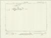
Northumberland nXIII.SE - OS Six-Inch Map
1 : 10560 Topographic maps Ordnance Survey Ordnance Survey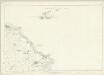
Northumberland XVII - OS Six-Inch Map
1 : 10560 Topographic maps Ordnance Survey Ordnance Survey
Farne. [Karte], in: Novus atlas absolutissimus, Bd. 8, S. 115.
1 Karte aus Atlas Janssonius Offizin
NU23 - OS 1:25,000 Provisional Series Map
1 : 25000 Topographic maps Ordnance Survey Ordnance Survey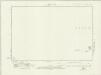
Northumberland nXIII.NW - OS Six-Inch Map
1 : 10560 Topographic maps Ordnance Survey Ordnance Survey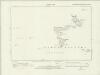
Northumberland nXIII.NE - OS Six-Inch Map
1 : 10560 Topographic maps Ordnance Survey Ordnance Survey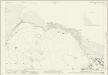
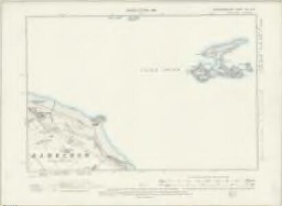
Northumberland (New Series) XIII.9 (inset XIII.5) (includes: Bamburgh Castle; Bamburgh; Budle; Ross) - 25 Inch Map
1 : 2500 Topographic maps Ordnance Survey Ordnance Survey
INSVLA SACRA; | Vulgo | HOLY ILAND [!]; | et | FARNE.
[Amsterdam : Joan Blaeu]
Insula Sacra; Vulgo Holy Iland; et Farne. [Karte], in: Theatrum orbis terrarum, sive, Atlas novus, Bd. 4, S. 530.
1 Karte aus Atlas Blaeu, Joan Blaeu, Willem Janszoon
Insula Sacra; Vulgo Holy Island; et Farne. [Karte], in: Le théâtre du monde, ou, Nouvel atlas contenant les chartes et descriptions de tous les païs de la terre, Bd. 4, S. 446.
1 Karte aus Atlas Blaeu, Willem Janszoon und Blaeu, Joan Blaeu, Willem Janszoon
Insvla sacra; vulgo Holy Iland; et Farne
1 Karte : Kupferdruck ; 37 x 49 cm Blaeu Joan Blaeu
Insula Sacra; Vulgo Holy Iland; et Farne. [Karte], in: Theatrum orbis terrarum, sive, Atlas novus, Bd. 4, S. 530.
1 Karte aus Atlas Blaeu, Joan Blaeu, Willem Janszoon
Holy Iland ; Garnsey ; Farne ; Iarsey
[Amstelodami] : [apud Joannem Janssonium]
Holy Island (Hills) - OS One-Inch Revised New Series
1 : 63360 Topographic maps Ordnance Survey Ordnance Survey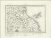
Holy Island (Outline) - OS One-Inch Revised New Series
1 : 63360 Topographic maps Ordnance Survey Ordnance Survey
Alnwick - OS One-Inch Map
1 : 63360 Topographic maps Ordnance Survey Ordnance Survey
Northumberland, North, Sheet 1 - Bartholomew's "Half Inch to the Mile Maps" of England & Wales
1 : 126720 Topographic maps Bartholomew, John George John Bartholomew & Co
Sheets 68-69. (Cary's England, Wales, and Scotland).
1 : 360000 Cary, John, ca. 1754-1835
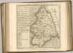
A new improved map of Northumberland
1 Karte : Kupferdruck ; 67 x 50 cm Kitchin; Hinton sold by J. Hinton at the Kings Arms in St. Pauls Church Yard
Comitatvs Northvmbria; vernacula Northvmberland
1 Karte : Kupferdruck ; 39 x 48 cm Blaeu Joan Blaeu