Maps of Una-Sana Canton
Accuratissima totius Savi area, in VI. Tabulis Geographicis repreasentata ab utraqve sua Origine usqve ad Illapsum in Danubium: nec non totius Labaci Fluvii una cum incurrentibus Fluminibus et adjacentibus Locis ac confiniis].
Mollova mapová sbírka Renner, F. C. Kaltschmidt, Abraham
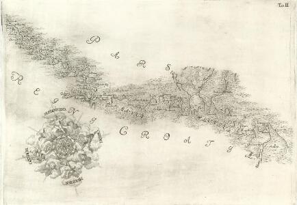
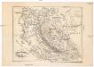
Pars Regni Croatiae
Mollova mapová sbírka Renner, F. C. Kaltschmidt, Abraham
Pars Styriae Pars Regni [Ca]rnioliae Croatiae
Mollova mapová sbírka Renner, F. C. Kaltschmidt, Abraham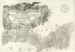
Ausführlicher Plan des gantzen Sau-Stroms, in VI. Tabellen vorgestellet, von seinen beyden Ursprüngen bis Zum Einfall in die Donau: wie auch des gantzen Laybaci-Flusses, sambt allen darein-fallengen Elüssen und daran liegenden Orthern, und Gränitzen.
Mollova mapová sbírka Renner, F. C. Kaltschmidt, Abraham
Carte Du Royaume De La Croatie
Mollova mapová sbírka
Charte des nordwestlichen Theil von Dalmatien
Dalmácie (Chorvatsko) Verlage der Kunst und Industrie
[Generalkarte von Bosnien und der Hercegovina]
1 : 300000 Bosnien-Herzegowina Bosnien
Generalkarte von Zentraleuropa
Ostrovy Quarnerské a Velebit
1 : 913000 Dalmácie (Chorvatsko)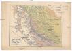
Ostrovy Quarnerské a Velebit
1 : 913000 Dalmácie (Chorvatsko)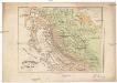
Ostrovy Quarnerské a Velebit
1 : 913000 Dalmácie (Chorvatsko)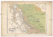
Ostrovy Quarnerské a Velebit
1 : 913000 Dalmácie (Chorvatsko)
Übersicht des Feldzuges 35 v. Chr.
1 : 200000 Südosteuropa Illyrien Feldzug Augustus
Grenzgebiet von Zagrabiensis und Corbaviensis
1 : 1850000 Diözese Krbava, Diözese Zagreb, Grenze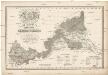
Mappa comitatus Zagrabiensis
1 : 240000 Záhřeb-oblast (Chorvatsko) Szemán, Joseph Kaiser, J. F.
Kostajnica
1 : 200000 Bosanska Kostajnica (Bosna a Hercegovina) Kartografska radionica
Karte vom Liccaner Grenz Regiment
1 : 105000 Chorvatsko Kossovich, Mathias Kaiser, J.F.
Senj
1 : 200000 Kartografska radionica
Bihac und Krupa.
from Spezialkarte der osterreichisch-ungarischen Monarchie.
Ivanic Klostar und Moslavina.
from Spezialkarte der osterreichisch-ungarischen Monarchie.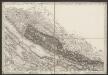
[Umgebung von Starigrad-Paklenica]
Kroatien Dalmatien Bezirk Zadar-Knin Umland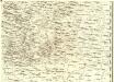
Ducatus Carnioliae Tabula Chorographica Iusu Sumptuque inclytorum Provinciae Statuum.
1 : 100000 Mollova mapová sbírka Florjančič de Grienfeld, Janez Dizma
Dolnji Lapac und Kulen-Vakuf.
from Spezialkarte der osterreichisch-ungarischen Monarchie.
Velika Corica und Lekenik.
from Spezialkarte der osterreichisch-ungarischen Monarchie.
Vrhpolje und Bosn. Petrovac.
from Spezialkarte der osterreichisch-ungarischen Monarchie.
Vrtoce DL. und Ribnikgrn.
from Spezialkarte der osterreichisch-ungarischen Monarchie.
Yugoslavia 1:100,000, Samobor
Yugoslavia 1:100,000 , Series GSGS 4396. Great Britain. War Office. [London] : War Office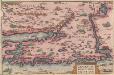
Zarae, Et Sebenici Descriptio [Karte], in: Theatrum orbis terrarum, S. 262.
1 Karte aus Atlas Ortelius, Abraham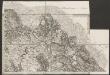
Umgebungen von Knin
Kroatien Dalmatien Knin Umland