Maps of Una-Sana

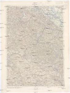
Kostajnica
1 : 200000 Bosanska Kostajnica (Bosna a Hercegovina) Kartografska radionica
Bihac und Krupa.
from Spezialkarte der osterreichisch-ungarischen Monarchie.
Prijedor und Sanski Most.; Spezialkarte der osterreichisch-ungarischen Monarchie.
from Spezialkarte der osterreichisch-ungarischen Monarchie. Austro-Hungarian Monarchy. Militärgeographisches Institut.,
Kostajnica und Novi.; Spezialkarte der osterreichisch-ungarischen Monarchie.
from Spezialkarte der osterreichisch-ungarischen Monarchie. Austro-Hungarian Monarchy. Militärgeographisches Institut.,
Sisek und Sunja.; Spezialkarte der osterreichisch-ungarischen Monarchie.
from Spezialkarte der osterreichisch-ungarischen Monarchie. Austro-Hungarian Monarchy. Militärgeographisches Institut.,
Zirovac und Vrnograc.; Spezialkarte der osterreichisch-ungarischen Monarchie.
from Spezialkarte der osterreichisch-ungarischen Monarchie. Austro-Hungarian Monarchy. Militärgeographisches Institut.,
Petrinja und Topusko.; Spezialkarte der osterreichisch-ungarischen Monarchie.
from Spezialkarte der osterreichisch-ungarischen Monarchie. Austro-Hungarian Monarchy. Militärgeographisches Institut.,
Gefecht bei Peči
1 : 25000 Bosnien-Herzegowina Peć Gefecht
Der Plan Siscias von Marsigli, in den Maßstab der Hauptkarte verkleinert
Kroatien Illyrien Sisak Marsili, Luigi Ferdinando
Plan der Belagerung von Siscia
1 : 25000 Kroatien Illyrien Belagerung Augustus
Plan des Gefechtsfeldes von Bihač
1 : 25000 Bosnien-Herzegowina Bihać Gefechtsfeld Sufsich, J.
Plan des Gefechtsfeldes von Bihač
1 : 25000 Bosna a Hercegovina Sussich, J. K.k. Generalstab
Plan des Gefechtsfeldes von Bihač
1 : 25000 Bosna a Hercegovina Sussich, J. K.k. Generalstab
Plan des Gefechtsfeldes von Bihač
1 : 25000 Bosnien-Herzegowina Bihać Gefechtsfeld Sufsich, J.
[Generalkarte von Bosnien und der Hercegovina]
1 : 300000 Bosnien-Herzegowina Bosnien
Generalkarte von Zentraleuropa
Übersicht des Feldzuges 35 v. Chr.
1 : 200000 Südosteuropa Illyrien Feldzug Augustus
Vrhpolje und Bosn. Petrovac.
from Spezialkarte der osterreichisch-ungarischen Monarchie.
Dolnji Lapac und Kulen-Vakuf.
from Spezialkarte der osterreichisch-ungarischen Monarchie.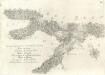
Accuratissima totius Savi area, in VI. Tabulis Geographicis repreasentata ab utraqve sua Origine usqve ad Illapsum in Danubium: nec non totius Labaci Fluvii una cum incurrentibus Fluminibus et adjacentibus Locis ac confiniis].
Mollova mapová sbírka Renner, F. C. Kaltschmidt, Abraham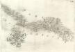
Pars Regni Croatiae
Mollova mapová sbírka Renner, F. C. Kaltschmidt, Abraham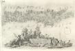
Pars Styriae Pars Regni [Ca]rnioliae Croatiae
Mollova mapová sbírka Renner, F. C. Kaltschmidt, Abraham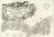
Ausführlicher Plan des gantzen Sau-Stroms, in VI. Tabellen vorgestellet, von seinen beyden Ursprüngen bis Zum Einfall in die Donau: wie auch des gantzen Laybaci-Flusses, sambt allen darein-fallengen Elüssen und daran liegenden Orthern, und Gränitzen.
Mollova mapová sbírka Renner, F. C. Kaltschmidt, Abraham
Sclavonia. Bosnia
Mollova mapová sbírka Hoffmann, Johannes Hoffmann, Johann
Vermehrte und Verbesserte Landkarten des Königreichs Ungarn :
1 : 500000 Mollova mapová sbírka Stier, Martin Böner, Johann-Alexander Endter, Martin
Croatia
Mollova mapová sbírka Hoffmann, Johannes Hoffmann, Johann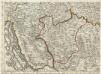
Augustissimo Romanor. Imperatori Iosepho I. Hungaria Regi Invictissimo Mappam Hanc Regni Hungariae
1 : 540000 Mollova mapová sbírka Müller, Johann Christoph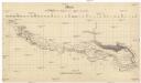
Skelett zur Übersicht der Savestrecke von Agram bis Semlin
1 : 580000 Záhřeb-oblast (Chorvatsko)
Zagreb, Brod, Osijek, Glina, Knin, Sarajevo
1 : 750000 Glina (Chorvatsko) Cronenberg, E. K. u. k. Militärgeographisches Institut