Maps of Zagrebacka

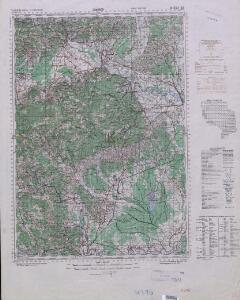
Yugoslavia 1:100,000, Samobor
Yugoslavia 1:100,000 , Series GSGS 4396. Great Britain. War Office. [London] : War Office
Gurkfeld.Rann und Samobor.
from Spezialkarte der osterreichisch-ungarischen Monarchie.
Gurkfeld Rann
1 : 75000 Krško
Jaska.; Spezialkarte der osterreichisch-ungarischen Monarchie.
from Spezialkarte der osterreichisch-ungarischen Monarchie. Austro-Hungarian Monarchy. Militärgeographisches Institut.,
Ducatus Carnioliae Tabula Chorographica Iusu Sumptuque inclytorum Provinciae Statuum.
1 : 100000 Mollova mapová sbírka Florjančič de Grienfeld, Janez Dizma
Ducatus Carnioliae Tabula Chorographica Iusu Sumptuque inclytorum Provinciae Statuum.
1 : 100000 Mollova mapová sbírka Florjančič de Grienfeld, Janez Dizma
Unter Krain
1 : 500000 Unterkrain
Mappa comitatus Zagrabiensis
1 : 240000 Záhřeb-oblast (Chorvatsko) Szemán, Joseph Kaiser, J. F.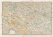
Karte des Krainisch-Kroatischen Gebirgslandes
1 : 250000 Chorvatsko Ravenstein, Ludwig Ludwig Ravenstein
Reichsratwahlkarte
Carte Du Royaume De La Croatie
Mollova mapová sbírka
Krain-Küstenland
1 : 850000 Kraňsko Meyer, Joseph Bibliographisches Institut
Königreich Illyrien, gouvernement Laibach
1 : 450000 Ilýrie Renner Apelt, O. C.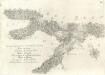
Accuratissima totius Savi area, in VI. Tabulis Geographicis repreasentata ab utraqve sua Origine usqve ad Illapsum in Danubium: nec non totius Labaci Fluvii una cum incurrentibus Fluminibus et adjacentibus Locis ac confiniis].
Mollova mapová sbírka Renner, F. C. Kaltschmidt, Abraham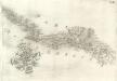
Pars Regni Croatiae
Mollova mapová sbírka Renner, F. C. Kaltschmidt, Abraham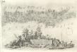
Pars Styriae Pars Regni [Ca]rnioliae Croatiae
Mollova mapová sbírka Renner, F. C. Kaltschmidt, Abraham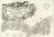
Ausführlicher Plan des gantzen Sau-Stroms, in VI. Tabellen vorgestellet, von seinen beyden Ursprüngen bis Zum Einfall in die Donau: wie auch des gantzen Laybaci-Flusses, sambt allen darein-fallengen Elüssen und daran liegenden Orthern, und Gränitzen.
Mollova mapová sbírka Renner, F. C. Kaltschmidt, Abraham
Karte vom Herzogthum Krain
1 : 290000 Kraňsko Loschan, Gottfried Stein, Carl
Celje
1 : 200000 Celje (Slovinsko) Kartografska radionica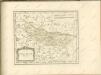

Grenzgebiet von Zagrabiensis und Corbaviensis
1 : 1850000 Diözese Krbava, Diözese Zagreb, Grenze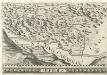
Stÿriae Ducatus Fertilisimi Nova Geographica Descriptio
1 : 200000 Mollova mapová sbírka Vischer, Georg Matthaeus Trost, Andreas
Übersicht der Krainer Metulum-Hypothesen
1 : 750000 Kroatien Ogulin (Region) Illyrien Augustus
Deutsche und Slowenen in der Untersteiermark nach dem Stande der Volkszählung von 1910
1 : 500000 Untersteiermark ethnische Gruppe
Routen von und nach dem Badeorte Töplitz
Varaždinske Toplice (Chorvatsko) C. Albrecht
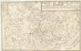
Rohitsch und Drachenburg.
from Spezialkarte der osterreichisch-ungarischen Monarchie.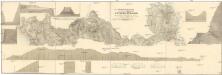
Situations Plan der königlich ungarisch priv. Louisen Strasse
1 : 73000 Metlika (Slovinsko) Schönvisner
Agram.
from Spezialkarte der osterreichisch-ungarischen Monarchie.
Rudolfswerth.
from Spezialkarte der osterreichisch-ungarischen Monarchie.