Maps of Landkreis Bamberg
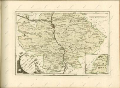
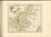
Des Bisthums Bamberg südliche Aemter
1 Karte : Kupferdruck ; 20 x 30 cm Reilly F. J. J. von Reilly
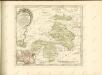
Sac. Rom. Imperii Principatus & Episcopatus Bambergensis Nova Tabula Geographica
1 : 260000 Mollova mapová sbírka Homann, Johann Baptist Homann, Johann Baptista
Deutsche Strassenprofilkarte für Rad - und Autofahrer 58 Nürnberg

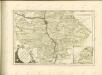
Tabulae geographicae principatus Brandenburg. Culmb. sive Baruthini
1 : 179600 Bavorsko severní (Německo) Lotter, Tobias Conrad Tob. Conrad Lotter
153. Bamberg, uit: Topographische Uebersichtskarte des Deutschen Reiches / herausgegeben v. d. Kartogr. Abt. d. Königl. Preuß. Landesaufnahme
1 : 200000 titelvariant: Topogr. Übersichtskarte des Deutschen Reiches; Annotatie: Titel boven bladen ook: Topogr. Übersichtskarte des Deutschen Reiches; Annotatie geografische gegevens: Op elk blad twee maatstokken: 10 Kilometer = 5,5 cm; 1 geogr. Meile = 3,6 cm; Legenda onder op elk blad Königlich Preußische Landesaufnahme. Kartographische Abtheilung [S.l : Königlich Preußische Landesaufnahme, Kartographische Abtheilung]
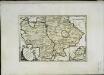
Principatus Brandenbvrgico Cvlmbacensis vel Barvthini
1 : 120000 Mollova mapová sbírka Cnopf, Matthäus Ferdinand Homann, Johann Baptista - dědici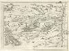
Geographica Provinciarum Sveviae Descriptio =
Mollova mapová sbírka Hurter, Johann Christoph Bodenehr, Johann Georg
Mappa Geographica Territorii Sacri Romani Imperii liberae Civitatis Norimbergensis
1 : 150000 Mollova mapová sbírka Cnopf, Matthäus Ferdinand Hauer, Daniel Adam Homann, Johann Baptista - dědici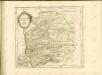

Territorivm Norimbergense
1 : 120000 Mollova mapová sbírka Schenk, Pieter Schenk, Peter I
Geographica Descriptio Montani cujusdam Districtus in Franconia in quo Illustrissimorum S. R. I. Comitum à Giech Particulare Territorium
1 : 65000 Mollova mapová sbírka Homann, Johann Baptist Homann, Johann Baptista
Territorivm Norimbergense
1 : 120000 Mollova mapová sbírka Blaeu, Willem Janszoon Blaeu, Willem Jansz.
Bezirck Der Nürnbergischen Pfleg Aembter Herrspruck Reicheneck Engelthal und Hohenstein im Alten Nordgau gelegen
1 : 45000 Mollova mapová sbírka Scheurer, Christoph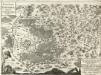
Territorium Norimbergense. Cum quibusdam adjacentibus locis
Mollova mapová sbírka Hoffmann, Johann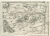
Geographica Provinciarum Sveviae Descriptio =
Mollova mapová sbírka Hurter, Johann Christoph Bodenehr, Gabriel
Nürnbergischer Bezirck
1 : 110000 Mollova mapová sbírka Scheurer, Christoph
Nürnbergischer Bezirck
1 : 110000 Mollova mapová sbírka Scheurer, Christoph
Norimberg. Agri, Fidissima Descrip.[Karte], in: Theatrum orbis terrarum, S. 241.
1 Karte aus Atlas Ortelius, Abraham Vrients, Jan Baptista
Norimberg. Agri, Fidissima Descrip.[Karte], in: Theatrum orbis terrarum, S. 149.
1 Karte aus Atlas Ortelius, Abraham
Territorium Norimbergense. [Karte] Nurnberg [1 Nebenkarte], in: Theatrum orbis terrarum, sive, Atlas novus, Bd. 1, S. 263.
1 Karte aus Atlas Blaeu, Joan Blaeu, Willem Janszoon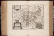
Territorivm Norimbergense
1 : 200000 Annotatie: Origineel is Blad 124 in atlas factice; Annotatie geografische gegevens: West boven; Inzet: Nurnberg Willem Jansz Blaeu 1571-1638 Amstelodami : exc. Guiljelm. Blaeuw
Territorium Norimbergense. [Karte], in: Le théâtre du monde, ou, Nouvel atlas contenant les chartes et descriptions de tous les païs de la terre, Bd. 1, S. 257.
1 Karte aus Atlas Blaeu, Willem Janszoon und Blaeu, Joan Blaeu, Willem Janszoon
Territorium Norimbergense. [Karte] Nurenberg [Nebenkarte], in: Novus atlas absolutissimus, Bd. 2, S. 235.
1 Karte aus Atlas Janssonius Offizin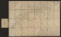
Territorium Norimbergense. [Karte] Nurnberg [Planvedute, Nebenkarte], in: Gerardi Mercatoris et I. Hondii Newer Atlas, oder, Grosses Weltbuch, Bd. 1, S. 310.
1 Karte aus Atlas Mercator, Gerhard und Hondius, Jodocus Jansson, Jan
Territorium Norimbergense. [Karte] Nurnberg., in: Novus Atlas, das ist, Weltbeschreibung, Bd. 1, S. 228.
1 Karte aus Atlas Blaeu, Joan Blaeu, Willem Janszoon
TERRITORIVM | NORIMBER- | GENSE
Amstelodami Exc. Guiljelm. Blaeuw