Maps of Guyana


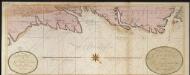
Facsimile: Part of Chart of the Guiana Coast by Thompson.
1 : 3000000 Faden, William, 1750?-1836
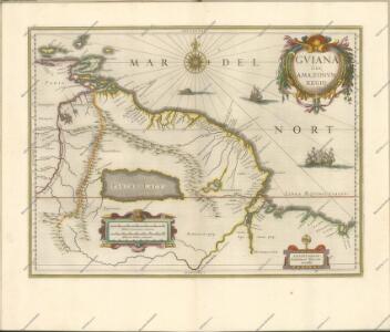
Facsimile: Guiana by Blaeuw.
1 : 7100000 Blaeuw, William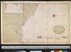
De kusten van Gujana in Westindia van Suriname tot Rio Oronoque, waerin tussen Cossewijne en Corretijne de riv. van Inikelke legt die bij ons onbekent was en in mijn groote caert van Suriname moet geteekent worden; voor de rest is omtrent de strekking van de riviere goede aenmerkingh
Suriname Gerard van Keulen
Facsimile: Surinam by Popple.
1 : 3787000 Popple, Henry
European Occupation in 1648.
1 : 2027520 Venezuela-British Guiana Boundary Commission
European Occupation in 1773.
1 : 2027520 Venezuela-British Guiana Boundary Commission
European Occupation in 1703.
1 : 2027520 Venezuela-British Guiana Boundary Commission
European Occupation in 1626.
1 : 2027520 Venezuela-British Guiana Boundary Commission
Grand View of European Occupation, 1597-1803 (1814).
1 : 2027520 Venezuela-British Guiana Boundary Commission
European Occupation in 1724.
1 : 2027520 Venezuela-British Guiana Boundary Commission
European Occupation in 1674.
1 : 2027520 Venezuela-British Guiana Boundary Commission
European Occupation in 1796.
1 : 2027520 Venezuela-British Guiana Boundary Commission
European Occupation in 1756.
1 : 2027520 Venezuela-British Guiana Boundary Commission
European Occupation in 1803 (1814).
1 : 2027520 Venezuela-British Guiana Boundary Commission
Boundaries Claimed or Proposed.
1 : 2027520 Venezuela-British Guiana Boundary Commission
European Occupation in 1597.
1 : 2027520 Venezuela-British Guiana Boundary Commission
Carta del Canton de Upata, Provincia de Guayana.
1 : 1300000 Codazzi, Agustin, 1793-1859
Orinoco.
1 : 2650000 Restrepo, Jose Manuel, 1781-1863
Drainage Basins.
1 : 2027520 Venezuela-British Guiana Boundary Commission
Forests and Savannas.
1 : 2027520 Venezuela-British Guiana Boundary Commission
Partie, Colombie. Amer. Merid. 3.
1 : 1641836 Vandermaelen, Philippe, 1795-1869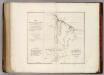
Map of British Guiana.
1 : 1520640 Arrowsmith, John
British Guayana.
1 : 2800000 Tallis, J. & F.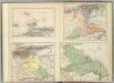
(Provincias de Margarita, Cumana, Barcelona, Guayana)
1 : 1300000 Codazzi, Agustin, 1793-1859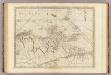
The coast of Caracas, Cumana, Parla and the mouths of Rio Orinoco.
1 : 1560000 Jefferys, Thomas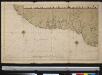
De kust van Guiana
Suriname Johannes van Keulen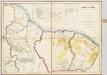
Kaart van Guiana, Engelsch, Nederlandsch en Fransch / naar de beste bronnen en eigen opnemingen geteekend in 1888 door W.L. Loth, gouvernements-landmeter in Suriname ; uitgegeven met goedkeuring van Zijne Excellentie Mr. H.J. Smidt, gouverneur der kolonie Suriname
1 : 1000000 Annotatie geografische gegevens: Legenda Amsterdam : J.H. de Bussy
Facsimile: Part of Chart of the Guiana Coast by Jefferys.
1 : 1510000 Jefferys, Thomas