Maps of Merauke

Bian-Rivier / prepared and reproduced by Base Map Plant USASOS SWPA, December 1942 - January 1943, from a Dutch map printed by Topografische Dienst (Topographic Service) Batavia, 1941
Base Map Plant USASOS SWPA [S.l.] : Base Map Plant USASOS/SWPA
Bian-Rivier / Netherlands Topographic Service
Netherlands Topographic Service Delft [Delft] : Netherlands Topographic Service
Gab-Gab meer / Topografische Dienst
Topografische Dienst Delft [Delft] : Topografische Dienst
Wan / Topografische Dienst
Topografische Dienst Delft [Delft] : Topografische Dienst
Boepoel / Topografische Dienst
Topografische Dienst Delft [Delft] : Topografische Dienst
Koa / Topografische Dienst
Topografische Dienst Delft [Delft] : Topografische Dienst
Moeting / Topografische Dienst
Topografische Dienst Delft [Delft] : Topografische Dienst
Fly-rivier / Topografische Dienst
Topografische Dienst Delft [Delft] : Topografische Dienst
Terek / Topografische Dienst
Topografische Dienst Delft [Delft] : Topografische Dienst
Torai / Topografische Dienst
Topografische Dienst Delft [Delft] : Topografische Dienst
Kabtel / Topografische Dienst
Topografische Dienst Delft [Delft] : Topografische Dienst
Bebeke / Topografische Dienst
Topografische Dienst Delft [Delft] : Topografische Dienst
Dohalik / Topografische Dienst
Topografische Dienst Delft [Delft] : Topografische Dienst
Jawar / Topografische Dienst
Topografische Dienst Delft [Delft] : Topografische Dienst
Saror / Topografische Dienst
Topografische Dienst Delft [Delft] : Topografische Dienst
Bladwijzer van Merauke en omgeving
[S.l. : s.n.]
Tanah Merah / Netherlands Topographic Service
Netherlands Topographic Service Delft [Delft] : Netherlands Topographic Service
Tanahmerah / prepared and reproduced by Base Map Plant USASOS/SWPA, December 1942 - January 1943, from a Dutch map printed by Topografische Dienst (Topographic Service) Batavia, 1940
Base Map Plant USASOS SWPA [S.l.] : Base Map Plant USASOS/SWPA
Merauke / prepared and reproduced by Base Map Plant USASOS SWPA, December 1942 - January 1943, from a Dutch map printed by Topografische Dienst (Topographic Service) Batavia, 1941
Base Map Plant USASOS SWPA [S.l.] : Base Map Plant USASOS SWPA
Merauke / Netherlands Topographic Service
Netherlands Topographic Service Delft [Delft] : Netherlands Topographic Service
Monggai / Topografische Dienst
Topografische Dienst Delft [Delft] : Topografische Dienst
Doemande / Topografische Dienst
Topografische Dienst Delft [Delft] : Topografische Dienst
Geologische overzichtskaart van den Nederlandsch Oost-Indischen Archipel : Nederlandsch Nieuw Guinea [Zuid] / bewerkt door J. Zwierzycki
Landsdrukkerij Weltevreden (Batavia) [Weltevreden (Batavia) : Landsdrukkerij]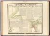
Partie, Nouvelle Guinee. Oceanique no. 30.
1 : 1641836 Vandermaelen, Philippe, 1795-1869
Kaiser-Wilhelmsland

Nederlandsch-Nieuw-Guinee
Topographische Inrichting Batavia Batavia : Top[ographische] Inr[ichting]
Západní Irian

Overzichtskaart van de Residentie Amboina en de Afdeeling Noord-Nieuw Guinea / samengesteld door het Encyclopaedisch Bureau [in] 1915
Encyclopaedisch Bureau Batavia Batavia : G. Kolff & Co.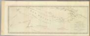
New Britain discoveries.
1 : 4500000 Hawkesworth, John, 1715?-1773


