Maps of Talaud Islands

Talaud Islands / prepared under the direction of the Chief of Engineers U.S. Army
Army Map Service U.S. Army Washington D.C. Washington D.C. : Army Map Service
Beo Road (Karakelang Island) / Corps of Engineers, War Department
War Department Washington D.C. . Corps of Engineers U.S. Army [Washington D.C.] : War Department
Talaud Islands / War Department, Washington D.C.. Corps of Engineers U.S. Army
[S.l. : s.n.]
Salebaboe Island / Corps of Engineers, War Department
War Department Washington D.C. . Corps of Engineers U.S. Army [Washington D.C.] : War Department
Talaud Islands / War Department, Washington D.C.. Corps of Engineers U.S. Army
[S.l. : s.n.]
Schetskaart van de Sangi- en Talaud Eilanden / samengesteld bij het E[ncyclopaedisch] B[ureau] der Afdeeling Bestuurszaken der Buitenbezittingen van het Departement van Binnenlandsch-Bestuur
Encyclopaedisch Bureau Batavia ['s-Gravenhage : N.V. Electrische Drukkerij 'Luctor et Emergo']
Liroeng / prepared under the direction of the Chief of Engineers U.S. Army
Army Map Service U.S. Army Washington D.C. Washington D.C. : Army Map Service
Sangir- en Talaud
[S.l. : s.n.]
San Agustin / Topografische Dienst
Topografische Dienst Batavia Batavia : Reproductiebedrijf Topografische Dienst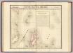
Partie, l'Ile Gilolo. Oceanique no. 15.
1 : 1641836 Vandermaelen, Philippe, 1795-1869
Kaart van het eiland Celebes
D. Heyse lith. te 's Hage ; steendr. v. P. Blommers te 's Hage te 's Hage : uitgave van K. Fuhri
Algemeene schetskaart van Nederlandsch-Indië : Gouv[ernement] Groote Oost, Res[identie] Manado / Topografische Dienst, Batavia
[S.l. : s.n.]
Reduzirte Karte von den Philippinen und den Sulu-Inseln
1 : 2356000 den Manen Don Alexandro ́s Malaspina, Espinosa y Tello's, [...] Don Ildefonso de Aragon gewidmet vom Verfasser [H. Berghaus] gest. v. Selmar Siebert Gotha : Perthes
127. Philippines. The World Atlas.
1 : 5000000 USSR (Union of Soviet Socialist Republics).
Carte des iles Moluques
1 : 3425000 par P. Melvill de Carnbee gravé par D. Heyse La Haye : lith de Ch. van Lier
No. 2. Mapa General.
1 : 6000000 U.S. Coast and Geodetic Survey
[Islas filipinas - distribution de temblores]
Atlas de Filipinas Algué, P. José Government Printing Office
[Islas filipinas - estaciones meteorologico-seismicas]
Atlas de Filipinas Algué, P. José Government Printing Office
[Islas filipinas - mapa general]
Atlas de Filipinas Algué, P. José Government Printing Office
Mapa de las Islas Filipinas : formado expresamente para "El Correo Espaÿûnol" / por el topografo D. José Mendez
Madrid : Mendez
[Islas filipinas - mapa orografico]
Atlas de Filipinas Algué, P. José Government Printing Office
[Islas filipinas - mapa etnografico]
Atlas de Filipinas Algué, P. José Government Printing Office
Archipiélago de Filipinas: regalo a los Sres. suscriptores de la Crónica de la guerra de Cuba y de la rebelión de las Filipinas, Año 1896 / Passo
1 mapa. Casa Editorial Maucci, Asalto 8, Barcelona. Passo Casa Editorial Maucci
No. 6. Distibucion de Temlores Signos.
1 : 6000000 U.S. Coast and Geodetic Survey
Islas Filipinas, 3a hoja / por el teniente coronel de ingenieros D. Francisco Coello ; las notas estadisticas e historicas han sido escritas por D. Pascual Madoz
1 : 1000000 1 full d'un mapa en tres fulls, b/n. Dins: Atlas de España y sus posesiones de ultramar Coello, Francisco ; Madoz, Pascual [Imprenta del Atlas de España]
Carte des îles Philippines, Célébes et Moluques
1 : 3700000 dressée par M. Daussy d'après les travaux le plus récents gravé par Chassant ; écrit par J.M. Hacq. [Paris] : Dépot-général de la Marine
Blad VII Siding, uit: Residentie Wester-Afdeeling van Borneo / Topographisch Bureau
1 : 200000 titelvariant: Residentie Westerafdeeling van Borneo; Annotatie: Titelvariant: Residentie Westerafdeeling van Borneo; Voor aanwezige bladen zie overzichtsblad; Annotatie geografische gegevens: Opname: 1886-1895 Topographisch Bureau, Batavia Batavia : Topographisch Bureau
Indonesia
IPPRESS Djakarta [Djakarta] : IPPRESS
La presqu'isle de l'Indie au dela du Gange, avec l'archipel des Indes
1 : 12640000 Asie jihovýchodní Bonne, Rigobert André


