Maps of Davao Oriental

San Agustin / Topografische Dienst
Topografische Dienst Batavia Batavia : Reproductiebedrijf Topografische Dienst
Talaud Islands / prepared under the direction of the Chief of Engineers U.S. Army
Army Map Service U.S. Army Washington D.C. Washington D.C. : Army Map Service
Beo Road (Karakelang Island) / Corps of Engineers, War Department
War Department Washington D.C. . Corps of Engineers U.S. Army [Washington D.C.] : War Department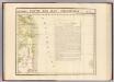
Partie, Iles Philippines. Oceanique no. 7.
1 : 1641836 Vandermaelen, Philippe, 1795-1869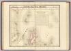
Partie, l'Ile Gilolo. Oceanique no. 15.
1 : 1641836 Vandermaelen, Philippe, 1795-1869
Talaud Islands / War Department, Washington D.C.. Corps of Engineers U.S. Army
[S.l. : s.n.]
Talaud Islands / War Department, Washington D.C.. Corps of Engineers U.S. Army
[S.l. : s.n.]
Salebaboe Island / Corps of Engineers, War Department
War Department Washington D.C. . Corps of Engineers U.S. Army [Washington D.C.] : War Department
No. 5. Estaciones Meteorologico-Seismicas.
1 : 6000000 U.S. Coast and Geodetic Survey
Mapa de las yslas Philipinas
1 : 3100000
[Islas filipinas - Mindanao oriental]
Atlas de Filipinas Algué, P. José Government Printing Office
[Islas filipinas - Mindanao Joló]
Atlas de Filipinas Algué, P. José Government Printing Office
Partie des Iles Philippines / [dressée par Ph. Vandermaelen]
[Bruxelles : P.M.G. Vandermaelen, Éditeur]
Sangir- en Talaud
[S.l. : s.n.]
No. 26. Mindanao Jolo.
1 : 2500000 U.S. Coast and Geodetic Survey
No. 27. Mindanao Oriental.
1 : 1830000 U.S. Coast and Geodetic Survey
Geologic reconnaissance map of Mindanoa / Bureau of Science, Division of Mines ; P. Moskaira, engraved ; geology by Warren D. Smith
Bureau of Science . Division of Mines [S.l.] : Bureau of Science
Schetskaart van de Sangi- en Talaud Eilanden / samengesteld bij het E[ncyclopaedisch] B[ureau] der Afdeeling Bestuurszaken der Buitenbezittingen van het Departement van Binnenlandsch-Bestuur
Encyclopaedisch Bureau Batavia ['s-Gravenhage : N.V. Electrische Drukkerij 'Luctor et Emergo']
Schetskaart van de Sangi- en Talaud Eilanden / E[ncyclopaedisch] B[ureau]
Encyclopaedisch Bureau Batavia ['s-Gravenhage : N.V. Electrische Drukkerij 'Luctor et Emergo']
Liroeng / prepared under the direction of the Chief of Engineers U.S. Army
Army Map Service U.S. Army Washington D.C. Washington D.C. : Army Map Service
Carte des îles Philippines, Célébes et Moluques
1 : 3700000 dressée par M. Daussy d'après les travaux le plus récents gravé par Chassant ; écrit par J.M. Hacq. [Paris] : Dépot-général de la Marine
Java in zijn natuurlijke en staatkundige gesteldheid / [C.M. Kan]
1 : 2000000 Annotatie: Uit: Kaart van den Nederlandsch-Indischen Archipel / bewerkt door C.M. Kan. - Amsterdam : Beijers, 1892 Kan, C. M. [Amsterdam : Beijers]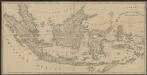
Kaart van Nederlands Oostindische bezittingen
1 : 7500000 Dl. Veelwaard Jr. del.t et sculps.t. uitgegeven door Maatschappij tot het Nut van 't Algemeen
Kaart van Nederlands Oostindische bezittingen / uitgegeven door Maatschappij tot het Nut van 't Algemeen ; Dl. Veelwaard Jr. del[ineavi]t et sculps[i]t
Maatschappij tot het Nut van 't Algemeen [S.l.] : Maatschappij tot het Nut van 't Algemeen
[Recto], uit: Kaart van Ned. Oost-Indië : (tevens automobielkaart) / door P. Joh. Bettink en J. Krijgsman
1 : 4150000 titelvariant: Sleeswijk's kaart van Ned. Oost-Indië; Annotatie: Omslagtitel: Sleeswijk's kaart van Ned. Oost-Indië Bettink, P. Joh.; Krijgsman, J. Bussum : Sleeswijk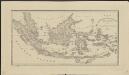
Kaart van Nederlands Oostindische bezittingen
1 : 7500000 Dl. Veelwaard Jr. del.t et sculps.t. uitgegeven door Maatschappij tot het Nut van 't Algemeen
Nieuwe kaart van de Filippynsche, Ladrones, Moluccos of Specery Eilanden alsmede Celebes enz. / uitgegeven te Amsterdam door Isaak Tirion
Te Amsterdam : door Isaak Tirion
Nederlandsch-Indië / J.H. de Bussy
Amsterdam : J.H. De Bussy
Pertambangan = Mining & Quarrying / disusun dibawa pengawasan Badan Atlas Nasional dengan bahan-bahan dari Departemen Perindustrian Dasar dan Pertambangan ; digambar dan ditjetak oleh Direktorat Topografi A.D. = prepared under supervision of National Atlas Agency on the basis of information suplied by Departemen Perindustrian Dasar dan Pertambangan ; drafted and printed by the Army Topographical Directorate
Badan Atlas Nasional Indonesia [Djakarta] : Direktorat Topografi A.D. = Army Topographical Directorate


