Maps of Ukraine

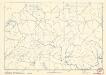
III. vojenské mapování 4563/4
1 : 25000
Géographie. croquis n3, Europe centrale
1 : 2500000 Molard, Jules, Commandant [Paris] : Service Géographique de l'Armée
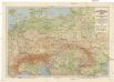
Mittel-Europa Österreich-Ungarn. Naturkarte
1 : 5000000 Mitteleuropa
Sbírka map a diagramů použitých na mírových konferencích v Paříži v letech 1919 - 1920
Grossdeutsches Reich und angrenzende Gebiete

Geologische Übersichtskarte von Mittel-Europa
Evropa střední F. Tempsky
Gnesen 50, uit: Special-Karte von Mittel-Europa / nach amtlichen Quellen bearbeitet von W. Liebenow
1 : 300000 titelvariant: W. Liebenow's Mittel-Europa; Annotatie: Titel boven de bladen: W. Liebenow's Mittel-Europa Johannes Wilhelm Liebenow 1822-1897 Frankfurt a. M. : Ludwig Ravenstein
Közép-Európa
1 : 5000000 Evropa střední Állami kiadóhivatal
Příruční mapa střední Evropy

Die Ältesten Karten von Deutschland
Soubor němých map pro střední školy

Austria
From Austria
Post und Strassen Karte der oesterreichischen Monarchie nebst allen angrenzenden Landern herausgegeben von der k.k. Obersten-Holf-Post-Verwaltung im Jahre 1840

Grossdeutsches Reich und angrenzende Gebiete
1 : 4000000 Evropa střední Leixner, František Zentral-Lehrerverlag und Buchhandlung
Skelet zur Übersichtskarte von Mittel-Europa im Masse 1:750 000 und zur Hypsometrischen Karte der österr[isch-] ungar[ischen] Monarchie
1 : 750000 Rakousko-Uhersko R. Lechner
Germania, Dacia.
1 : 13000000 Fenner, Rest.
Deutschlands geschichtlich geographischer Zeitraum von 158 v. Chr. bis 260 n. Chr
Evropa střední Ehrenkreutz, I. V.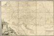
Post Charte der Kaiserl. Königl. Erblanden

8. Mittel und Ost-Europa oder Germanien und die illyrischen Provinzen des Römischen Reichs
Römisches Reich, Germanische Provinzen
Postkarte durch ganz Deutschland, Italien, Frankreich, Niederland, Preussen, Polen und Ungarn
Florencie (Itálie) Mollo, Tranquillo T. Mollo
Übersichtskarte der Verbreitung der Deutschen in Europa
Evropa Kiepert, Heinrich Haas, František Dietrich Reimer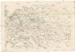
Eisenbahnkarte von Mittel-Europa
1 : 2560000 Evropa střední
Große Sprachenkarte von Mitteleuropa
1 : 2000000 Lange, Friedrich Reimer
Österreichisch-Ungarische Monarchie
Handatlas über alle Theile der Erde und über das Weltgebäude Stieler, Adolf Justus Perthes
Karte der floss- und schiffbaren Flüsse von Mittel-Europa
1 : 3000000 Evropa střední Jelussig, Othmar Kiepert, Heinrich
Vývoj državy rakousko - uherské

Sbírka map a diagramů použitých na mírových konferencích v Paříži v letech 1919 - 1920

Eisenbahn-Übersichtskarte von Mittel-Europa
Evropa R. v. Waldheim


