Maps of Lithuania

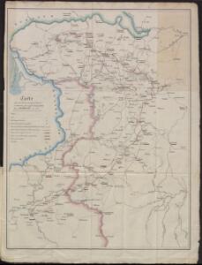
Carte des operations du corps d'armée commandé par le général polonais, Henri Dembinski en 1831
Litauen Weißrussland Polen / Aufstand <1830-1831> Dembiński, Henryk Dembiński, Henryk
Litauen, O. Pruisen en Noord Gouv. Gen.
1 : 3000000 Annotatie: Vrijgegeven door W.B.N. 15-5-'44 Den Haag : Kompas
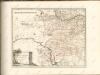
Europe Centrale (Partie Orientale).
1 : 1750000 Jouvet et Cie.
Magni dvcatus Lithvaniae ceterarumq[ue] regionum illi adiacentium exacta descrip illss.mi ac excell.mi principis ac dni D. Nicolai Christophori Radziwil D. G. Olycae ac in Nieswies ducis, S. Rom. Imp. principis in Szylowiec ac Mir comitis, et S. Sepulchri Hirosolimitani militis etc
1 : 2000000 Litva Schenk, Pieter P. Schenk et G. Valk
Magnus ducatus Lithuania in suos Palatinatus et Castellanias divisa non solum accuratisime delineata, sed etiam plurimis in alliis Mappis omissis locis
1 : 1350000 Georg Friderich Lotter, sculps. Aug. Vind. : Tob. Conr. Lotter
Kartenskizze des polnisch-weißrussischen Grenzgebietes
Polen Weißrussland Grenzgebiet
Magn[us] dvcatvs Litvaniae
1 : 1630000 Bělorusko Nieprzecki, Jan Mayer, Tobias impensis Homannianorum Heredum
MAGN[US] DVCATVS LITVANIAE
1 : 1670000 Bělorusko Nieprzecki, Jan Mayer, Tobias impensis Homannianorum Heredum
Magnus ducatus Lithuania
1 : 149000 Bělorusko Lotter, Tobias Conrad Lotter, Georg F. Tob. Conr. Lotter
Magnus ducatus Lithuania
1 : 149000 Bělorusko Lotter, Tobias Conrad Lotter, Georg F. Tob. Conr. Lotter
Magni Dvcatvs Litvaniae in svos Palatinatvs et Districtvs Divisvs
1 : 1600000 Mollova mapová sbírka Nieprzecki, Jan Homann, Johann Baptista - dědici
Mapa nowej unji Polski z Litwą
1 : 2000000 Bělorusko Romer, Eugeniusz Instytut kartograficzny Atlas
[Litauen, Lettland]
Litauen, Lettland, ethnische Gruppe
Verwaltungsgebiet Ober Ost. Einteilung der Kreise und Eisenbahnlinien
Baltikum Oberost Weltkrieg <1914-1918> Eisenbahnnetz
Verwaltungsgebiet Ober Ost und geschlossene Sprachgebiete
Baltikum Oberost Weltkrieg <1914-1918>
Übersichtskarte von Ostpreußen, Kurland und den angrenzenden Gebieten
1 : 750000 Kuronsko k. u. k. Hof- und Universitätsbuchhandlung R. Lechner (W. Müller)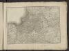
Théatre de la guerre actuelle, en Allemagne, en Pologne et en Turquie. n4 (bis), Dantzig
1 : 900000 Chanlaire, Pierre Grégoire 1758-1817 Paris : chez l'auteur P. G. Chanlaire
Kalnuotumo ir nuotakumo Lietuvos
1 : 630000 Lotyšsko Matulionis, P. S. Schropp'sche Lehrmittel-Handlung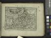
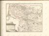
Prussia.
from Abraham Ortelius his epitome of the theater of the worlde / nowe latlye ... renewed and augmented ... by Micheal Coignet, mathematitian of Antwarpe.
Chelm und Podlachien
Polen Chełm (Województwo) Podlachien Auner, H.
Mapa narodowościowa polskich kresów północno-wschodnich i Litwy
1 : 1000000 Litva Machlejd, Jerzy Zaborski, Bogdan Gebethner & Wolff
Li palatinati di Nowogrodek Podlachia e Brzesk Littew / tratta dall'atlante polacco del Sig.r Rizzi
1 : 1300000 1 Karte : Kupferdruck ; 31 x 40 cm Zuliani, Giuliano presso Antonio Zatta
Ethnographische Karte von Litauen
1 : 2000000 Litauen Ethnische Gruppe Kettler, Julius Iwan (red.)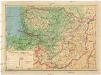
Lietuvos žemelapis
1 : 200000 Litva Spaudos fondas
Delineatio memorabilis conflictus et victoriae Lithuanorum Duce Radivilio de Cricevio
Bělorusko
Castra defensiva Ducis Radiuly Reciciae, obiecta aduentui Eliae Bohaczenlio
Bělorusko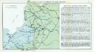
Nr. 7. Kämpfe in Kurland und Nordpolen zum Schutze Ostpreußens
Baltikum Weltkrieg <1914-1918>, Ostfront