Maps of Alba

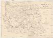
Rîul Sebeş
1 : 75000 Sebeş (Region) Geripp: Feldw. R. Zellhofer. Terrain: Offiz. G. Leitner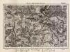
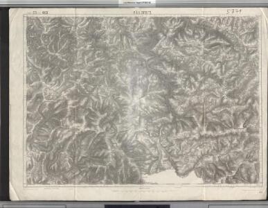
Lambert-Cholesky sheet 2957 (Făgădău)
1 : 20000 Romanian military topographic map sheet under Lambert-Cholensky projection Institutul Geografic Militar geo-spatial.org Institutul Geografic Militar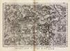
Lambert-Cholesky sheet 2956 (Curmatura)
1 : 20000 Romanian military topographic map sheet under Lambert-Cholensky projection Direcția Topografică Militară geo-spatial.org Direcția Topografică Militară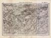
Lambert-Cholesky sheet 3057 (Vârful Strâmba Mare)
1 : 20000 Romanian military topographic map sheet under Lambert-Cholensky projection Serviciul Geografic al Armatei geo-spatial.org Serviciul Geografic al Armatei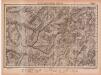
Lambert-Cholesky sheet 2856 (Rovinel)
1 : 20000 Romanian military topographic map sheet under Lambert-Cholensky projection Institutul Geografic Militar geo-spatial.org Institutul Geografic Militar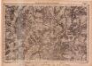
Lambert-Cholesky sheet 2857 (Măgureni)
1 : 20000 Romanian military topographic map sheet under Lambert-Cholensky projection Institutul Geografic Militar geo-spatial.org Institutul Geografic Militar
Riul Sebes.
from Spezialkarte der osterreichisch-ungarischen Monarchie.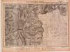
Lambert-Cholesky sheet 2955 (Poiana Runcu)
1 : 20000 Romanian military topographic map sheet under Lambert-Cholensky projection Institutul Geografic Militar geo-spatial.org Institutul Geografic Militar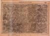
Lambert-Cholesky sheet 2958 (Sugag)
1 : 20000 Romanian military topographic map sheet under Lambert-Cholensky projection Serviciul Geografic al Armatei geo-spatial.org Serviciul Geografic al Armatei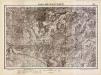
Lambert-Cholesky sheet 3058 (Jina)
1 : 20000 Romanian military topographic map sheet under Lambert-Cholensky projection Serviciul Geografic al Armatei geo-spatial.org Serviciul Geografic al Armatei
Lambert-Cholesky sheet 2855 (Petrila)
1 : 20000 Romanian military topographic map sheet under Lambert-Cholensky projection Institutul Geografic Militar geo-spatial.org Institutul Geografic Militar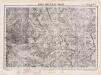
Lambert-Cholesky sheet 2858 (Dealul Rechita)
1 : 20000 Romanian military topographic map sheet under Lambert-Cholensky projection Direcția Topografică Militară geo-spatial.org Direcția Topografică Militară
Szasz-Sebes [Muhlbach].
from Spezialkarte der osterreichisch-ungarischen Monarchie.
Petroseny.
from Spezialkarte der osterreichisch-ungarischen Monarchie.
Verestorony [Rothenthurm-Pasz].
from Spezialkarte der osterreichisch-ungarischen Monarchie.
Gebiet um Hermannstadt
1 : 600000 Hermannstadt, Hermannstadt (Region)
Transilvania
Mollova mapová sbírka Hoffmann, Johannes Hoffmann, Johann
Siebenbürgen
Sedmihradsko (Rumunsko) Kunst- und Industrie Comptoir
Carte de la Roumanie et pays limitrophes. Bukarest
1 : 500000 France. Service géographique de l'armée [Paris] : Service géographique de l'armée
Sheet XV: Karte Des Oesterreichischen Kaiserstaates.
1 : 576000 Scheda, Josef
Nagyszeben (Hermannstadt), Brassó (Kronstadt), Bukarest, Craiova, Vidin, Rusčuk
1 : 750000 Brašov (Rumunsko : oblast) Korb, L. K. u. k. Militärgeographisches Institut
Hermannstadt, Kronstadt, Bukarest, Craiova, Vidin, Rusčuk
1 : 750000 Brašov (Rumunsko : oblast) K. k. militär-geographisches Institut
Generalkarte Von Siebenbürgen. Nach geometrisch gemessenen Karten und andern zuverlaessigen Hilfsmitteln verjüngt, und graduirt von Herrn A. von Wenzely. Herausgegeben von Herrn F. A. Schraembl
1 : 430000 Siebenbürgen Produkt, Straßennetz Wenzely, Anton; Schraembl, Franz Anton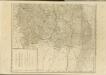

Übersichtskarte von Mittel - Europa

XV, uit: General-Karte des oesterreichischen Kaiserstaates mit einem grossen Theile der angrenzenden Länder / durch Josef Scheda ... bearb. und hrsg
1 : 576000 Annotatie geografische gegevens: Maatstokken: oesterreichische Meilen, geografische oder deutsche Meilen, preussische Meilen, türkische Berri, französische Lieues, russische Werste; Maatstok per blad: wiener Klafter, öster. Meilen; Blad XIX: statistische en taalkundige informatie; Blad XIX: legenda [Wien : K.K. Militärisch-Geografisches Institut]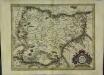
Transylvania
1 Karte : Kupferdruck ; 32 x 41 cm Mercator; Hondius excusum apud Henricum Hondium sub insigno atlantis
Siebenburgen.
1 : 2800000 Meyer, Joseph, 1796-1856
Strassen-Karte der banatischen Militair-Grenze
1 : 440000 Banát