Maps of Centru

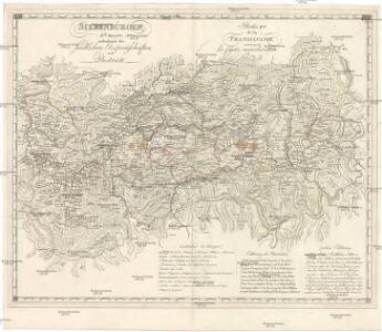
Siebenbürgen
Sedmihradsko (Rumunsko) Kunst- und Industrie Comptoir
Nova et accurata Transylvaniae
1 : 720000 Rumunsko Schenk, Pieter G. Valk et P. Schenk
Nova et accurata Transylvaniae descriptio
1 : 685200 Sedmihradsko (Rumunsko) Janssonius, Johannes apud Ioannem Ianßonium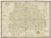
Erdély nagyfejedelemség Pöldrasza
1 : 860000 Sedmihradsko (Rumunsko) Raffelsperger, Franz Raffelsperger Ferencz
Grossfürstenthum Siebenbürgen
Sedmihradsko (Rumunsko) Marco Berra
Neueste Karte von Siebenbürgen
Grosser Hand-Atlas über alle Theile der Erde in 170 Karten Meyer, J. Verlag des Bibliographischen Instituts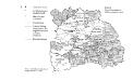
Verwaltungskarte Siebenbürgens 1847
Siebenbürgen Verwaltungsgliederung
Transylvania Sibenburgen
1 : 690000 Mollova mapová sbírka Blaeu, Willem Janszoon Blaeu, Joan I.
Transylvania Sibenburgen
1 : 690000 Mollova mapová sbírka Blaeu, Willem Janszoon Blaeu, Joan I.
Siebenburgen.
1 : 2800000 Meyer, Joseph, 1796-1856
Nova et Accurata Transylvaniae
1 : 690000 Mollova mapová sbírka Valk, Gerhard Schenk, Peter I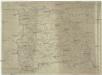
Karte von Siebenbürgen
1 : 980000 Rumunsko Mollo, Tranquillo Tranquillo Mollo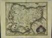
Transylvania
1 Karte : Kupferdruck ; 32 x 41 cm Mercator; Hondius excusum apud Henricum Hondium sub insigno atlantis
Bez titulu: Přehledná mapa střední Evropy

Übersichtskarte von Mittel - Europa

Carte de la Roumanie et pays limitrophes. Klausenbourg
1 : 500000 France. Service géographique de l'armée [Paris] : Service géographique de l'armée
[Střední Rumunsko]
1 : 420600 Rumunsko Schraembl, Franz Anton F.A. Schraembl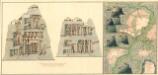
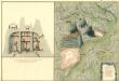
Plan dern Bergwerg bei Carlburg und Vardia
Mollova mapová sbírka Geyer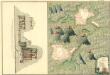
Plan von Bergwerg Pestian und Ivota
Mollova mapová sbírka Geyer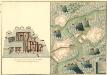
Plan der Bergwerg, Flod, Gilamare und Giogy
Mollova mapová sbírka Geyer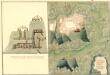
Plan des Bergwergs Weres Patack
Mollova mapová sbírka Geyer
Generalkarte von Zentraleuropa

Ost-Karpathen
1 : 600000 Karpaten (Südost)
Vermehrte und Verbesserte Landkarten des Königreichs Ungarn :
1 : 500000 Mollova mapová sbírka Stier, Martin Böner, Johann-Alexander Endter, Martin
Transilvania
Mollova mapová sbírka Hoffmann, Johannes Hoffmann, Johann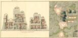
Plan deren Bergwerg Nagiay: i Offi und Bedas
Mollova mapová sbírka Geyer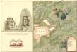
Plan des Bergwergs Igen.
Mollova mapová sbírka Geyer
Gebiet um Hermannstadt
1 : 600000 Hermannstadt, Hermannstadt (Region)
Siebenbürgen
1 : 600000 Siebenbürgen