Maps of okres Prachatice

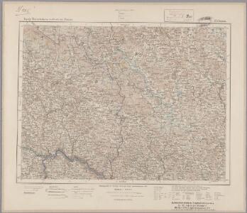
175. Passau, uit: Topographische Uebersichtskarte des Deutschen Reiches / herausgegeben v. d. Kartogr. Abt. d. Königl. Preuß. Landesaufnahme
1 : 200000 titelvariant: Topogr. Übersichtskarte des Deutschen Reiches; Annotatie: Titel boven bladen ook: Topogr. Übersichtskarte des Deutschen Reiches; Annotatie geografische gegevens: Op elk blad twee maatstokken: 10 Kilometer = 5,5 cm; 1 geogr. Meile = 3,6 cm; Legenda onder op elk blad Königlich Preußische Landesaufnahme. Kartographische Abtheilung [S.l : Königlich Preußische Landesaufnahme, Kartographische Abtheilung]
Das Herzogthum Ober und Nieder Baiern, 2
1 Karte : 43 x 55 cm Lotter
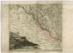
Reisehandbuch für das Königreich Böhmen

Fol. II
1 Karte : 43 x 55 cm Königliche Akademie der Wissenschaften
Šumava generální mapa značených cest turistických
Šumava

G. Freytag & Berndt Touristenwanderkarte des Böhmerwaldes und Bayrischen Waldes
1 : 200000 Bavorský les (Německo : pohoří) Bundesleitung des deutschen Böhmerwaldbundes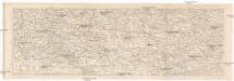
Šumava
1 : 288000 Šumava-oblast Kohut, Josef Líčka, Josef nákladem Františka Řivnáče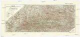
Šumava
1 : 200000 Šumava-oblast Pacovský, Jaroslav Klub českoslov. turistů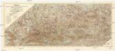
Šumava
1 : 200000 Šumava (pohoří : oblast) Klub českoslov. turistů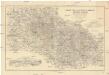
Karte des Bayrischen und des Böhmer-Waldes
1 : 250000 Bavorský les (Německo) Waltenberger, Anton Dressel, H. Waldverein
Jihozápadní Čechy
1 : 220000 Šumava-oblast Wagner, Jan Eduard F. Kytka
Jihozápadní Čechy
1 : 220000 Šumava-oblast Wagner, Jan Eduard F. Kytka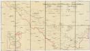
Schutzvereins-Ortsgruppen des Böhmerwaldes und Deutsch-Südböhmens
1 : 200000 Čechy jižní (Česko)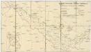
Deutsche Gemeinden u. Pfarren Südböhmens
1 : 200000 Čechy jižní (Česko) Blechinger, L.
Jihozápadní Čechy

Südwestliches Böhmen
1 : 220000 Jihočeský kraj (Česko) Wagner, Jan Eduard F. Kytka
Deutsche Strassenprofilkarte für Radfahre.
České Budějovice-oblast (Česko) Scheiner, Josef Mittelbach, R. Mittelbach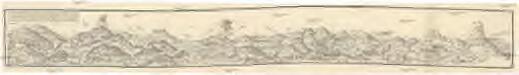
Eine Böhmenwald-Grenzkarte vom Jahre 1514
Šumava-oblast Schrötter, Georg Instituts für ostbairische Heimatforschung
Darstellung des Gesichtskreises von dem Fürst Iosephs Thurme auf dem Schöninger im Planskerwalde in Böhmen
1 : 330000 Blanský les (Česko) Falta, Joseph Hafner, Joseph
Darstellung des Gesichtskreises von dem Fürst Iosephs Thurme auf dem Schöninger im Planskerwalde in Böhmen
1 : 330000 Blanský les (Česko) Falta, Josef Hafner, Josef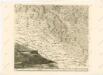
Mappa geographica regni Bohemiae in duodecim circuloc divisae ... Sectio. XXII.
Müllerova mapa Čech
1 : 132000
Budweis 131, uit: Special-Karte von Mittel-Europa / nach amtlichen Quellen bearbeitet von W. Liebenow
1 : 300000 titelvariant: W. Liebenow's Mittel-Europa; Annotatie: Titel boven de bladen: W. Liebenow's Mittel-Europa Johannes Wilhelm Liebenow 1822-1897 Frankfurt a. M. : Ludwig Ravenstein
Monumenta Cartographica Bohemiae II.: Müllerova mapa

Flussgebiet der Moldau und Maltsch bis Budweis
1 : 300000 Vltava-povodí (Česko) Babánek, František Schwihlik, F.
Budějowský kraj w Králowství českém
1 : 140000 České Budějovice-oblast (Česko) Loth, Johann Schönfelder, Franz von Friedrich Kretzschmar
Budějowský kraj w Králowství českém
1 : 140000 České Budějovice-oblast (Česko) Loth, Johann Schönfelder, Franz von Friedrich Kretzschmar
Charte vom Budweiser Kreise des Königreiches Böheim
1 : 241000 České Budějovice-oblast (Česko) Kreibich, František Jakub Jindřich Enders, C. W. C.W. Enders
Charte vom Budweiser Kreise des Königreiches Böheim
1 : 241000 České Budějovice-oblast (Česko) Kreibich, František Jakub Jindřich Enders, C. W. C.W. Enders
Charte vom Budweiser Kreise des Königreiches Böheim
1 : 241000 České Budějovice-oblast (Česko) Kreibich, František Jakub Jindřich Enders, C. W. C.W. Enders
Charte vom Budweiser Kreise des Königreiches Böheim
1 : 241000 České Budějovice-oblast (Česko) Kreibich, František Jakub Jindřich Enders, C. W. C.W. Enders