Maps of Böhmerwald
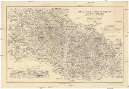
Karte des Bayrischen und des Böhmer-Waldes
1 : 250000 Bavorský les (Německo) Waltenberger, Anton Dressel, H. Waldverein
Neubertova generální automapa Republiky československé
1 : 200000 Klatovy (Česko : oblast) Soukup, Jan V. Neubert a synové
G. Freytag & Berndt Touristenwanderkarte des Böhmerwaldes und Bayrischen Waldes
1 : 200000 Bavorský les (Německo : pohoří) Bundesleitung des deutschen Böhmerwaldbundes
Hydrografische Uibersichtskarte der Flüsse, Bäche und sonstigen Gewässer im Königreiche Boehmen

Das Herzogthum Ober und Nieder Baiern, 2
1 Karte : 43 x 55 cm Lotter
Mappa Electoratus et Ducatus Bavariae Superioris et Inferioris, Ducatus Neoburgesis cum Episcopatibus Frisingensi Ratisbonensi Passaviensi et Praepositura Bergtolsgadensi.
1 : 260000 Mollova mapová sbírka Apian, Philipp
Jihozápadní Čechy
1 : 220000 Šumava-oblast Wagner, Jan Eduard F. Kytka
Jihozápadní Čechy
1 : 220000 Šumava-oblast Wagner, Jan Eduard F. Kytka
[Čechy]
1 : 390000 Čechy (Česko)
Šumava

Jihozápadní Čechy
Šumava generální mapa značených cest turistických
Reisehandbuch für das Königreich Böhmen

Fol. II
1 Karte : 43 x 55 cm Königliche Akademie der Wissenschaften
Šumava
1 : 200000 Šumava-oblast Pacovský, Jaroslav Klub českoslov. turistů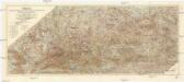
Šumava
1 : 200000 Šumava (pohoří : oblast) Klub českoslov. turistů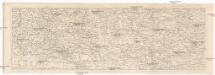
Šumava
1 : 288000 Šumava-oblast Kohut, Josef Líčka, Josef nákladem Františka Řivnáče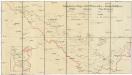
Schutzvereins-Ortsgruppen des Böhmerwaldes und Deutsch-Südböhmens
1 : 200000 Čechy jižní (Česko)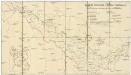
Deutsche Gemeinden u. Pfarren Südböhmens
1 : 200000 Čechy jižní (Česko) Blechinger, L.
175. Passau, uit: Topographische Uebersichtskarte des Deutschen Reiches / herausgegeben v. d. Kartogr. Abt. d. Königl. Preuß. Landesaufnahme
1 : 200000 titelvariant: Topogr. Übersichtskarte des Deutschen Reiches; Annotatie: Titel boven bladen ook: Topogr. Übersichtskarte des Deutschen Reiches; Annotatie geografische gegevens: Op elk blad twee maatstokken: 10 Kilometer = 5,5 cm; 1 geogr. Meile = 3,6 cm; Legenda onder op elk blad Königlich Preußische Landesaufnahme. Kartographische Abtheilung [S.l : Königlich Preußische Landesaufnahme, Kartographische Abtheilung]
Charte von königlich Bayerschen Kreise der Unterdonau
1 : 360000 Bavorsko (Německo) Blume Aug. Kneisel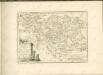
Des Herzogthums Niederbayern Pfleggerichte Kelhaim, Dietfurt, Abach, Haidau, Stadt am Hof, Straubing, Miterfels, Cham, Furt, Kötzting, Neukirchen, Viechtach, Leonsberg, Schwarzach, Linden, Zwisel, Regen, Deckendorf, Hengersberg, Winzen, Diessenstein und Bernstein oder das Rentamt Straubing
1 Karte : Kupferdruck ; 20 x 34 cm Reilly F. J. J. von Reilly
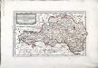
Südwestliches Böhmen
1 : 220000 Jihočeský kraj (Česko) Wagner, Jan Eduard F. Kytka
Sacri Romani imperii circuli et electoratus Bavariae tabula, 4
4 Blätter : s.n.
Provincia Prachinensis
Prácheňsko (Česko) Müller, Johann Christoph JC. Winkler
Provincia Prachinensis
Prácheňsko (Česko) Bernardi, Augustin Augustin Bernardi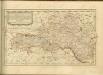

Generální mapa Protektorátu Čechy a Morava

Regni Bohemiae circulus Prachinensis
1 : 211000 Prácheňsko (Česko) Müller, Johann Christoph editus curis Homannianorum Heredum