Maps of Haguenau-Wissembourg

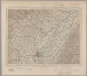
169. Strassburg i. Elsass, uit: Topographische Uebersichtskarte des Deutschen Reiches / herausgegeben v. d. Kartogr. Abt. d. Königl. Preuß. Landesaufnahme
1 : 200000 titelvariant: Topogr. Übersichtskarte des Deutschen Reiches; Annotatie: Titel boven bladen ook: Topogr. Übersichtskarte des Deutschen Reiches; Annotatie geografische gegevens: Op elk blad twee maatstokken: 10 Kilometer = 5,5 cm; 1 geogr. Meile = 3,6 cm; Legenda onder op elk blad Königlich Preußische Landesaufnahme. Kartographische Abtheilung [S.l : Königlich Preußische Landesaufnahme, Kartographische Abtheilung]
Alsatia inferior
1 Karte : Kupferdruck ; 17 x 27 cm Specklin; Quad Johannes Bussemacher
Der District Hagenau
1 : 182000 Haguenau (Francie)
Alsatia inferior
1 Karte : Kupferdruck ; 14 x 22 cm Lambert Andreae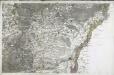
[Strasbourg]
1 Blatt : 60 x 92 cm s.n.
Le cours du Rhin de Bâle à Hert près Philisbourg contenant l'Alsace et partie du Brisgau, 4
1 Blatt : 76 x 52 cm Le Rouge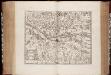
Territorium Argentoratense / apud Janssonio-Waesbergios, Mosem Pitt et Stephanum Swart
1 : 103000 Annotatie: Origineel is Blad 114 in atlas factice; Kaart toont het gebied rondom Straatsburg, deels gelegen in de Elzas en deels in Baden-Württemberg; In rechter bovenhoek: XLIV; Met wapens; Annotatie geografische gegevens: Schaalstok op de kaart: Milliaria Germanica communia; Oost boven Johannes Janssonius van Waesberge -1681?; Moses Pitt ca. 1654-1696; Stephanus Swart [Oxford : printed at the Theatre at Oxford]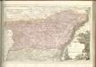
Geographica Provinciarum Sveviae Descriptio =
Mollova mapová sbírka Hurter, Johann Christoph Bodenehr, Johann Georg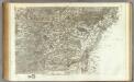
162 Strasbourg.
1 : 86400 Cassini family; Cassini, Cesar-Francois, 1714-1784
Territorium Argentoriatense. [Karte], in: Novus atlas absolutissimus, Bd. 2, S. 208.
1 Karte aus Atlas Janssonius Offizin
Chorographia Argentorati Alsatiæ metropolis
1 Karte : Kupferdruck ; 47 x 56 cm Seutter Matthäus Seutter
Argentorati territorium, vulgo Strasburger Gebiet
1 Karte : Kupferdruck ; 46 x 57 cm Allard by I. Cóvens et C. Mortier
Argentoratensis Agri Descriptio. [Karte], in: Theatrum orbis terrarum, S. 267.
1 Karte aus Atlas Ortelius, Abraham Vrients, Jan Baptista
Argentoratensis Agri Descriptio. [Karte], in: Theatrum orbis terrarum, S. 175.
1 Karte aus Atlas Ortelius, Abraham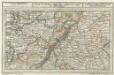
Fortlovis mitt der Gegend auff 6 Stunden.
1 : 250000 Mollova mapová sbírka Bodenehr, Gabriel Bodenehr, Gabriel
Le Flambeau de la Guerre Allumee au Rhin
Mollova mapová sbírka Delisle, Guillaume Schenk, Peter II
Carte über den groesten Theil des untern Elsasses, nebst der Grenze von Teutschland und Lotharingen. &c.
Bechstatt, I. C.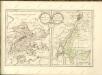

Argentorati Territorium, vulgo Strasburger Gebiet Cum Maxima Episcopatus Cognominis, ac Occidentaliori Badensis Marchionatus Parte &c.
1 : 120000 Mollova mapová sbírka Allard, Carel Allard, Carel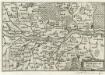
Fort-Louys
1 : 170000 Mollova mapová sbírka Person, Nikolaus Person, Nicolas
Chorographia Argentorati Alsatiae Metropolis
1 : 85000 Mollova mapová sbírka Seutter, Matthäus Seutter, Matthäus
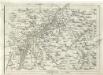
Territorium Argentoratense
1 : 625000 Štrasburk (Francie) Janssonius, Johannes Ioannes Iansonius
Territorium Argentoratense
1 : 600000 Štrasburk (Francie) Janssonius, Johannes Ioannes Iansonius
Territorium Argentoratense
1 : 130000 Mollova mapová sbírka Valk, Gerhard Schenk, Pieter Schenk, Peter I
Territorium Argentoratense
1 : 130000 Mollova mapová sbírka Janssonius, Johannes Keere, Pieter van den Janssonius, Johannes I
Argentoratensis Agri Descriptio
1 : 770000 Mollova mapová sbírka Specklin, Daniel Plantin, Christoph
Le Flambeau de la Guerre Allumee au Rhin
Mollova mapová sbírka Delisle, Guillaume Schenk, Peter II
Geologische Karte der Umgebungen von Baden
1 : 50000 Nordblatt Sandberger, Fr. Chr. Fr. Müller'sche Hofbuchhandlung