Maps of Licko-Senjska

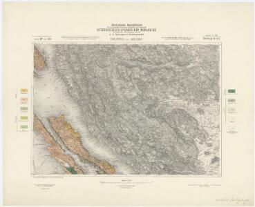
Zone 27, Col. XII, Carlopago und Jablanac, uit: Geologische Karte der im Reichsrathe vertretenen Königreiche und Länder der Österreich-Ungarischen Monarchie : auf Grundlage der Specialkarte i.M. 1:75.000 des k.u.k. Militär-geographischen Institutes / neu bearb. und als Kartenwerk von 341 Blattnummern in zwanglosen Lfg. hrsg. durch die k.k. Geologische Reichsanstalt in Wien
1 : 75000 titelvariant: Geologische Spezialkarte der im Reichsrate vertretenen Königreiche und Länder der Österreichisch-Ungarischen Monarchie; Geologische Specialkarte der im Reichsrathe vertretenen Königreiche und Länder der Österreichisch-Ungarischen Monarchie; Annotatie: Titel bovenaan kaartblad: Geologische Spezialkarte der im Reichsrate vertretenen Königreiche und Länder der Österreichisch-Ungarischen Monarchie en Geologische Specialkarte der im Reichsrathe vertretenen Königreiche und Länder der Österreichisch-Ungarischen Monarchie; Annotatie geografische gegevens: Coördinaten gebaseerd op nulmeridiaan van Ferro (Hierro) Kaiserlich-Königliche Geologische Reichsanstalt, Wenen Wien : K.K. Geologische Reichsanstalt
Karlobag und Jablanac.
from Spezialkarte der osterreichisch-ungarischen Monarchie.
Umgebungen von Arbe
Kroatien Dalmatien Rab Umland
Senj
1 : 200000 Kartografska radionica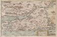
Zarae, et Sebenici Descriptio
Zadar (Region) Lazius, Wolfgang
Karte vom Liccaner Grenz Regiment
1 : 105000 Chorvatsko Kossovich, Mathias Kaiser, J.F.
Senj und Otocac.
from Spezialkarte der osterreichisch-ungarischen Monarchie.
Skelet-Karte für Curs-Skizzen
Chorvatsko K. u. k. Kriegs-Marine
Pago.
from Spezialkarte der osterreichisch-ungarischen Monarchie.
Lussinpiccolo und Punta Loni.
from Spezialkarte der osterreichisch-ungarischen Monarchie.
Arbe
1 : 200000 Kroatien Rab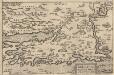
Zarae, Et Sebenici Descriptio [Karte], in: Theatrum orbis terrarum, S. 357.
1 Karte aus Atlas Ortelius, Abraham Vrients, Jan Baptista
Generalkarte von Zentraleuropa

Die adriatische Küste von Pola bis Zara
1 : 900000 Kroatien Adriaküste
Grenzgebiet von Zagrabiensis und Corbaviensis
1 : 1850000 Diözese Krbava, Diözese Zagreb, Grenze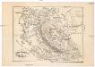
Ostrovy Quarnerské a Velebit
1 : 913000 Dalmácie (Chorvatsko)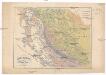
Ostrovy Quarnerské a Velebit
1 : 913000 Dalmácie (Chorvatsko)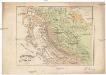
Ostrovy Quarnerské a Velebit
1 : 913000 Dalmácie (Chorvatsko)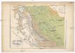
Ostrovy Quarnerské a Velebit
1 : 913000 Dalmácie (Chorvatsko)
Charte des nordwestlichen Theiles von Dalmatien
Dalmácie (Chorvatsko) im Verlage des Kunst und Industrie Comptoirs
Charte des nordwestlichen Theil von Dalmatien
Dalmácie (Chorvatsko) Verlage der Kunst und Industrie
Partie de la Dalmatie du nord ouest
Dalmácie (Chorvatsko) im Verlage des Kunst und Industrie Comptoirs
Goritiae, Karstii, Chaczeolae, Carniolae, Histriae, et Windorvm marchae descrip
1 Karte : Kupferdruck ; 31 x 23 cm Lazius; Ortelius s.n.
Goritiae, Karstii, Chaczeolae, Carniolae, Histriae, et Windorvm marchae descrip
1 Karte : Kupferdruck ; 31 x 23 cm Lazius; Ortelius s.n.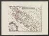
Der Noerdliche Theil Des Königreichs Dalmatien
1 : 1000000 Dalmatien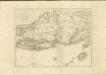

Tabula DUCATUS CARNIOLIAE VINDORUM MARCHIAE et HISTRIAE
1 : 520000 Cirknické jezero (Slovinsko) Homann, Johann Baptist Valvasor, Janez Vajkard â Io. Bapt. Homanno
Tabula ducatus Carnioliae Vindorum Marchiae et Histriae
1 : 510000 Cirknické jezero (Slovinsko) Homann, Johann Baptist Valvasor, L. B. â Io. Bapt. Homanno
Vermehrte und Verbesserte Landkarten des Königreichs Ungarn :
1 : 500000 Mollova mapová sbírka Stier, Martin Böner, Johann-Alexander Endter, Martin