Maps of Vesoul
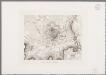
[Vesoul et environs]
1 : 20000 Annotatie: Herdruk van originele koperplaat; Oorspr. uitg.: ca. 1850 [Paris : I.G.N.]
[Vesoul]
1 Blatt : 61 x 92 cm Durand s.n.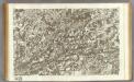
145 Vesoul.
1 : 86400 Cassini family; Cassini, Cesar-Francois, 1714-1784
Sequani Partie des Archidconnes de Favernay et de Luxeuil du Dioecese de Besancon
1 : 240000 Mollova mapová sbírka Sanson, Nicolas Somer, Jean Pruthenus Sanson, Nicolas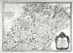
Sequani
1 Karte : Kupferdruck ; 39 x 55 cm Sanson; Robert de Vaugondy; Somer chés le S Robert geogr. ord. du roy quai de l'Horloge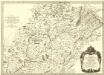
Sequani Partie des Archidconnes. de Favernay et de Luxeuil du Dioecese de Besançon
1 : 240000 Mollova mapová sbírka Sanson, Nicolas Somer, Jean Pruthenus Mariette, Pierre
Dijon 153, uit: Special-Karte von Mittel-Europa / nach amtlichen Quellen bearbeitet von W. Liebenow
1 : 300000 titelvariant: W. Liebenow's Mittel-Europa; Annotatie: Titel boven de bladen: W. Liebenow's Mittel-Europa Johannes Wilhelm Liebenow 1822-1897 Frankfurt a. M. : Ludwig Ravenstein
Dijon 153, uit: [W. Liebenow's Special-Karte von Mittel-Europa]
1 : 300000 titelvariant: W. Liebenow's Mittel-Europa; Annotatie: Titel boven de bladen: W. Liebenow's Mittel-Europa Johannes Wilhelm Liebenow 1822-1897 Hannover : Hermann Oppermann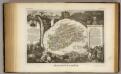
Dept. De La Hte. Saone.
1 : 571000 Levasseur, Victor.
Sequani
1 Karte : Kupferdruck ; 39 x 47 cm Sanson; Robert de Vaugondy; Somer chez le Sr. Robert geographe ordin. du roy quai de l'Horloge du Palais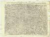
Carte topographique d'Allemagne
1 : 224000 Alsasko (Francie) Jaeger, Johann Wilhelm Abraham I.W.A. Iaeger
Carte topographique d'Allemagne
1 : 224000 Alsasko (Francie) Jaeger, Johann Wilhelm Abraham I. W. A. Iaeger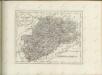

Basel 154, uit: [W. Liebenow's Special-Karte von Mittel-Europa]
1 : 300000 titelvariant: W. Liebenow's Mittel-Europa; Annotatie: Titel boven de bladen: W. Liebenow's Mittel-Europa Johannes Wilhelm Liebenow 1822-1897 Hannover : Hermann Oppermann
Département de la Haute Saone
1 Karte : Kupferdruck ; 48 x 48 cm Houdan; Dumez chez Dumez directeur de l'Atlas national rue de la Harpe no. 26
Partie septentrionale du comté de Bourgogne ou Franche-Comté
1 Karte : Kupferdruck ; 46 x 55 cm Robert de Vaugondy; Gobin G. et D. Robert de Vaugondy
Département de la Haute Saone
1 : 260000 Haute-Saône (Francie) Houdan, d' P. G. Chanlaire et Dumez
Département de la Haute Saone
1 : 260000 Haute-Saône (Francie) Chanlaire, Pierre-Grégoire P.G. Chanlaire
Schulwandkarte zur Geschichte der Schweiz
1 : 180000 Nordwest-Blatt Oechsli, Wilhelm ; Baldamus, Alfred Kartograph. Verlagsanstalt von Georg Lang
Distanzenkarte von der Schweiz
1 : 200000 1 Karte in 8 Teilen nach den besten Hülfsquellen bearb. von R. Huber Wagner, Bern
Wandkarte der Schweiz
1 : 200000 1 Karte auf 8 Blättern J.M. Ziegler Wurster, Winterthur
Besançon
1 : 200000 1 Karte entworfen und bearbeitet von Woerl ; in Stein gestochen unter seiner Leitung 1835 ; Lithographie von B. Herder Herder, Freiburg im Breisgau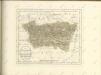

Les Suisses Leurs Alliés et Leurs Suiets
1 : 250000 Mollova mapová sbírka Jaillot, Alexis-Hubert Jaillot, Alexis Hubert
Les Suisses leurs alliés et leurs suiets
Švýcarsko Jaillot, Alexis-Hubert Ludvík AH. Iaillot
Carte de la Suisse avec les plans des cheflieux des 22 cantons
1 : 200000 1 Karte auf 8 Bl. dessinée et publié par Henri Keller ; Lithogr. von J. Schweizer = Charte der Schweiz mit den Grundrissen der Hauptorte der 22 Cantone Keller, Zürich
Original von Keller's zweiter Reisekarte der Schweiz
1 : 500000 1 Karte in 4 Teilen gest. v. J. Scheurmann Keller, Zürich
Superior Burgundiae Comitatus Vulgo la Franche Comte Complectens Praefecturas Amontii Dolae Avalli Quibus Adjacetus Comitatus Montis Balliardi
1 : 410000 Mollova mapová sbírka Valk, Gerhard Valck, Gerard
Nova Helvetiae Tabula Geographica
1 : 290000 Mollova mapová sbírka Scheuchzer, Johann Jakob Huber, Johann Heinrich Scheuchzer, Johann Jakob
![[Vesoul et environs]](https://images-2.georeferencer.com/images/iiif/735950975799/full/,300/0/native.jpg)

