Maps of Polynesia

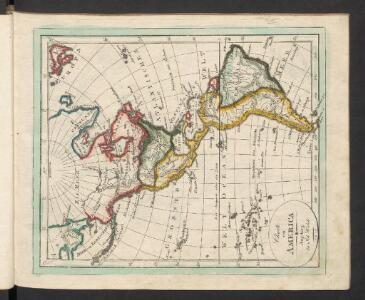
America
Neuester Schul-Atlas Walch, Johann im Verlag bei Joh. Walch
[Terra]
země světa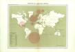
Atlas du Comité central des houilleres de France: Cartes des bassins houillers de la France, de la Grande-Bretagne, de la Belgique et de l'Allemagne
The World.
1 : 65000000 Letts, Son & Co.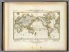
Darstellung Der Isodynamischen Linien.
1 : 130000000 Berghaus, Heinrich
Linien gleicher magnetischer Inklination (Isoklinen)
Atlas des Erdmagnetismus Neumayer, Georg Justus Perthes
[Verbreitungsbezirke der wichtigsten Kulturgewächse]
Zweiter Band, enthaltend in vier Abtheilungen die Vertheilung der Organismen: 5. Pflanzen-Geographie, 6. Thier-Geographie, 7. Anthropographie, 8. Ethnographie Humboldt, Alexander von Verlag von Justus Perthes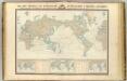
Navigation, les oceans.
1 : 67000000 Garnier, F. A., 1803-1863
Thermometrie.
1 : 70000000 Garnier, F. A., 1803-1863
India Extrema; XIX. Nova Tabula. [Karte], in: Claud. Ptolemaeus. Geographia lat. cum mappis [...], S. 413.
1 Karte aus Atlas Münster, Sebastian [und Ptolemaeus, Claudius]
[Botanical Geography]
The physical atlas Johnston, Alexander Keith William Blackwood & Sons
Welt-Karte zur Übersicht der Meeres-Strömungen und des Schnellverkehrs
Hand-Atlas über alle Theile der Erde und über das Weltgebäude Stieler, Adolf Justus Perthes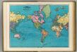
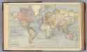
World, Mercator's projection.
1 : 64000000 Rand McNally and Company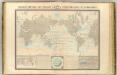
Courants atmospheriques, oceaniques.
1 : 70000000 Garnier, F. A., 1803-1863
Atlas über die Entwicklung von Industrie und Handel der Schweiz in dem Zeitraume vom Jahr 1770 bis zum Jahr 1870
1 : 500000 Absatzgebiete des Schweizerischen Ausfuhrhandels 1870 Wartmann, Hermann Wurster Randegger & Co.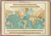
World - bathy-orographical.
1 : 83000000 John Bartholomew and Son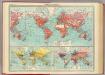
World - commerce.
1 : 92000000 John Bartholomew and Son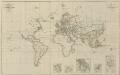
IX. Charte für die allgemeine Geschichte von Carl V. bis auf den Anfang des XXX-jährigen Krieges : d.i. von 1519 bis 1618 n. Christus
Entworfen von F.W. Benicken A. Falger gr. Weimar : im Verlage des L. Industrie-Comptoirs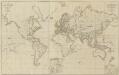
XII. Charte für die allgemeine Geschichte vom Anfange der österr. Erbfolge-Krieges bis auf den Tod Friedrichs des Zweiten : d.i. von 1740 bis 1786 n. Christus
Entworfen von F.W. Benicken in Stein grav. von A. Falger Weimar : im Verlage des L. Industrie-Comptoirs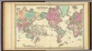
Colton's Map Of The World On Mercator's Projection.
1 : 65000000 Colton, G.W.
Welt-Karte zur Ubersicht der Luft-Stromungen und der See-Wege.
1 : 115000000 Berghaus, Hermann
Welt-Karte zur Ubersicht der Meeres-Stromungen und des Schnellverkehrs.
1 : 115000000 Berghaus, Hermann
Atlas über die Entwicklung von Industrie und Handel der Schweiz in dem Zeitraume vom Jahr 1770 bis zum Jahr 1870
1 : 500000 Absatzgebiete des Schweizerischen Ausfuhrhandels 1820 Wartmann, Hermann Wurster Randegger & Co.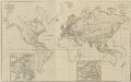
XIV. Charte für die allgemeine Geschichte vom Frieden zu Presburg bis auf den IIten Frieden zu Paris : d.i. von 1806 bis 1815 n. Christus
Entworfen von F.W. Benicken Weimar : im Verlage des L. Industrie-Comptoirs
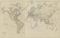
DIE ERDE in Zwey Halbkugeln der östlichen und westlichen
země světa
Typus Orbis A Ptol. Descriptus [Karte], in: Claud. Ptolemaeus. Geographia lat. cum mappis [...], S. 251.
1 Karte aus Atlas Münster, Sebastian [und Ptolemaeus, Claudius]
Facsimile: Langsdorff's Map of the World.
1 : 92000000 Von Langsdorff, G.H.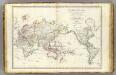
Mappe-monde.
1 : 55000000 Brue, Adrien Hubert, 1786-1832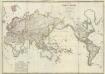
Composite: Mappe-monde
1 : 27000000 Brue, Adrien Hubert, 1786-1832