Maps of Asia

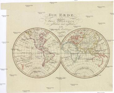
DIE ERDE in Zwey Halbkugeln der östlichen und westlichen
země světa
Distribution primitive du genre humain.
1 : 95000000 Vincent
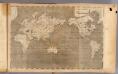
Mappe-monde.
1 : 55000000 Brue, Adrien Hubert, 1786-1832
Welt-Karte zur Ubersicht der Luft-Stromungen und der See-Wege.
1 : 115000000 Berghaus, Hermann
Welt-Karte zur Ubersicht der Meeres-Stromungen und des Schnellverkehrs.
1 : 115000000 Berghaus, Hermann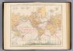
Weltverkehrs, Meeresstromungen.
1 : 90000000 Andree, Richard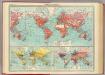
World - commerce.
1 : 92000000 John Bartholomew and Son
[Map of the world]
Tsurumine, Shigenobu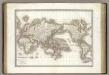
Mappe-monde.
1 : 75000000 Lapie, M. (Pierre), 1779-1850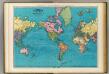
World, Mercator's projection.
1 : 64000000 Rand McNally and Company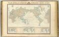
Navigation, les oceans.
1 : 67000000 Garnier, F. A., 1803-1863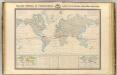
Thermometrie.
1 : 70000000 Garnier, F. A., 1803-1863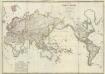
Composite: Mappe-monde
1 : 27000000 Brue, Adrien Hubert, 1786-1832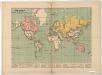
The world on Mercator's projection : showing the British possessions and chief ports coloured red
Relief shown by hachures. "Supplement to the Illustrated London News, May 9, 1885." Marginal notes on the population, revenue, imports and exports value and distance from Great Britain for each colony. London : Illustrated London News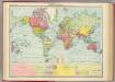
World - political.
1 : 82000000 John Bartholomew and Son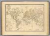
Terre, Mercator proj.
1 : 70000000 Andriveau-Goujon, J.
Planiglob zur Ubersicht der verschiedenen Bekleidung's Weise der Bewohner des ganzen Erdbodens.
1 : 140000000 Berghaus, Heinrich
Welt-Karte zur Übersicht der Meeres-Strömungen und des Schnellverkehrs
Hand-Atlas über alle Theile der Erde und über das Weltgebäude Stieler, Adolf Justus Perthes
India Extrema; XIX. Nova Tabula. [Karte], in: Claud. Ptolemaeus. Geographia lat. cum mappis [...], S. 413.
1 Karte aus Atlas Münster, Sebastian [und Ptolemaeus, Claudius]
[Terra]
země světa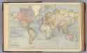
The World.
1 : 65000000 Letts, Son & Co.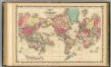
Map Of The World on Mercator's Projection.
1 : 75000000 Johnson, A.J.
Hyetographic; rain map.
1 : 71500000 Johnston, Alexander Keith, 1804-1871
Kaart van de eilanden beoosten Java [and] Overzigtskaart voor de ligging van den Oost Indischen Archipel, met betrekking tot Australië en tot de naaste kusten van Afrika, Azië en Amerika
Grav. en druk v. T. Hooiberg te Leiden te s'Hage : uitgave van K. Fuhri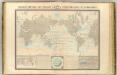
Courants atmospheriques, oceaniques.
1 : 70000000 Garnier, F. A., 1803-1863
[Verbreitungsbezirke der wichtigsten Kulturgewächse]
Zweiter Band, enthaltend in vier Abtheilungen die Vertheilung der Organismen: 5. Pflanzen-Geographie, 6. Thier-Geographie, 7. Anthropographie, 8. Ethnographie Humboldt, Alexander von Verlag von Justus Perthes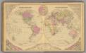
World.
1 : 60000000 Gray, Frank Arnold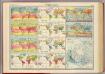
World - climate.
1 : 260000000 John Bartholomew and Son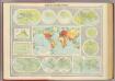
Mapping of the world.
1 : 120000000 John Bartholomew and Son
General chart, Mercator proj.
1 : 168000000 Seaman, James V.
World Mercator's projection.
1 : 112000000 Arrowsmith, Aaron; Lewis, Samuel