Maps of Ukraine

[Europäisches Russland, Südliches Blatt]
Hand-Atlas über alle Theile der Erde nach dem neuesten Zustande und über das Weltgebäude Stieler, Adolf bei Justus Perthes
Europ. Russland
Stieler's Hand-Atlas Stieler, Adolf bei Justus Perthes
Südliches Blatt vom Europ. Russland
Hand-Atlas über alle Theile der Erde nach dem neuesten Zustande und über das Weltgebäude Stieler, Adolf bei Justus Perthes
Cvmania Magna olim Hvnnia Orientalis
1 : 6500000 Mollova mapová sbírka
Theatre de la guerre sur les frontieres entre les deux grands monarques de Russie & de Turquie ou carte nouvelle d'une grande partie de la Russie ou l'on a la Petite Tartarie, l'Ukraine la Crimée & le pais des Cosaques la mer de Azof & la Mer Noire & les pais circomvoisins
1 : 3000000 Azovské moře (Ukrajina a Rusko) Ottens, Reinier Ottens, Josua par R. & I. Ottens

Taurica Chersonesus. Nostra aetate Przecopsca et Gazara dicitur [Karte], in: Gerardi Mercatoris Atlas, sive, Cosmographicae meditationes de fabrica mundi et fabricati figura, S. 167.
1 Karte aus Atlas Mercator, Gerhard Montanus, Petrus
Taurica Chersonesus. Nostra aetate Przecopsca et Gazara dicitur [Karte], in: Atlas, sive, Cosmographicae meditationes de fabrica mundi et fabricati figura, S. 162.
1 Karte aus Atlas Mercator, Gerhard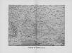
Reliefkarte der Ukraine und Krim
Ukraine, Krim
S. Russia in Europe.
1 : 8900000 Seaman, James V.
71-72. Ucraina, Mar Nero.
1 : 3000000 Touring club italiano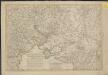
Nouveau théatre de la guerre entre les Turcs et les Russes et l'Empereur
1 : 4500000 Petit sculp.
[XIV], uit: Geognostische Karte des Oesterreichischen Kaiserstaates mit einem grossen Theile Deutschland's u. Italien / hauptsachlich nach ... Haidinger's geognostischer Karte dieses Staates bearb. von Josef Scheda
1 : 3000000 titelvariant: General-Karte von Europa in 25 Blättern; Annotatie: Bijlage bij: General-Karte von Europa in 25 Blättern. - 1:2.592.000. - 1845-1847 Scheda, Joseph Wien : K.K. Militär. Geografisch. Institut
Tabula Geographica QUA PARS RUSSIAE MAGNAE, PONTUS EUXINUS seu MARE NIGRUM et TARTARIA MINOR
1 : 3000000 Anatolie (Turecko) Homann, Johann Baptist a Ioh. Baptista Homanno
Tabula geographica qua pars Russiae Magnae, Pontus Euxinus seu Mare Nigrum et Tauriae Regnum cum finitimis Bulgariae, Romaniae et Natoliae provincis exhibetur
1 : 3000000 Anatolie (Turecko) Homann, Johann Baptist a Ioh. Baptista Homanno
Plan von der Krim und der Nogdyschen und Kubanschen Tatarey
1 : 7420000 Krym (Ukrajina)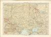
Sovětský svaz v mapách

Taurica Chersonesus, Nostra aetate Przecopsca, et Gazara dicitur. [Karte], in: Novus Atlas, das ist, Weltbeschreibung, Bd. 1, S. 66.
1 Karte aus Atlas Blaeu, Joan Blaeu, Willem Janszoon
Schema teatra voennych dějstvīj Azovskago flota 1695-1711 g.
Schwarzes Meer Südukraine Kriegsmarine

Ukraine. Ethnographische Karte des einheitlichen ukrainischen Gebiets ohne Enklaven
1 : 8000000 Ukraine Ethnische Gruppe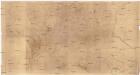
[Ukrajina - vrstevnice a říční síť]
Ukrajina
Ukrania quae et Terra Cosaccorum / exhibita à Ioh. Baptista Homanno
1 : 3200000 1 Karte : Kupferdruck ; 46 x 56 cm Homann, Johann Baptist [Homann]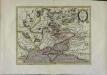
Tavrica chersonesvs nostra ætate Przecopsca et Gazara dicitur
1 Karte : Kupferdruck ; 30 x 39 cm Mercator; Hondius Henricus Hondius
Tavrica chersonesvs, hodie Przecopsca, et Gazara dicitur
1 : 3100000 1 Karte : Kupferdruck ; 36 x 48 cm Mercator, Gerhard excudebat Janssonio-Waesbergii et Moses Pitt
Taurica chersonesus nostra aetate Przecopsca et Gazara dicitur / per Gerardum Mercatorem
1 : 3700000 1 Karte : Kupferdruck ; 30 x 38 cm Mercator, Gerhard [Jodocus Hondius]
Tavrica Chersonesvs, nostra aetate Przecopsca et Gazara dicitur
1 : 3100000 1 Karte : Kupferdruck ; 36 x 48 cm Mercator, Gerhard
Tavrica chersonesvs, hodie Przecopsca, et Gazara dicitur
1 : 3100000 1 Karte : Kupferdruck ; 36 x 48 cm Mercator, Gerhard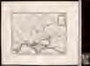
![[Europäisches Russland, Südliches Blatt]](https://images-2.georeferencer.com/images/iiif/656521866398/full/,300/0/native.jpg)

