Maps of Carpathian Mountains

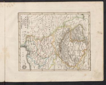
Preussen, Polen, Galizien, Ungarn, Siebenbürgen
Schul-Atlas über alle Theile der Erde nach dem neuesten Zustande, und über das Weltgebäude Stieler, Adolf bei Justus Perthes
Preussen, Polen, Galizen, Ungarn, Siebenbuergen
Ostmitteleuropa
Allemagne orientale.
1 : 2000000 Andriveau-Goujon, J.
Europe orientale
1 : 2000000 Bruxelles : De Rouck
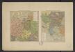
Polsko, Československo, Maďarsko a Rumunsko
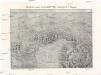
Plastická mapa východních Alp rakouských a Karpat
Alpy rakouské-oblast Emil Šolc
Karpathenlaender, Polen und Preussen
E. von Sydow's Schul-Atlas in sechs und dreissig Karten Sydow, Emil von bei Justus Perthes
REGNUM POLONIAE ejusque confinia
1 : 10700000 Evropa východní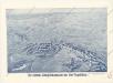
Der östliche Kriegsschauplatz aus der Vogelschau
Atlas Niox ; Atlas Niox. No. 31, Populations de l'Europe centrale. No. 31 bis, Populations de la péninsule des Balkans
1 : 6000000 Niox, Gustave-Léon 1840-1921 Paris : Ch. Delagrave
Karpathenländer, Polen und Preussen
Ostmitteleuropa Skizzenbuch
Western Russia from the Baltic to the Euxine (Black Sea).
1 : 3380000 Sharpe, J.
Regni Poloniae, Magni Ducatus Lithuaniae Coeterarumq[ue] Regi Poloniae Subditarum Regionum Tabula
1 : 3100000 Allard, Carel
[Polen, Galizien, Ungarn, Kroatien u. Siebenbürgen; Moldau und Walachey]
Schul-Atlas über alle Theile der Erde nach dem neuesten Zustande, und über das Weltgebäude Stieler, Adolf Justus Perthes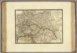
Empire d'Autriche, Monarchie Prussienne, Confederation Germanique, Pologne.
1 : 3500000 Brue, Adrien Hubert, 1786-1832
Mapa Polski
1 : 1500000 Evropa střední a východní Pokorny, Wilhelm Tomaszewski, Adam Księgarnia polska Bernarda Połonieckiego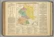
Poland, Prussia, and Hungary.
1 : 5000000 Lavoisne, M.
Germany, Austria, and Switzerland.
1 : 4092000 Gray, Frank Arnold
Střední Evropa
1 : 3000000 Evropa střední Kuchař, Karel V. Neubert a synové
Tabula nova totius regni Poloniae
1 : 4050000 Litva Sanson, Nicolas Visscher, Nicolaus apud Nicolaum Vißcher
Poloniae finitimarumque locorum descriptio / auctore Wenceslao Godreccio Polono
1 : 2500000 1 Karte : Kupferdruck ; 37 x 49 cm Grodecki, Wacław [Aegidius Coppenius Diesth]
Oorlogskaart van Polen : bijzonder geschikt voor het volgen van de internationale gebeurtenissen / [cartografie] W. Seghers
1 : 1111000 W. Seghers Antwerpen : Patria ; [etc.]
Hungaria.
from Abraham Ortelius his epitome of the theater of the worlde / nowe latlye ... renewed and augmented ... by Micheal Coignet, mathematitian of Antwarpe.
Poloniae, Lituaniaeque Descritpio. [Karte], in: Theatrum orbis terrarum, S. 369.
1 Karte aus Atlas Ortelius, Abraham Vrients, Jan Baptista
Poloniae, Lituaniaeque Descritpio. [Karte], in: Theatrum orbis terrarum, S. 274.
1 Karte aus Atlas Ortelius, Abraham
Polonia
Polsko
Eastern Germany, distribution of population.
1 : 2400000 Covers Poland, East Prussia, and border areas of Germany and Czechoslovakia. "From: Atlas des deutschen Lebensraumes in Mitteleuropa, plate 27. Data as of 1930-1934." "No. A-6287." United States. Office of Strategic Services. Research and Analysis Branch. [Washington, D.C.] : R & A, OSS
La Polonia
Bělorusko Zatta, Antonio Zatta
Dritte Theilung Polens 1795
Polen Teilung Polens <1795>