Maps of Nový Knín

Sudowitz (Sudowice) - c7533-1-002 - Kaiserpflichtexemplar der Landkarten des stabilen Katasters
1 : 2880
Sudowitz (Sudowice) - c7533-1-001 - Kaiserpflichtexemplar der Landkarten des stabilen Katasters
1 : 2880
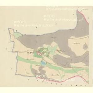
Neu Knin (Nowo Knin) - c5314-1-001 - Kaiserpflichtexemplar der Landkarten des stabilen Katasters
1 : 2880
Neu Knin (Nowo Knin) - c5314-1-003 - Kaiserpflichtexemplar der Landkarten des stabilen Katasters
1 : 2880
Neu Knin (Nowo Knin) - c5314-1-002 - Kaiserpflichtexemplar der Landkarten des stabilen Katasters
1 : 2880
Krzischow (Křissow) - c3670-1-002 - Kaiserpflichtexemplar der Landkarten des stabilen Katasters
1 : 2880
Krzischow (Křissow) - c3670-1-001 - Kaiserpflichtexemplar der Landkarten des stabilen Katasters
1 : 2880
Kram (Kramy) - c3508-1-002 - Kaiserpflichtexemplar der Landkarten des stabilen Katasters
1 : 2880
Kram (Kramy) - c3508-1-001 - Kaiserpflichtexemplar der Landkarten des stabilen Katasters
1 : 2880
Kram (Kramy) - c3508-1-003 - Kaiserpflichtexemplar der Landkarten des stabilen Katasters
1 : 2880
Zaborna Lhotta - c9008-1-002 - Kaiserpflichtexemplar der Landkarten des stabilen Katasters
1 : 2880
Zaborna Lhotta - c9008-1-003 - Kaiserpflichtexemplar der Landkarten des stabilen Katasters
1 : 2880
Zaborna Lhotta - c9008-1-001 - Kaiserpflichtexemplar der Landkarten des stabilen Katasters
1 : 2880
Korkin - c3336-1-001 - Kaiserpflichtexemplar der Landkarten des stabilen Katasters
1 : 2880
Korkin - c3336-1-002 - Kaiserpflichtexemplar der Landkarten des stabilen Katasters
1 : 2880

Karte des Dobřischer Bezirkes im Prager Kreise
1 : 7000 Dobříš-oblast (Česko) Wagner, Jan Eduard Karl André
Karte des Dobřischer Bezirkes im Prager Kreise
1 : 7000 Dobříš-oblast (Česko) Wagner, Jan Eduard Karl André


Přehledná mapa vltavské trati Kamýk-Štěchovice
1 : 25000 Kamýk (Česko : vodní nádrž) Ředitelství pro stavbu vodních cest
Soubor map okresů Pražského kraje

Wotický vikariát
Votice-oblast (Česko)
Karte des Gemeindegrenzen

Geologická mapa Československé republiky, list: Beroun - Hořovice (4052)

Geologická mapa Československé Republiky

Beraun und Hořowitz
1 : 75000 Beroun (Česko : oblast) Radler K. u. k. militär-geographisches Institut
Beraun und Hořowitz
1 : 75000 Beroun (Česko : oblast) Radler K. u. k. Militärgeographisches Institut
Beraun und Hořowitz
1 : 75000 Beroun (Česko : oblast) K. u. k. Militärgeographisches Institut