Maps of Korkyně

Krzischow (Křissow) - c3670-1-002 - Kaiserpflichtexemplar der Landkarten des stabilen Katasters
1 : 2880
Krzischow (Křissow) - c3670-1-001 - Kaiserpflichtexemplar der Landkarten des stabilen Katasters
1 : 2880
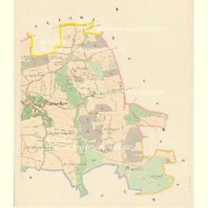
Korkin - c3336-1-001 - Kaiserpflichtexemplar der Landkarten des stabilen Katasters
1 : 2880
Korkin - c3336-1-002 - Kaiserpflichtexemplar der Landkarten des stabilen Katasters
1 : 2880
Kram (Kramy) - c3508-1-002 - Kaiserpflichtexemplar der Landkarten des stabilen Katasters
1 : 2880
Kram (Kramy) - c3508-1-001 - Kaiserpflichtexemplar der Landkarten des stabilen Katasters
1 : 2880
Kram (Kramy) - c3508-1-003 - Kaiserpflichtexemplar der Landkarten des stabilen Katasters
1 : 2880
Sudowitz (Sudowice) - c7533-1-002 - Kaiserpflichtexemplar der Landkarten des stabilen Katasters
1 : 2880
Sudowitz (Sudowice) - c7533-1-001 - Kaiserpflichtexemplar der Landkarten des stabilen Katasters
1 : 2880
Busch (Buss) - c0686-1-003 - Kaiserpflichtexemplar der Landkarten des stabilen Katasters
1 : 2880
Busch (Buss) - c0686-1-002 - Kaiserpflichtexemplar der Landkarten des stabilen Katasters
1 : 2880
Busch (Buss) - c0686-1-001 - Kaiserpflichtexemplar der Landkarten des stabilen Katasters
1 : 2880
Busch (Buss) - c0686-1-004 - Kaiserpflichtexemplar der Landkarten des stabilen Katasters
1 : 2880
Neuhof (Nowedwory) - c5262-1-001 - Kaiserpflichtexemplar der Landkarten des stabilen Katasters
1 : 2880
Neuhof (Nowedwory) - c5262-1-002 - Kaiserpflichtexemplar der Landkarten des stabilen Katasters
1 : 2880
Neuhof (Nowedwory) - c5262-1-003 - Kaiserpflichtexemplar der Landkarten des stabilen Katasters
1 : 2880

Karte des Dobřischer Bezirkes im Prager Kreise
1 : 7000 Dobříš-oblast (Česko) Wagner, Jan Eduard Karl André
Karte des Dobřischer Bezirkes im Prager Kreise
1 : 7000 Dobříš-oblast (Česko) Wagner, Jan Eduard Karl André

Přehledná mapa vltavské trati Kamýk-Štěchovice
1 : 25000 Kamýk (Česko : vodní nádrž) Ředitelství pro stavbu vodních cest
Soubor map okresů Pražského kraje

Wotický vikariát
Votice-oblast (Česko)
Benešov
1 : 75000 Benešov (Česko : oblast) Vojenský zeměpisný ústav
Königsaal und Beneschau
1 : 75000 Benešov (Česko : oblast) Charlemont K. u. k. Militärgeographisches Institut
Königsaal und Beneschau
1 : 75000 Benešov (Česko : oblast) K. u. k. Militärgeographisches Institut
Příbramer Vicariat
Příbram-oblast (Česko)
Vilímkovy místopisné mapy zemí Koruny české
1 : 100000 Benešov (Česko : oblast) Srp, Jan Jos. R. Vilímek
Podrobná mapa Království českého
1 : 100000 Benešov (Česko : oblast) Srp, Jan Jaroslav Bursík