Maps of Střešovice

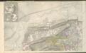
Plan der Gegend vor dem Strahofer Thor der Hauptstadt Prag
Strahov (Praha, Česko) Thurn-Taxis, Wilhelm von Renner, Emanuel von
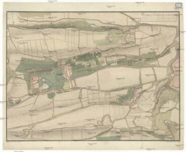
Střeschowitz (Střessowic) - c7457-1-001 - Kaiserpflichtexemplar der Landkarten des stabilen Katasters
1 : 2880
Střeschowitz (Střessowic) - c7457-1-002 - Kaiserpflichtexemplar der Landkarten des stabilen Katasters
1 : 2880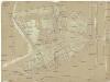
Stadt Strahov
Strahov (Praha, Česko)
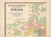
Plan der Haupstadt Prag 11

Kriegs-Expedit. Karte in Böhmen III Blat in welcher die Belagerung Prag A. 1742 von den 28. Iul. bis 13. 7br. zuversichtlich vorgestellet wird
Malá Strana (Praha, Česko) Sinsart Perizot von Homaenn. Erben
Auto-Praha : automobilní plán Velké Prahy a příručka pro automobilisty
1 : 50000
Výškopisný plán hlavního města Prahy s okolím

Orientační plán hlavního města Prahy s okolím
1 : 5000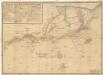
Grund-Rieß uber den Kossirz- und Czibulker Hoff auch Czisarzska
1 : 2500 Košíře (Praha, Česko) Mann, Johann Joseph Florian
Gross Brzewnow (Welky Břewnow) - c0558-1-001 - Kaiserpflichtexemplar der Landkarten des stabilen Katasters
1 : 2880
Gross Brzewnow (Welky Břewnow) - c0558-1-002 - Kaiserpflichtexemplar der Landkarten des stabilen Katasters
1 : 2880
Gross Brzewnow (Welky Břewnow) - c0558-1-003 - Kaiserpflichtexemplar der Landkarten des stabilen Katasters
1 : 2880
Welleslawin - c8362-1-002 - Kaiserpflichtexemplar der Landkarten des stabilen Katasters
1 : 2880
Welleslawin - c8362-1-001 - Kaiserpflichtexemplar der Landkarten des stabilen Katasters
1 : 2880
Orientační plán hlavního města Prahy s okolím
1 : 5000
Výškopisný plán hlavního města Prahy s okolím

Orientační plán hlavního města Prahy s okolím

Mapový obraz Malé Strany a Strahova ze 17. století : [faksimile plánů]

Plán hlavního města království českého Praha
Plán královského hlavního města Prahy 1815

Praha : orientační plán : Československá spartakiáda 1975
1 : 15000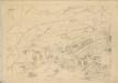
Polohopisný plán královského hlavního města Prahy : 1.Staré město, 2.Nové město, 3.Malá strana, 4.Hradčany, 5.Josefov, 6.Vyšehrad pak Smíchova, Karlína, král.Vinohradů, Žižkova a Nuslí, s udáním starých i nových čísel domů
1 : 4000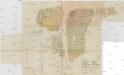
Situations-Plan der königl. Hauptstadt Prag nebst Smichov u. Karolinenthal
1 : 4000 Karlín (Praha, Česko) Mayr, Josef Spolek notářů v Čechách
Grundris der kaisel. königl. Hauptstadt Prag im Königreich Böhmen
Praha (Česko) Scheidlen, CH. F. Seybold, I.
Orientační plán hlavního města Prahy
Orientierungsplan der Hauptstadt Prag
Jiřík, Rudolf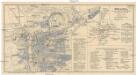
Praha
Praha (Česko) Salač, Klement Metzeroth, Carl B. Kočí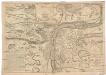
Plan de l'attaque et de la defense de Prag
Praha (Česko) Le Rouge, Georges-Louis Soubise, Charles de Rohan chez le sr. le Rouge