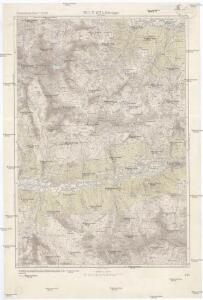
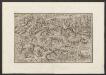
Maps of St. Veit in Defereggen

St. Veit in Defereggen
1 : 25000 Kartographisches Institut
Hopfgarten in Defereggen
1 : 50000 Tyrolsko (Rakousko) Kartographisches Institut
Oberes Defereggental
1 : 25000 Tyrolsko (Rakousko) Kartographisches, früher Militärgeographisches Institut
Lienz.
from Spezialkarte der osterreichisch-ungarischen Monarchie.
G. Freytag's Touristen-Wanderkarte
1 : 100000 Vysoké Taury (Rakousko : pohoří) Freytag, Gustav G. Freytag & Berndt
Touristen-Wanderkarte
1 : 100000 Benátské Alpy (Itálie) G. Freytag & Berndt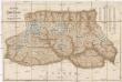
Karte der Hohen Tauern
1 : 144000 Vysoké Taury (Rakousko : pohoří) Sonklar, Karl von Beck'sche Universitäts Buchhandlung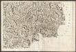
Carte du Tyrol
1 : 150000 Ost-Blatt Anich, Peter par le Dépôt Général de la Guerre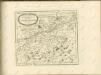
Militair Karte von Süd-Deutschland in 20 Sectionen
1 : 400000 19. Section Coulon, Alois von A. von Coulon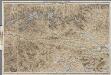
[Kaart], uit: Karte der Ost-Tiroler Alpen, Tauern und Dolomiten / von Ludwig Ravenstein
1 : 250000 Ravenstein, Ludwig Frankfurt am Main : Ravenstein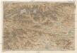
Karte der Ost-Tiroler Alpen, Tauern und Dolomiten
1 : 250000 Dolomity (Itálie) Ravenstein, Ludwig Ludwig Ravenstein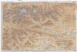
Karte der Ost-Tiroler Alpen, Tauern und Dolomiten
1 : 250000 Dolomity (Itálie) Ravenstein, Ludwig Ludwig. Ravenstein
Generalkarte von Zentraleuropa
Das Herzoghtum Kaernten öestreichischen und salzburgischen Antheils
1 : 610000 Korutansko (Rakousko)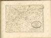

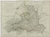
Herzogthum Salzburg
1 : 3200000 Salcburk (Rakousko : oblast) bei Marco Berra
Salzburg und Berchtesgaden
1 : 4000000 Berchtesgaden (Německo)
Tirolis
Mollova mapová sbírka Hoffmann, Johannes Hoffmann, Johann
Herzogthum Salzburg

Salzburg und Berchtesgaden
1 : 493000 Berchtesgaden (Německo) Jirasek, F. A. F.A. Jirasek
General-Karte von Salzburg
Lechner, R.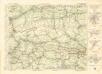
Freytag & Berndt ́s: Auto-Strassenkarten

Nova et accurata Carinthiae ducatus tabula geographica
1 : 194000 Klagenfurt (Rakousko) Homann, Johann Baptist a Io. Bapt. Homanno
Nova et accurata Carinthiae ducatus tabula geographica
1 : 190000 Korutansko (Rakousko) Homann, Johann Baptist a Io. Bapt. Homanno
Nova et accurata Carinthiae ducatus tabula geographica
1 : 190000 Korutansko (Rakousko) Homann, Johann Baptist a Io. Bapt. Homanno
Nova et accurata Carinthiae ducatus tabula geographica
1 : 194000 Korutansko (Rakousko) Homann, Johann Baptist a Io. Bapt. Homanno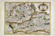
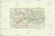
Saltzbvrg archiepiscopatus cum ducatu Carinthiæ
1 Karte : Kupferdruck ; 32 x 46 cm Mercator; Hondius sumptibus Henrici Hondij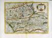
Saltzbvrg archiepiscopatus cum ducatu Carinthiæ
1 Karte : Kupferdruck ; 32 x 46 cm Mercator; Hondius sumptibus Henrici Hondij