Maps of Tyrol

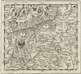
Tirolis
Mollova mapová sbírka Hoffmann, Johannes Hoffmann, Johann
Atlas Tyrolensis
Mollova mapová sbírka Anich, Peter

Generalkarte von Zentraleuropa

Tyrolis sub Felici Regimine Mariae Theresiae Rom. Imper. Avg. Chorographice Delineata ...
1 : 104000 Mollova mapová sbírka Mansfeld, Johann Ernst Mansfeld, Johann Ernest
Tyrolis sub Felici Regimine Mariae Theresiae Rom. Imper. Avg. Chorographice Delineata ...
1 : 104000 Mollova mapová sbírka Mansfeld, Johann Ernst Mansfeld, Johann Ernest
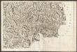
Tyrolis sub Felici Regimine Mariae Theresiae Rom. Imper. Avg. Chorographice Delineata ...
1 : 104000 Mollova mapová sbírka Mansfeld, Johann Ernst Mansfeld, Johann Ernest
Tyrolis sub Felici Regimine Mariae Theresiae Rom. Imper. Avg. Chorographice Delineata ...
1 : 104000 Mollova mapová sbírka Mansfeld, Johann Ernst Mansfeld, Johann Ernest
Strecke
Bludenz (Rakousko) K. k. Österreichische Staatsbahnen
Innsbruck 157, uit: Special-Karte von Mittel-Europa / nach amtlichen Quellen bearbeitet von W. Liebenow
1 : 300000 titelvariant: W. Liebenow's Mittel-Europa; Annotatie: Titel boven de bladen: W. Liebenow's Mittel-Europa Johannes Wilhelm Liebenow 1822-1897 Frankfurt a. M. : Ludwig Ravenstein
[Tirol]
Tyrolsko (Rakousko) Woerl Herder, B. B. Herder
Militair Karte von Süd-Deutschland in 20 Sectionen
1 : 400000 19. Section Coulon, Alois von A. von Coulon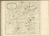

Salisburgensis jurisdictionis locorumque vicinorum vera descriptio
1 Karte : Kupferdruck ; 18 x 26 cm Quad; Nagel; Bussemacher; Secznagel Johannes Bussemacher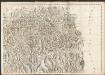
Carte du Tyrol
1 : 150000 Nordost-Blatt Anich, Peter par le Dépôt Général de la Guerre
Gebirgs-Karte
Alpy rakouské (pohoří) in Commission der literarisch-artistischen Anstalt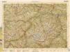
B.Z. - Karte von Oesterreich
Carte du Tyrol
1 : 150000 Ost-Blatt Anich, Peter par le Dépôt Général de la Guerre
Tyrolis sub Felici Regimine Mariae Theresiae Rom. Imper. Avg. Chorographice Delineata ...
1 : 104000 Mollova mapová sbírka Mansfeld, Johann Ernst Mansfeld, Johann Ernest
Per Inclyti Circuli Suevici Supremorum Ordinum
1 : 160000 Mollova mapová sbírka Pfeffel, Johann Andreas Homann, Johann Baptista - dědici
Per Inclyti Circuli Suevici Supremorum Ordinum :
1 : 160000 Mollova mapová sbírka Pfeffel, Johann Andreas Pfeffel, Johann Andreas I.
Brenner-Bahn
1 : 96000 Bolzano (Itálie) Fr. Unterberger's Kunsthandlung
[Stubaier Alpen]
1 : 100000 Stubaiské Alpy (Itálie a Rakousko : pohoří) Freytag & Berndt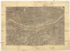
[Innsbruck a okolí]
1 : 144000 Innsbruck-oblast (Rakousko)
Tyrolis sub Felici Regimine Mariae Theresiae Rom. Imper. Avg. Chorographice Delineata ...
1 : 104000 Mollova mapová sbírka Mansfeld, Johann Ernst Mansfeld, Johann Ernest
Zillerthaler Alpen

Uebersichtskarte des Oetzthaler Gletscher-Gebietes
1 : 144000 Ötztalské Alpy (Itálie a Rakousko : pohoří) Berghaus, Hermann Sonklar, Karl von Justus Perthes
Reutte - Partenkirchen - Wetterstein - Gebirge

[Innsbruck und Umgebung]
1 : 250000 Innsbruck (Rakousko : oblast) Wagner & Debes