Maps of Westminster

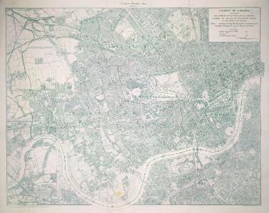
Map shewing the situation of all premises licensed for the sale of intoxicating liquors in the County of London
London County Council
Insurance Plan of London Western District Vol. A: Key Plan
1 : 21120 This "key plan" indicates coverage of the Goad 1901 series of fire insurance maps of London that were originally produced to aid insurance companies in assessing fire risks. The building footprints, their use (commercial, residential, educational, etc.), the number of floors and the height of the building, as well as construction materials (and thus risk of burning) and special fire hazards (chemicals, kilns, ovens) were documented in order to estimate premiums. Names of individual businesses, property lines, and addresses were also often recorded. Together these maps provide a rich historical shapshot of the commercial activity and urban landscape of towns and cities at the time. The British Library holds a comprehensive collection of fire insurance plans produced by the London-based firm Charles E. Goad Ltd. dating back to 1885. These plans were made for most important towns and cities of the British Isles at the scales of 1:480 (1 inch to 40 feet), as well as many foreign towns at 1:600 (1 inch to 50 feet). Chas E Goad Limited Chas E Goad Limited
MAP OF THE WESTERN SIDE OF LONDON, DISTINGUISHING THE ESTATE OF HER MAJESTY'S COMMISSIONERS FOR THE EXHIBITION OF 1851.
1 : 21120 Map of Kensington with title along the top and scale bar below the plan. The site of the Great Exhibiton of 1851 in Hyde Park is highlighted in green. Day & Son
Insurance Plan of London West & West North West Vols. A & B: Key Plan
1 : 10560 This "key plan" indicates coverage of the Goad 1891 series of fire insurance maps of London that were originally produced to aid insurance companies in assessing fire risks. The building footprints, their use (commercial, residential, educational, etc.), the number of floors and the height of the building, as well as construction materials (and thus risk of burning) and special fire hazards (chemicals, kilns, ovens) were documented in order to estimate premiums. Names of individual businesses, property lines, and addresses were also often recorded. Together these maps provide a rich historical shapshot of the commercial activity and urban landscape of towns and cities at the time. The British Library holds a comprehensive collection of fire insurance plans produced by the London-based firm Charles E. Goad Ltd. dating back to 1885. These plans were made for most important towns and cities of the British Isles at the scales of 1:480 (1 inch to 40 feet), as well as many foreign towns at 1:600 (1 inch to 50 feet). Chas E Goad Limited Chas E Goad Limited
Surrey II - OS Six-Inch Map
1 : 10560 Topographic maps Ordnance Survey Ordnance Survey
A PLAN of the ROADS Under the DIRECTION and CARE of this TRUST and divers Roads Adjacent.
1 : 16351 The title of this road map of Kensington and Chelsea appears in a panel above the plan, with the compass star at top right and scale bar at bottom left. The roads within the Kensington and Hyde Park Trust are indicated by a shadowed line; the king's private roads by a double line; the common roads by a double dotted line; and the footpaths by a single dotted line. Turnpikes and junctions are numbered for reference with distances given in a table down the left side of the plate. Roberts, R.
London SW.
1 : 15840 Stanford, Edward
An exact survey of the city's of London Westminster , XI
1 Blatt : 53 x 71 cm John Rocque
Charles Booth's descriptive map of London poverty 1889
Charles Booth
Thames and Metropolis Improvement plan
Martin, John
A PLAN of HYDE-PARK with the CITY and LIBERTIES of WESTMINSTER &c. Shewing the several IMPROVEMENTS propos'd
This plan shows renovations in Hyde Park and around Westminster.Two Royal palaces have been planned, in Hyde Park and Green Park. The red lines show an intention to regularize the street plan, replacing the narrow irregular streets with a gridlike formation. Gwynn, John
London
Grosser Hand-Atlas über alle Theile der Erde in 170 Karten Meyer, J. Verlag des Bibliographischen Instituts
PLAN OF WESTMINSTER. No II
This map is highlighted to give a retrospective view of the extent of Westminster. Represented in blue is the territory of Westminster according to the Decretal of AD1222 , while the red outline shows the present boundary. The green and yellow outlines indicate manor boundaries. Basire, J.
London NW.
1 : 15840 Stanford, Edward
PLAN OF WESTMINSTER. No 1 [A Plan of the City of Westminster, showing all the Parishes, as well as the Ancient Boundary of Westminster, in the year 951.]
An orange coloured area shows the extent of Westminster according to King Edgar's Charter of AD951. The contemporary boundary of Westminster is shown in red. Basire, J.
PLAN OF WESTMINSTER. No III
The area shaded red represents the extent of Westminster as defined in the Letters Patent of 3 August 1604. Basire, J.
The London directory, or a new & improved plan of London, Westminster, & Southwark, with the adjacent country, the new buildings, the new roads, and the late alterations by opening of new streets, & widening of others
1 : 15840
A plan of London, Westminster, and Southwark
1 : 26750
Insurance Plan of London West North-West District Vol. B: Key Plan
1 : 3600 This "key plan" indicates coverage of the Goad 1902 series of fire insurance maps of London that were originally produced to aid insurance companies in assessing fire risks. The building footprints, their use (commercial, residential, educational, etc.), the number of floors and the height of the building, as well as construction materials (and thus risk of burning) and special fire hazards (chemicals, kilns, ovens) were documented in order to estimate premiums. Names of individual businesses, property lines, and addresses were also often recorded. Together these maps provide a rich historical shapshot of the commercial activity and urban landscape of towns and cities at the time. The British Library holds a comprehensive collection of fire insurance plans produced by the London-based firm Charles E. Goad Ltd. dating back to 1885. These plans were made for most important towns and cities of the British Isles at the scales of 1:480 (1 inch to 40 feet), as well as many foreign towns at 1:600 (1 inch to 50 feet). Chas E Goad Limited Chas E Goad Limited
MAP of the GROSVENOR ESTATE (tinted pink) as it was in the Year 1723. with the intended Streets about Grosvenor Square.
1 : 5592 The title of this plan features at top right, with compass star at middle right and explanatory note at bottom right. The boundaries of the St George parish are outlined in red, with the properties in the estate in pink, and parks and open spaces in green. The plan shows the proposed new street plans for Grosvenor Square, but not the Chelsea waterworks,which featured in the original drawing from which this print was produced.
Surrey II.SE - OS Six-Inch Map
1 : 10560 Topographic maps Ordnance Survey Ordnance Survey
London VI.SE - OS Six-Inch Map
1 : 10560 Topographic maps Ordnance Survey Ordnance Survey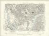
London X.NE - OS Six-Inch Map
1 : 10560 Topographic maps Ordnance Survey Ordnance Survey
A NEW and ACCURATE PLAN of the CITY of WESTMINSTER The DUTCHY of LANCASTER and Places Adjacent
John Rocque developed his surveying talent at a young age, making plans of the great houses and gardens of the nobility.This early experience led to him taking up large-scale surveying, producing plans such as this one of Westminster. Here, Tottenham Court and Marylebone are mostly fields but Westminster has grown sufficiently to demand the construction of a new bridge.Westminster Bridge was opened in 1750 and watermen were paid 163;25,000 in compensation as the new bridge made them largely redundant. The Chelsea Water Works Company, shown south of Totthill Fields, was set up to improve water supply to Westminster and "parts adjacent".The Company were the first to introduce slow sand filtration to purify Thames water. Rocque, John
NEW and ACCURATE PLAN of the CITY of WESTMINSTER, The DUTCHY of LANCASTER and Places Adjacent
1 : 11520 The title of this map appears in cartouche at top right, with a compass rose at top left. A territory with its own courts and administration, the Duchy of Lancaster was created in 1267 by Edward III for his younger son John. The Duchy was attached to the Crown when Prince Henry of Bolingbroke, the last Duke of Lancaster, became Henry IV in 1399. To this day, the Duchy has retained its own jurisdiction under the Chancellor of the Duchy of Lancaster.The chancellorship is a high governmental position, and sometimes a cabinet poist. Since, for at least the last two centuries, the Chancellor rarely has had any significant duties pertaining to the Duchy's management, he is usually available as a minister without portfolio. Recent Chancellors have included Labour cabinet minister Mo Mowlam.
Plan of the parish of PADDINGTON in the County of Middlesex 6
The development of Paddington began at the end of the Napoleonic wars, when the Bishop of London granted permission for building on his estate north of Hyde Park. Under Gutch's supervision, works continued into the 1850s, extending to Bayswater and the Edgware and Harrow Roads. The title of this plan appears at top left, with compass rose at top right and scale bar at bottom left. Also at bottom left is a key to the land acquired by the Grand Junction Canal Company from the Bishop of London. This the area in red on the plan, which also shows the final proposals for the new street plan at Bayswater. Gutch, George
Plan of the parish of PADDINGTON in the County of Middlesex 7
The development of Paddington began at the end of the Napoleonic wars, when the Bishop of London granted permission for building on his estate north of Hyde Park. Under Gutch's supervision, works continued into the 1850s, extending to Bayswater and the Edgware and Harrow Roads. The title of this plan appears at top left, with compass rose at top right and scale bar at bottom left. It shows the final street plan, with the Bishop of London's estate outlined in green, the Great Western Railway terminus in red, and the Paddington estate in yellow. Gutch, George
A new and exact plan of the city of London and suburbs thereof, 1
1 Blatt : 60 x 52 cm Henry Overton
Map SHEWING THE IMPROVEMENTS Now in Progress at the WEST END OF LONDON
1 : 3840 The title of this plan of Hanover Square and the Parish of St George appears with the publisher's imprint at lower right. Compass star and scale bars are featured at top left. The plan shows Buckingham Palace and additions made in the Regency period to the street plan. The Parish of St. George was established in 1725 and extended from Regent Street (then called Swallow Street) to the Serpentine, and from Oxford Street to include the whole of Mayfair, Belgravia and Pimlico. Ward, E. T.