Old maps of Rhaunen

Discover the past of Rhaunen on historical maps

Browse the old maps

Discovering the Cartography of the Past

Rhaunen


Parent places:

Related places:

City

Maps of Rhaunen

Maps of Rhaunen

$title$

Meßtischblatt 3459 : Hottenbach, 1886

1 : 250000 Hottenbach. - Aufn. 1885. - 1:25000. - [Berlin]: Reichsamt für Landesaufnahme, 1886. - 1 Kt.
$title$

Meßtischblatt 3460 : Gemünden, 1907

1 : 250000 Gemünden. - Aufn. 1905. - 1:25000. - [Berlin]: Reichsamt für Landesaufnahme, 1907. - 1 Kt.
$title$

Le Flambeau de la Guerre Allumee au Rhin

Mollova mapová sbírka Delisle, Guillaume Schenk, Peter II
$title$

Montroyal :

1 : 270000 Mollova mapová sbírka Person, Nikolaus Person, Nicolas
$title$

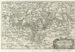
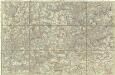
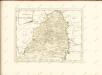
198 Birkenfeld, uit: Topographische Special-Karte von Deutschland (von Central-Europa) / begründet von D.G. Reymann ; [entworfen und gezeichn. von Heinrich Berghaus... [et al.]]

1 : 200000 Annotatie: Lit.: Daniel Gottlob Reymann und die "Topographische Special-Karte von Deutschland" / von Wolfgang Scharfe, in: Kartographische Nachrichten, 39 (1989), Heft I, p. 1-10; Handgeschreven titel: Reymann's Deutschland : 24 Sectionen: Jena, Penig, Dresden, Zittau, Hirschberg, Breslau, Brieg, Andernach, Coblenz, Giessen, Fulda, Schleusingen, Plauen, Zwickau, Teplitz, Jung Bunzlau, Hohenelbe, Glatz, Neisse, Simmern, Prag, Luxemburg, Birkenfeld; Aanwezig: 23 bladen Reymann, Daniel Gottlob; Berghaus, Heinrich [Berlin : 2. Departement des Kriegsministeriums, Bureau für Plan- und Kartenzeichnung]
$title$

$title$

Treveri Archidiacones de Treves, et de Tholey dans le Dioecese de l'Archevesché de Treves.

Mollova mapová sbírka Sanson, Guillaume Sanson, Guillaume
$title$

$title$

Mosellauf von Koblenz bis Trier : mit seitlich angebrachtem Führer

Annotatie: Op omslag: Nr. 28 Da; Met beschrijving van bezienswaardigheden aan weerszijden van de kaart Köln : Bremer
$title$

Theatre de la Guerre sus la Mosella, avec le choc., qui se donna entre les deux Armées le 20. Octobre 1735

Mollova mapová sbírka
$title$

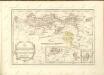
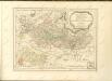
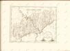
Theatre De La Guerre Dans Les Pays Qui Sont Situéz Entre le Rhin, la Saare, la Moselle et la Basse Alsace. [Karte], in: Atlas nouveau, contenant toutes les parties du monde [...], Bd. 1, S. 235.

1 Karte aus Atlas Sanson, Nicolas Jaillot, Alexis Hubert und Mortier, Pieter
$title$

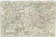
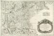
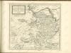
Tractus Hunnorum tabula exactissima, proponens maximam partem Sylvae olim dictae Arduenna, elect. Mogunt. Palat. ad Rhenum, et Trevir. princip. et com. Cattimelib. infer. Nassov. cum adjac. comit. et regionibus intra Rhenum, Mosellam, Saramque, secundum exactissimae vederoviae

Ardeny Buna, Wilhelm C.
$title$

[Poříčí Mosely]

Mosela, řeka-oblast Buna, Wilhelm C.
$title$

Partie Occidentale du Palatinat et Eslectorat du Rhein

1 : 125000 Mollova mapová sbírka Sanson, Guillaume Jaillot, Alexis Hubert
$title$

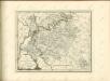
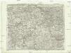
Partie Septentrionalo Des Pays qui sont situéz Entre le Rhein, la Saare, la Moselle, et la Basse Alsace. [Karte], in: Atlas nouveau, contenant toutes les parties du monde [...], Bd. 1, S. 238.

1 Karte aus Atlas Sanson, Nicolas Jaillot, Alexis Hubert und Mortier, Pieter
$title$

$title$

Partie Orientale du Palatinat et Eslectorat du Rhein.

1 : 260000 Mollova mapová sbírka Sanson, Guillaume Jaillot, Alexis Hubert
$title$

$title$

Carte topographique tres exacté de la Wetteravie

1 : 220000 Hesensko (Německo) Coentgen, Heinrich Hugo chez I.W.A. Iaeger
$title$

Carte topographique tres exacté de la Wetteravie

1 : 220000 Hesensko (Německo) Jaeger, Johann Wilhelm Abraham I. W. A. Jaeger
$title$

Die Pfalz oder Rhein - Bayern

$title$

[Kaart], uit: Kleines Relief-Panorama des Rheines

titelvariant: Kleines farbiges Relief-Panorama des Rheines; Annotatie: Titel op omslag: Kleines farbiges Relief-Panorama des Rheines; Met ill. van bezienswaardigheden aan weerszijden van de kaart Köln am Rhein : Hoursch & Bechstedt
$title$

$title$

Le Duché de Luxembourg divisé en Quartier Walon et Allemand

1 : 140000 Mollova mapová sbírka Jaillot, Alexis-Hubert Jaillot, Alexis Hubert
$title$

$title$

Höhenschichten-Karte der Eifel / von H. Rauff ; gezeichn. von W. Rose

1 : 200000 Annotatie geografische gegevens: Gebaseerd op: Topografische Uebersichtskarte des Deutschen Reiches Hermann Rauff; W. Rose fl. 1900 Bonn : Cohen
$title$

Théatre de la Guerre ou Carte Nouvelle De le Cours du Rhin depuis Worms jusqu'a Bonne et Les Pays Adjacens

1 : 250000 Mollova mapová sbírka Delisle, Guillaume Ottens, Josua
$title$

Archiepiscopatus et Electoratus Trevirensis Novissima delineatio

1 : 310000 Mollova mapová sbírka Wit, Frederik de Wit, Frederick
$title$

$title$

Cursus Rheni a Basilea usque ad Archi-Episcopatum Coloniensem :

1 : 2900000 Mollova mapová sbírka Seutter, Matthäus Seutter, Matthäus
© MapTiler © OpenStreetMap contributors
How does it work?
These instructions will show you how to find historical maps online.
Getting started
Type the place name in the search box to find the exact location. You can further adjust the search by zooming in and out.
Zoom
Zoom in and out with the buttons or use your mouse or touchpad natively.
Exact Area tool
Click here and draw a rectangle over the map to precisely define the search area.
Set filters
Narrow your search with advanced settings, such as Years (from/to), Fulltext, Publisher, etc.
Results
See the results of your search on the right side. You can scroll down to find more maps of this location.
?

Download OldMapsOnline Mobile