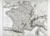
Maps of Metropolitan France

Galliae Regni Potentiss: Nova Descriptio. [Karte], in: Theatrum orbis terrarum, S. 30.
1 Karte aus Atlas Ortelius, Abraham
Galliae Regni Potentiss: Nova Descriptio [Karte], in: Theatrum orbis terrarum, S. 110.
1 Karte aus Atlas Ortelius, Abraham Vrients, Jan Baptista
Gallia
1 : 4250000 Francie Plancius, Petrus Petrus Plancius
Galliae Regni Potentiss: Nova Descriptio [Karte], in: Theatrum orbis terrarum, S. 63.
1 Karte aus Atlas Ortelius, Abraham
Carte de France
1 Karte : Kupferdruck ; 54 x 65 cm Klinger J. G. Klinger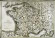
Carte de France
1 Karte : Kupferdruck ; 51 x 77 cm Brion de la Tour; Basset; Basset chez Basset m.d d'estampes rue St. Jacques au coin de celle des Mathurins
Gallia Vetus Ad Iulii Caesaris commentaria. [Karte], in: Gerardi Mercatoris et I. Hondii Newer Atlas, oder, Grosses Weltbuch, Bd. 2, S. 152.
1 Karte aus Atlas Mercator, Gerhard und Hondius, Jodocus Jansson, Jan
Gallia Vetus, Ad Iulii Caesaris commentaria [...] [Karte], in: Theatrum orbis terrarum, S. 371.
1 Karte aus Atlas Ortelius, Abraham
Carte de la France : avec ses établissements politiques, militaires, civils et religieux / dressée au Dépôt Général de la Guerre ...
1 : 1800000 Annotatie: Afdruk van koperplaat; Oorspr. uitg.: Paris, 1811 Dépôt de la Guerre, Frankrijk [Paris : IGN]
Gallia Vetus Ad Iulii Caesaris commentaria. [Karte], in: Novus atlas absolutissimus, Bd. 4, S. 23.
1 Karte aus Atlas Janssonius Offizin
Frankreich
1 Karte : Kupferdruck ; 18 x 22 cm Walch zu finden bey Ioh. Walch
Jak vzniká mapa
Carte itinéraire de l'empire français et du royaume d'Italie
1 Karte : Kupferdruck ; 56 x 71 cm Tardieu; Chanlaire chez l'auteur rue Geoffroy-Langevin n.o 328 (et 7. n.le ordre)
Carte itinéraire de l'empire français et du royaume d'Italie
1 Karte : Kupferdruck ; 56 x 71 cm Tardieu; Chanlaire chez l'auteur rue Geoffroy-Langevin n.o 328 (et 7. n.le ordre)
Charte von Frankreich in Departements eingetheilt
1 : 2500000 Francie Joh. Walch
Charte von Frankreich
1 : 2400000 Francie Streit, Friedrich Wilhelm Geograph. Instituts
Charte von Frankreich
1 : 2400000 Francie Streit, Friedrich Wilhelm Geograph. Instituts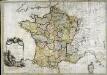
La France
1 Karte : Kupferdruck ; 54 x 77 cm Brion de la Tour; Le Campion; Le Campion chez les Campions freres rue St. Jacques à la ville de Rouen no. 8
La France au commencement de la 3eme. race (987-996)
1 : 1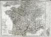
Carte de la France
1 Karte : Kupferdruck ; 55 x 66 cm Poirson; Jean chez Jean M.d d'estampes r. St. Jean de Beauvais n.o 10
La France
1 Karte : Kupferdruck ; 49 x 67 cm Fortin; Robert de Vaugondy; Arrivet chez Fortin ing.r pour les globes et sphères rue de la Harpe près celle du Foin
La France
1 Karte : Kupferdruck ; 49 x 67 cm Delamarche; Robert de Vaugondy; Arrivet chez Delamarche géographe rue du Foin St. Jacques au collège de M.e Gervais
La France
1 Karte auf 2 Blättern : Kupferdruck ; 59 x 92 cm Inselin; Jaillot chez le Sr. Jaillot géographe ordinaire du roy quay et a coté des grands Augustins
Gallia Vetus, Ad Iulij Caesaris commentaria. [Karte], in: Theatrum orbis terrarum, S. 467.
1 Karte aus Atlas Ortelius, Abraham Vrients, Jan Baptista
France in 1789.
1 : 5900000 Malte-Brun, Conrad, 1775-1826
Frankreich

[Historisch-geographischer Atlas zu den allgemeinen Geschichtswerken von C. v. Rotteck, Pölitz u. Becker] : Frankreich eine Uebersicht der Bildung und der Hauptbegebenheiten dieses Staates
von Julius Loewenberg Lithographie von B. Herder in Freiburg im Breisgau [Freiburg im Breisgau] : [Herder]
Le Royaume De France, distingué suivant l'estendue de Toutes Ses Provinces Et Ses Acquisitions, dans l'Espagne, dans l'Italie, dans l'Allemagne [...] [Karte], in: Atlas nouveau, contenant toutes les parties du monde [...], Bd. 1, S. 74.
1 Karte aus Atlas Sanson, Nicolas Jaillot, Alexis Hubert und Mortier, Pieter
![Galliae Regni Potentiss: Nova Descriptio. [Karte], in: Theatrum orbis terrarum, S. 30.](https://images-0.georeferencer.com/images/iiif/060158093584/full/,300/0/native.jpg)

