Maps of Dinaric Alps

Pannoniae, Et Illyrici Veteris Tabula. [Karte], in: Theatrum orbis terrarum, S. 383.
1 Karte aus Atlas Ortelius, Abraham
Pannoniae, Et Illyrici Veteris Tabula. [Karte], in: Theatrum orbis terrarum, S. 484.
1 Karte aus Atlas Ortelius, Abraham Vrients, Jan Baptista
Jugoslavia
1 : 2000000 Bartholomew. Firme [Edinburgh] : Edinburgh Geographical Institute
Handkarte des Jugoslawischen Reiches
1 : 1500000 Evropa jihovýchodní Ed. Hölzel
Pohraničí rakousko-uhersko-italské
1 : 1250000 Itálie Machát, František V. Neubert
Carta delle provincie Illiriche co'loro diversi stabilimenti e con una parte degli stati limitrofi
1 : 500000 Ilýrie Bordiga, Benedetto
Das jugoslawische Eisenbahnnetz im Jahre 1918
1 : 2500000 Jugoslawien Eisenbahnnetz Kežić, Danijel ; John, Holger W.
Itinerarium Norici, Pannoniae, Moesiae Superioris Liburniae Et Dalmatiae Secundum Tabulae Peutingerianae Segmentum III, IV A Marcomannis Ad Sarmatas Usque
1 : 4300000 Mollova mapová sbírka
Eisenbahnnetz und Aufteilung der Adriaküste in Zonen (nach Vasković)
1 : 2500000 Jugoslawien Eisenbahnnetz Kežić, Danijel ; John, Holger W.
Pannonien kirchl. Verhältnisse im X. Jahrh.
Pannonien Kirchengeschichte
Das jugoslawische Eisenbahnnetz im Jahre 1969
1 : 2500000 Jugoslawien Eisenbahnnetz Kežić, Danijel ; John, Holger W.
Eisenbahnnetz und Adria-Bahn-Projekte 1922
1 : 2500000 Jugoslawien Eisenbahnnetz Kežić, Danijel ; John, Holger W.
Politische Aufteilung des Königreichs Jugoslawien auf Banschaften 1929
Jugoslawien Verwaltungsgliederung Džambo, Jozo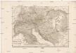
Italia superior, Rhaetia, Noricum, Pannonia, Daciae et Illyrici partes occidentales
1 : 1880000 Dácie Reichard, Christian Gottlieb Campius, D. a D. Campio
Jugoslawien nach dem Zweiten Weltkrieg (bis 1991) mit Republiken und Autonomen Provinzen
1 : 2500000 Jugoslawien Clewing, Konrad ; John, Holger W.

Die administrative Einteilung des Königreiches Jugoslawien nach Banschaften/banovine (ab 1929)
1 : 2500000 Jugoslawien Verwaltungsgliederung Clewing, Konrad ; John, Holger W.
Staatenbildung im ehemaligen Jugoslawien, 1991 - 2008
1 : 2500000 Jugoslawien Auflösung, Staatenbildung Clewing, Konrad ; John, Holger W.
Besetzung und territoriale Aufteilung Jugoslawiens im Zweiten Weltkrieg
1 : 2500000 Jugoslawien Besetzung, Weltkrieg <1939-1945> Clewing, Konrad ; John, Holger W.
Politische Aufteilung des Königreichs SHS auf Gebiete (oblasti) 1922
Kraljevina Srba, Hrvata i Slovenaca Verwaltungsgliederung Džambo, Jozo
Pannonien kirchl. Verhältnisse bis 884
Pannonien Kirchengeschichte
Vojvodina - Immigration und Emigration von Serben und sonstigen ethnischen Gruppen im Vergleich bis 1981
Wojwodina Migration, ethnische Gruppe Hofinger, Veronika
Jugoslávie

Zerstückelung Jugoslawiens nach der Okkupation 1941
Jugoslawien Balkanfeldzug <1941>, Besetzung Džambo, Jozo
Binnenmigration im ehemaligen Jugoslawien: Vojvodina - Immigration und Emigration 1953-1961
Wojwodina Binnenwanderung Hofinger, Veronika
Vojvodina: Immigration und Emigration von Ungarn bis 1971
Wojwodina Migration, Magyaren Hofinger, Veronika
Vojvodina: Immigration und Emigration von Serben bis 1961
Wojwodina Migration, Serben Hofinger, Veronika
Vojvodina: Immigration und Emigration 31.03.1953 - 31.03.1981
Wojwodina Migration Hofinger, Veronika
Vojvodina: Immigration und Emigration von Ungarn bis 1981
Wojwodina Migration, Magyaren Hofinger, Veronika
![Pannoniae, Et Illyrici Veteris Tabula. [Karte], in: Theatrum orbis terrarum, S. 383.](https://images-0.georeferencer.com/images/iiif/484655933696/full/,300/0/native.jpg)

