Carte cataloguée
Jugoslavia


Titre complet:Jugoslavia
Année de l'image:1933
Date de publication:1933
Éditeur:[Edinburgh] : Edinburgh Geographical Institute
Taille physique:20 x 30 cm
Échelle de la carte:1:2 000 000
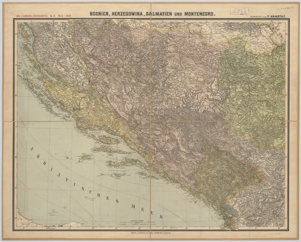
[Kaart], uit: Bosnien, Herzegowina, Dalmatien und Montenegro / bearb. von F. Handtke
1890
Friedrich H. Handtke 1815-1879
1:600k
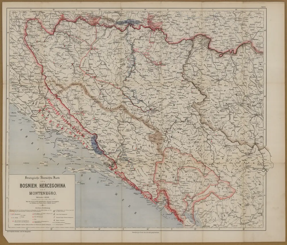
Strategische-Übersichts-Karte von Bosnien, Herzegowina und Montenegro
1878
K.K milit. geogr. Institut
1:600k
Die Südslavenländer
1875
Ed. Hölzel
1:3m
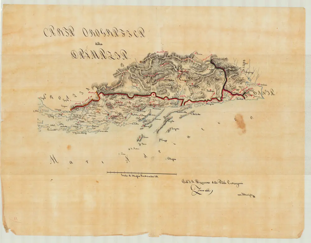
Carta Orografica della Dalmazia
1834
Jabornigg von Altenfels, Rudolf
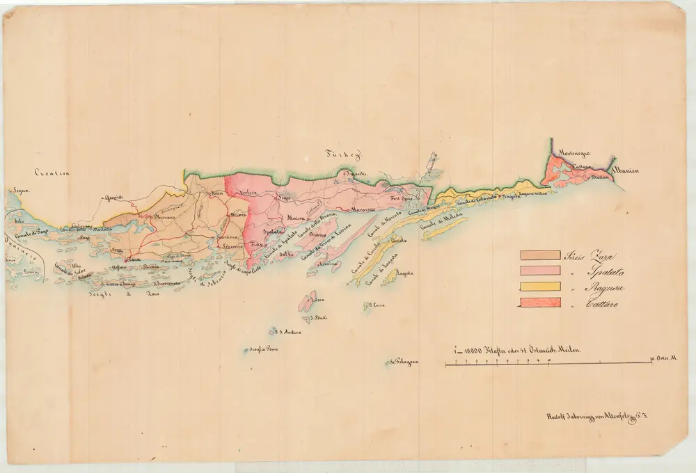
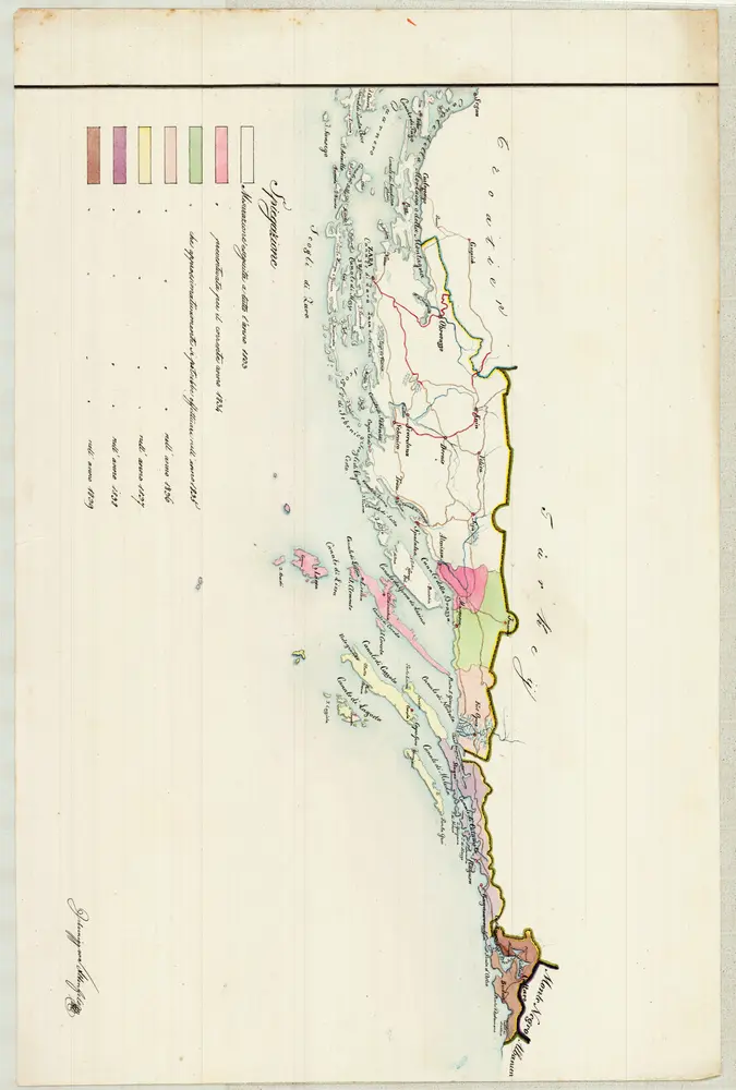
Kreiseinteilung von Dalmatien
1834
Jabornigg von Altenfels, Rudolf
Dalmacie [sic], Bosna a Hercegovina
1892
Milbauer, Vl.
1:2m
Katastralkarte
1834
Jabornigg von Altenfels, Rudolf
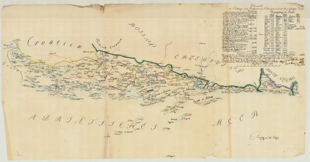
Uebersicht der Distanzen und Peripherien von Dalmazien und den hierzu gehörigen Inseln
1834
Jabornigg von Altenfels, Rudolf
1:647k
n/a
1737
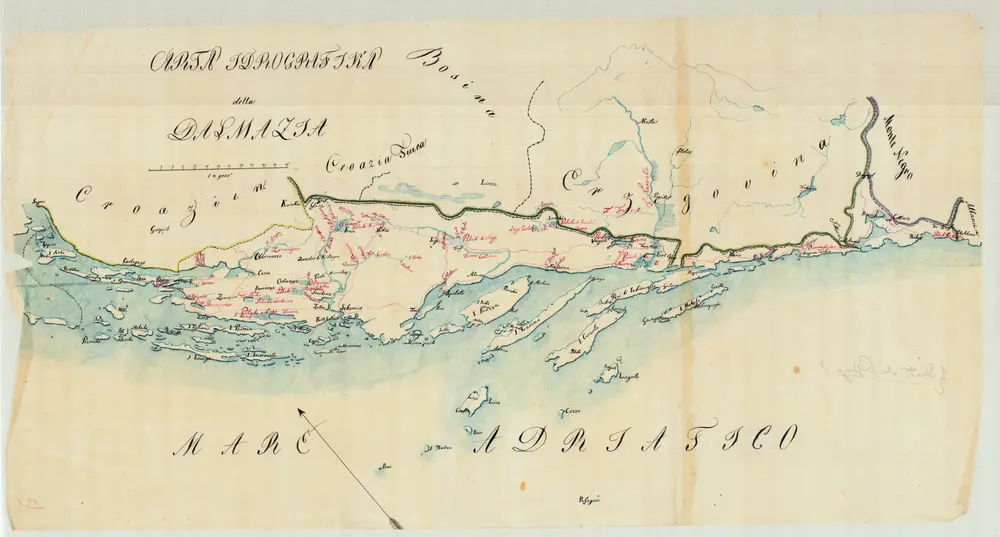
Carta Idrografika della Dalmazia
1834