Maps of China

Octava Asie Tabula [Karte], in: Claudii Ptolemei viri Alexandrini mathematice discipline philosophi doctissimi geographie opus [...], S. 214.
1 Karte aus Atlas Waldseemüller, Martin [und Ptolemaeus, Claudius] Übelin, Georg
Tabula Asiae VIII. [Karte], in: Geographia universalis vetus et nova complectens Claudii Ptolemaei Alexandrini enarrationis libros VIII, S. 287.
1 Karte aus Atlas Münster, Sebastian [und Ptolemaeus, Claudius]
[Octava Asie tabula] [Karte], in: Clavdii Ptholomei Viri Alexandrini Cosmographie, S. 179.
1 Karte aus Atlas Nicolaus Germanus [und Ptolemaeus, Claudius]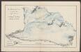
Octava Asie Tabula [Karte], in: [Clavdii Ptholomei Cosmographi ...], S. 323.
1 Karte aus Atlas Nicolaus Germanus [und Ptolemaeus, Claudius]
Chinese Empire And Japan.
1 : 19300000 Greenleaf, Jeremiah
Chinese Empire And Japan.
1 : 19300000 Greenleaf, Jeremiah
Chinese Empire And Japan.
1 : 15840000 Burr, David H., 1803-1875
China.
from A system of geography, or, A new & accurate description of the earth in all its empires, kingdoms and states : illustrated with history and topography, and maps of every country : fairly engraven on copper, according to the latest discoveries and corrections / by Herman Moll.
Asie Orientale.
1 : 15000000 Garnier, F. A., 1803-1863
Das östliche Hoch-Asien
Schul-Atlas in 36 Karten Völter, Daniel Verlag der J.M. Dannheimer'schen Buchhandlung
The National Geographic Magazine map of China and its territories
1 : 10000000 Bartholomew, J. G. (John George), 1860-1920 National Geographic Society
Übersichts-Karte von Ost-Hoch-Asien
1 : 12760000 Asie východní Grimm, J. L. Etzel, Franz August von G. Reimer
Übersichts-Karte von Ost-Hoch-Asien
1 : 12760000 Asie východní Grimm, J. L. Etzel, Franz August von C. Ritter und O'etzel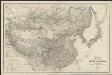
Karte von China und Japan
1 : 7100000 von H. B[erghaus] gest. v. Mädel II u. s. Sch. Gotha : Perthes
Chinesisches Reich
Adolf Stieler's Handatlas über alle Theile der Erde und über das Weltgebäude Stieler, Adolf Justus Perthes
Chinese Empire.
1 : 31000000 Fenner, Rest.
Charte von China und den angränzenden Ländern, und Völkerschaften so wie sie dem letzten Kaiser Tschien-Long unterworfen waren
Čína Kiepert, Heinrich Macartney, George Macartney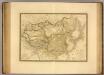
Empire Chinois, Japon.
1 : 13600000 Picquet, C.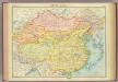
China - political.
1 : 10000000 John Bartholomew and Son
108-109. China, Mongolia, Korea. The World Atlas.
1 : 10000000 USSR (Union of Soviet Socialist Republics).
The Chinese Empire compiled from native and foreign authorities
1 : 9700000 The Chinese Empire Compiled from Native and Foreign Authorities 1882年,S. Wells Williams卫三畏 (1812-1884)绘制,Jacob Wells修订,G. Stern刻版,New York: Charles Scribner's Sons出版。 该图详细刻画了清末中国疆域、行政区划及边疆地区。卫三畏曾在1847年左右曾出版了一幅题为Map of the Chinese empire, compiled from native & foreign authorities的彩色中国地图,现藏于国会图书馆,1953年又出版了一幅题为Map of the Chinese Empire : compiled from native & foreign authorities的黑白中国地图(仅部分着黄色),而1882年的这版中国地图,是在前两版的基础上,根据新调查的数据进行修订而成。卫三畏是清末最为杰出的汉学家,对中国有着持续深入的研究,这幅地图可以代表19世纪末西方对中国疆域和政区认识的最高水平,尤其是对内陆边疆和海疆的认识。 附插图2幅:Map of the City of Canton & Adjacent Islands,描绘珠三角地形与广州城市格局;Harbor & Island of Amoy,描绘厦门岛及周边海湾。 Map of the city of Canton & adjacent islands, Harbor & island of Amoy 1图,黑白印刷,英文,图幅49 x 54 cm,比例尺约为1:9,700,000,经纬度约为E65°-140°; N18°-55°。 Harvard-Yenching | Offsite Storage (HD)|MLC-C|HY53A6,Hollis Number:008375431 S. Wells Williams New York: Charles Scribner's Sons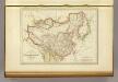
L'Empire Chinois et du Japon.
1 : 23600000 Malte-Brun, Conrad, 1775-1826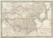
Das Chinesische Reich und das Kaiserthum Japan
1 : 10780000 Japonsko Humboldt, Alexander von im Verlage des Geograph. Institut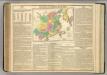
China and Japan.
1 : 13000000 Lavoisne, M.
Chinese Empire and Japan.
1 : 19500000 Schonberg & Co.
Das Chinesische Reich und das Kaiserthum Japan
1 : 10666000 entworfen und gezeichnet von C. F. Weiland Weimar : Verlag des Geograph. Instituts
107. China, Political. The World Atlas.
1 : 15000000 USSR (Union of Soviet Socialist Republics).
Chine et Japon.
1 : 10250000 Montemont, A.
Chinesische, Japanische Reich.
1 : 19200000 Radefeld, Carl Christian Franz, 1788-1874
![Octava Asie Tabula [Karte], in: Claudii Ptolemei viri Alexandrini mathematice discipline philosophi doctissimi geographie opus [...], S. 214.](https://images-2.georeferencer.com/images/iiif/531601915463/full/,300/0/native.jpg)

