Maps of Regierungsbezirk Gießen

Nassovia Comitatus [Karte], in: Novus atlas absolutissimus, Bd. 2, S. 162.
1 Karte aus Atlas Janssonius Offizin
Nassovia Comitatus. [Karte], in: Novus Atlas, das ist, Weltbeschreibung, Bd. 1, S. 273.
1 Karte aus Atlas Blaeu, Joan Blaeu, Willem Janszoon
Nassovia Comitatus. [Karte], in: Theatrum orbis terrarum, sive, Atlas novus, Bd. 1, S. 254.
1 Karte aus Atlas Blaeu, Joan Blaeu, Willem Janszoon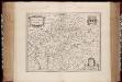
Nassovia comitatus / Salomon Rogiers sculpsit ; Guiljelm. Blaeuw excudit
1 : 300000 Annotatie: Origineel is Blad 104 in atlas factice; Annotatie geografische gegevens: Schaalstokken op de kaart: Miliaria Germanica communia, en: Horae itineris Salomon Rogiers ca 1592- v. 1640; Willem Jansz Blaeu 1571-1638 Amstelodami : Guiljelm. Blaeuw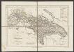
Nassovia Comitatus [Karte], in: Gerardi Mercatoris et I. Hondii Newer Atlas, oder, Grosses Weltbuch, Bd. 1, S. 200.
1 Karte aus Atlas Mercator, Gerhard und Hondius, Jodocus Jansson, Jan
NASSOVIA | Comitatus
Salomon Rogiers sculpsit [Amsterdam : Joan Blaeu]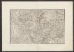
Militair Karte von Süd-Deutschland in 20 Sectionen
1 : 400000 1. Section Coulon, Alois von A. von Coulon
Herzogthum Nassau
1 : 538200 Nasavsko Hoeckner, Carl aus der Schweinfurten Geographischen Gravirsanstalt des Bibliographischen Instituts
Herzogthum Nassau, Landgrafschaft Hessen Homburg und die Freie Stadt Frankfurt
Grosser Hand-Atlas über alle Theile der Erde in 170 Karten Meyer, J. Verlag des Bibliographischen Instituts

Das Herzogthum Nassau
1 : 438000 Weimar : Verlag des Geographischen Instituts
Nassovia Comitatvs
1 : 1300000 Mollova mapová sbírka Hondius, Henricus Hondius, Henricus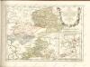

Principatus Nassaviae, divisus in speciales Comitatus, Nassaviam, Hadamariam, Beilstenium, Veilburgum, Dietziam, Usingam, Id Stanium, Dilemburgum et Sigenam ostenduntur
1 : 200000 Mollova mapová sbírka Valk, Gerhard Valck, Gerard
Le Theatre de Bellone :
Mollova mapová sbírka Schenk, Pieter Braakman, Adriaan
Generalkarte von Zentraleuropa

[Kaart], uit: Rheinlauf von Mainz bis Köln : mit seitlicher Beschreibung
Annotatie: Met beschrijving en ill. van bezienswaardigheden aan weerszijden van de kaart Köln : Bremer
Das Herzogthum Nassau
1 : 200000 Wimmer, Friedrich Scholz
Charte vom Herzogthum Nassau
1 : 200000 Fembo, Christoph
Nassau, Hessen Homburg, Frankfurt a/M.
1 : 340000 Grassl, J. (Joseph)
Le Cours du Rhin depuis Worms, jusqu'a Bonne et les Pays Adjacens
1 : 240000 Mollova mapová sbírka Delisle, Guillaume Liébaux L'Isle, Guillaume de
Partie Orientale Du Temporel De L'Archevesché et Eslectorat De Treves. [Karte], in: Atlas nouveau, contenant toutes les parties du monde [...], Bd. 1, S. 200.
1 Karte aus Atlas Sanson, Nicolas Jaillot, Alexis Hubert und Mortier, Pieter
Cursus Rheni a Basilea Usque Ad Archi-Episcopatum Coloniensem

Cursus Rheni a Basilea usque ad Archi-Episcopatum Coloniensem :
1 : 2900000 Mollova mapová sbírka Seutter, Matthäus Seutter, Matthäus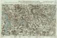
Neue Topographische Carte Der Lahn von Marburg bis zu ihrem Einflus in den Rhein mit Bemerkung der in dieser Gegend vorgefallenen Kriegsbegebenheiten von 1795 und 1796
Brand, Peter; Thum, C.; Schalck, Anna Maria; Coentgen, Georg Joseph Brand u. Thum
Nassau, Hessen-Homburg, Frankfurt.
1 : 344000 Flemming, Carl
Partie Orientale Du Temporel De L'Archevesché et Eslectorat, De Treves
1 : 210000 Mollova mapová sbírka Sanson, Guillaume Jaillot, Alexis Hubert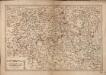
Les Environs De La Lahne depuis Marbvrg iusqu' à Ems avec les pais adiacents
1 : 200000
Partie Orientale du Temporel, de l'Archevesché et Eslectorat de Treves
1 : 220000 Mollova mapová sbírka Sanson, Guillaume Jaillot, Alexis Hubert
![Nassovia Comitatus [Karte], in: Novus atlas absolutissimus, Bd. 2, S. 162.](https://images-2.georeferencer.com/images/iiif/321419117426/full/,300/0/native.jpg)

