Maps of Atlas Mountains

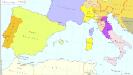
Pascaarte Van 't westlyckste deel vande Middelandsche-Zee [...] [Karte], in: Novus atlas absolutissimus, Bd. 9, S. 253.
1 Karte aus Atlas Janssonius Offizin
Pascaarte Van't westlyckste deel vande Middelandsche-Zee [...] [Karte], in: Het vijfde Deel Des Grooten Atlas : Vervatende De Water-Weereld, S. 187.
1 Karte aus Atlas Jansson, Jan Jansson, Jan
Paskaert van 't westelycke deel der Middelandsche Zee
1 Karte : Kupferdruck ; 41 x 51 cm Doncker by Hendrick Doncker boekverkoper en graadbooghmaker inde Nieuwbrugsteegh in 't Stuurmans gereedschap
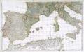
Occidentalior tractus Maris Mediterranei
1 Karte : Kupferdruck ; 47 x 56 cm Renard apud L. Renard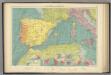
W. Mediterranean.
1 : 5000000 Philip, George
[133][136] Occidentalior tractus Maris Mediterranei, uit: Atlas sive Descriptio terrarum orbis
Annotatie: Gedigitaliseerde versie. Amsterdam. Heiloo : Picturae (vervaardiger), 2015. tiff-bestand. Gedigitaliseerd: 07-01-2015; Origineel: Universiteitsbibliotheek Vrije Universiteit (XL.05127.-) ; Netherlands; Titelpagina ontbreekt Wit, Frederik de Amsterdam : Frederick de Wit
Ooster Deel der Middelandsche Zee [Karte] [Bona.] [Saragoßa.] [C. Carbonera] [Baya de Agde in Languedoq.] [Alcol] [P. Farina.] [Susa.] [Alzyra.] [8 Nebenkarten], in: De Nieuwe Groote Vermeerderde Zee-Atlas ofte Water-Werelt, S. 51.
1 Karte aus Atlas Doncker, Hendrick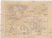
Hispania
Kartágo (zaniklé město)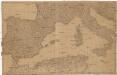
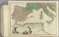
[Spanien und Italien]
Itálie Adam, Jakob
Carte de la Mer Méditerranée, 1
1 Blatt : 50 x 51 cm Froullé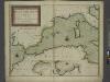
A new chart of the coast of the MEDITERRANEAN SEA
from The sea-atlas : containing an hydrographical description of most of the sea-coasts of the known parts of the world.
Partie occidentale de la mer Méditerranée
1 Karte : Kupferdruck ; 49 x 55 cm Robert de Vaugondy Didier Robert de Vaugondy
La Mediterranée, 1
1 Blatt : 53 x 63 cm Le Rouge
La mer Mediterranée vers l'occident
1 Karte : Kupferdruck ; 38 x 49 cm Duval P. Duval
Atlas für Handel und Industrie: Für Kaufleute, Fabrikante u. Gewerbetreibende, Handlungs- u. Gewerbe-Schulen

Western part of the mediterranean sea with the coasts of Spain France Italy Barbary
1 Blatt : 53 x 68 cm Sayer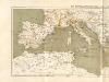
Atlas für Industrie- und Handelsgeographie: Für commercielle und technische Lehranstalten, für Kaufleute und Industrielle
Prémière partie de la carte d'Europe contenant la France, l'Alemagne, l'Italie, l'Espagne & les isles britanniq.s, 2
1 Blatt : 53 x 85 cm s.n.
Mediterranean W.
1 : 2850000 Faden, William, 1750?-1836
Mediterranean Basin.
1 : 6400000 Johnston, Alexander Keith, 1804-1871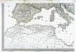
Carte d'Europe ou sont tracées les limites des empires, royaumes, et etats souverains, feuille 5
1 Blatt : 56 x 87 cm Semen etc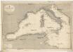
Mittelmeer
1 : 2500000 Středozemní moře (západní oblast) Reichs-Marine-Amt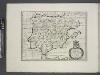
Spain, or Celtiberia.
from A new sett of maps both of antient and present geography : wherein not only the latitude and longitude of many places are corrected according to the latest observations, but also the most remarkable differences of antient and present geography may be quickly discern'd by a bare inspection or comparing of correspondent maps, which seems to be the most natural and easy method to lead young students (for whose use the work is principally intended) unto a competent knowledge of the geographical science : together with a geographical treatise particularly adapted to the use and design of these maps / by Edward Wells, M.A. and student of Christ-Church, Oxon.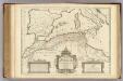
Africae Tabula Geographica.
1 : 4500000 L'Isle, Guillaume de, 1675-1726
Südeuropa 1829
Südeuropa Kunz, Andreas ; Röss, Wolf ; Johnen, Bettina ; Moeschl, Joachim Robert
In notitiam ecclesiasticam Africae tabula geographica
1 : 4500000 L'Isle, Guillaume de, 1675-1726 Apud Auctorem, Via vulgo dicta des Canettes propè Sancti Sulpitii fanum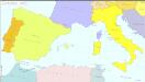
Südeuropa 1962
Südeuropa Kunz, Andreas ; Treiling, Thomas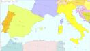
![Pascaarte Van 't westlyckste deel vande Middelandsche-Zee [...] [Karte], in: Novus atlas absolutissimus, Bd. 9, S. 253.](https://images-2.georeferencer.com/images/iiif/309186620932/full/,300/0/native.jpg)

