编目地图
A new chart of the coast of the MEDITERRANEAN SEA


完整标题:A new chart of the coast of the MEDITERRANEAN SEA
描述:1707
物理尺寸:20 x 30 cm
Carte d'Espagne et de Portugal, comprenant les routes de poste et autres de ces deux roiaumes
1788
1:1m
[XVI], uit: Geognostische Karte des Oesterreichischen Kaiserstaates mit einem grossen Theile Deutschland's u. Italien / hauptsachlich nach ... Haidinger's geognostischer Karte dieses Staates bearb. von Josef Scheda
1847
Scheda, Joseph
1:3m
Spanien et Portugal
1819
Walch, Johann
Die Königreiche Spanien und Portugal
1809
chez Tranquillo Mollo
Duitsland, Polen, Tsjecho-Slowakije en Oostenrijk [A]
1956
Arnoldus Johannes Cornelius Krafft (1892-)
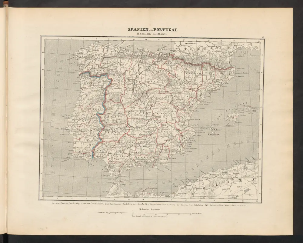
[Spanien und Portugal, Iberische Halbinsel]
1857
Ziegler, Jakob Melchior
Maroc
1908
Flotte de Roquevaire, R. de
1:1m

F.B. Škorpila Zeměpisný atlas pro měšťanské školy, mapa ze strany: 17
1934
Škorpil, František Bohumil

Atlas portatilis, oder Compendieuse Vorstellung Der gantzen Welt, in einer kleinen Cosmographie, Der grünenden Jugend zum Besten in XXX. saubern Land-Charten, mit Einer kurtzen Erläterung Zum andernmal heraus gegeben [von Johann Christoph Weigel], mapa ze strany: mapa_8
1724
Gregorii Johann Gottfried
De l'Espagne en general
1780
Clouet
De l'Espagne divisée par provinces
1780
Clouet