Maps of Staffordshire

Salopiensis Comitatus cum Staffordiensi. Shropshire & Staffordshire. [Karte], in: Novus atlas absolutissimus, Bd. 7, S. 353.
1 Karte aus Atlas Janssonius Offizin
delineation of the strata of England and Wales, with part of Scotland
1 : 320000 Blatt 7 Smith, William Cary
Salopiensis Comitatus cum Staffordiensi = Shropshire & Staffordshire
1 : 240000 [Amstelodami] : [apud Joannem Janssonium]
Staffordiensis Comitatus; vulgo Stafford Shire. [Karte], in: Le théâtre du monde, ou, Nouvel atlas contenant les chartes et descriptions de tous les païs de la terre, Bd. 4, S. 319.
1 Karte aus Atlas Blaeu, Willem Janszoon und Blaeu, Joan Blaeu, Willem Janszoon
Central and Northern England. Pergamon World Atlas.
1 : 500000 Polish Army Topography Service
STAFFORDIAE Comitatu
This is a map of Staffordshire from the 1583 edition of the Saxton atlas of England and Wales. This atlas was first published as a whole in 1579. It consists of 35 coloured maps depicting the counties of England and Wales. The atlas is of great significance to British cartography as it set a standard of cartographic representation in Britain and the maps remained the basis for English county mapping, with few exceptions, until after 1750. During the reign of Elizabeth I map use became more common, with many government matters referring to increasingly accurate maps with consistent scales and symbols, made possible by advances in surveying techniques. Illustrating the increasing used of maps in government matters, Lord Burghley, Elizabeth I’s Secretary of State, who had been determined to have England and Wales mapped in detail from the 1550s, selected the cartographer Christopher Saxton to produce a detailed and consistent survey of the country. The financier of the project was Thomas Seckford Master of Requests at the Court of Elizabeth I, whose arms appear, along with the royal crest, on each map. Here Saxton’s name appears in the decorative scale bar, as does the name of the engraver of this map, Franciscus Scatterus, one of seven English and Flemish engravers employed to produced the copper plates for the atlas. The Elizabethan coat of arms appears in the top right hand corner and the Seckford arms of appear beneath this. Saxton, Christopher Ryther, Augustine
Sheet 5 Midlands (N.), uit: Maps of England & Wales : scale 4 miles to 1 inch / Ordnance Survey
1 : 253440 titelvariant: Maps of England and Wales; Annotatie: Titel op cassette; Met bladoverzicht op de achterzijde van de cassette; Annotatie geografische gegevens: Hoogtelijneninterval 200 ft Ordnance Survey, United Kingdom Southampton : Ordnance Survey Office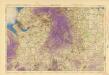
Ordnance Survey of England and Wales (Aeronautical map)
Great Britain. War Office. General Staff. Geographical Section [London] : [Air Ministry],
Staffordiensis Comitatus; Vulgo Stafford Shire. [Karte], in: Theatrum orbis terrarum, sive, Atlas novus, Bd. 4, S. 367.
1 Karte aus Atlas Blaeu, Joan Blaeu, Willem Janszoon
Staffordiensis Comitatus; Vulgo Stafford Shire. [Karte], in: Theatrum orbis terrarum, sive, Atlas novus, Bd. 4, S. 367.
1 Karte aus Atlas Blaeu, Joan Blaeu, Willem Janszoon
Comitatus Salopiensis; Anglice Shrop Shire. [Karte], in: Theatrum orbis terrarum, sive, Atlas novus, Bd. 4, S. 374.
1 Karte aus Atlas Blaeu, Joan Blaeu, Willem Janszoon
Comitatus Salopiensis; Anglice Shrop Shire. [Karte], in: Theatrum orbis terrarum, sive, Atlas novus, Bd. 4, S. 374.
1 Karte aus Atlas Blaeu, Joan Blaeu, Willem Janszoon
Comitatus Salopiensis; Anglice Shrop Shire. [Karte], in: Le théâtre du monde, ou, Nouvel atlas contenant les chartes et descriptions de tous les païs de la terre, Bd. 4, S. 322.
1 Karte aus Atlas Blaeu, Willem Janszoon und Blaeu, Joan Blaeu, Willem Janszoon
STAFFORDIENSIS | COMITATVS; | Vulgo | STAFFORD SHIRE.
[Amsterdam : Joan Blaeu]
STAFFORDIAE Comitatus
This is a map of Staffordshire by Christopher Saxton which dates from 1577. It forms part of an atlas that belonged to William Cecil Lord Burghley, Elizabeth I’s Secretary of State. Burghley used this atlas to illustrate domestic matters.This map is actually a proof copy of one which forms part of Christopher Saxton’s Atlas of England and Wales. This atlas was first published as a whole in 1579. It consists of 35 coloured maps depicting the counties of England and Wales. The atlas is of great significance to British cartography as it set a standard of cartographic representation in Britain and the maps remained the basis for English county mapping, with few exceptions, until after 1750. During the reign of Elizabeth I map use became more common, with many government matters referring to increasingly accurate maps with consistent scales and symbols, made possible by advances in surveying techniques. Illustrating the increasing use of maps in government matters, Lord Burghley, who had been determined to have England and Wales mapped in detail from the 1550s, selected the cartographer Christopher Saxton to produce a detailed and consistent survey of the country. The financier of the project was Thomas Seckford Master of Requests at the Court of Elizabeth I, whose arms appear, along with the royal crest, on each map. This map was engraved by Franciscus Scatterus, one of a team of seven English and Flemish engravers employed to produce the copper plates for the atlas. Saxton, Christopher Scatterus, Franciscus
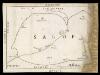
SALOPIAE COMITATUS Sheet 22
This map of Shropshireis from the 1583 edition of the Saxton atlas of England and Wales.This atlas was first published as a whole in 1579. It consists of 35 coloured maps depicting the counties of England and Wales. The atlas is of great significance to British cartography as it set a standard of cartographic representation in Britain and the maps remained the basis for English county mapping, with few exceptions, until after 1750. During the reign of Elizabeth I map use became more common, with many government matters referring to increasingly accurate maps with consistent scales and symbols, made possible by advances in surveying techniques. Illustrating the increasing used of maps in government matters, Lord Burghley, Elizabeth I’s Secretary of State, who had been determined to have England and Wales mapped in detail from the 1550s, selected the cartographer Christopher Saxton to produce a detailed and consistent survey of the country. The financier of the project was Thomas Seckford Master of Requests at the Court of Elizabeth I, whose arms appear, along with the royal crest, on each map. Saxton, Christopher Ryther, Augustine
COMITATVS | SALOPIENSIS; | Anglice | SHROP SHIRE.
[Amsterdam : Joan Blaeu]
SALOPIAE COMITATUS f.86
This is a map of Shropshire by Christopher Saxton dating from 1577. It forms part of an atlas that belonged to William Cecil Lord Burghley, Elizabeth I’s Secretary of State. Burghley used this atlas to illustrate domestic matters. This map is actually a proof copy of one which forms part of Christopher Saxton’s Atlas of England and Wales. This atlas was first published as a whole in 1579. It consists of 35 coloured maps depicting the counties of England and Wales. The atlas is of great significance to British cartography as it set a standard of cartographic representation in Britain and the maps remained the basis for English county mapping, with few exceptions, until after 1750. During the reign of Elizabeth I, map use became more common, with many government matters referring to increasingly accurate maps with consistent scales and symbols, made possible by advances in surveying techniques. Illustrating the increasing use of maps in government matters, Lord Burghley, who had been determined to have England and Wales mapped in detail from the 1550s, selected the cartographer Christopher Saxton to produce a detailed and consistent survey of the country. The financier of the project was Thomas Seckford Master of Requests at the Court of Elizabeth I, whose arms appear, along with the royal crest, on each map. Burghley has annotated this map, adding several place names. The map was engraved by Remigius Hogenbergius, one of a team of seven English and Flemish engravers employed to produced the copper plates for the atlas. Saxton, Christopher Hogenbergius, Remigius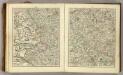
Sheets 40-41. (Cary's England, Wales, and Scotland).
1 : 360000 Cary, John, ca. 1754-1835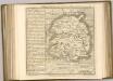
Map of Shropshire f. 75*
This is a manuscript map of Shropshire. It forms part of an atlat which belonged to Lord Burghley, Secretary of State to Elizabeth I, who used it to illustrate domestic matters. It shows only the principal towns, distinguishing between those with a castle and those without by means of a symbol of two connected towers with crenellations. The River Severn, marked Sabrina F, is charted. Lord Burghley has added a name adjacent to a place where the river is bridged. Lord Burghley was concerned with communication routes as revealed by his annotation. The draughtsman has indicated relief by hill symbols in two places. The map features a scale bar, but this is partly obscured by damage to the map.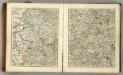
Sheets 31-32. (Cary's England, Wales, and Scotland).
1 : 360000 Cary, John, ca. 1754-1835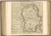

An accurate map of Shrop Shire
1 Karte : Kupferdruck ; 51 x 68 cm Bowen; Hinton sold by J. Hinton at the Kings Arms in St. Pauls Church Yard
Comitatvs Salopiensis; anglice Shrop Shire
1 Karte : Kupferdruck ; 37 x 48 cm Blaeu Joan Blaeu
Staffordiensis comitatvs; vulgo Stafford Shire
1 Karte : Kupferdruck ; 39 x 49 cm Blaeu Joan Blaeu
Shropshire, Sheet 17 - Bartholomew's "Half Inch to the Mile Maps" of England & Wales
1 : 126720 Topographic maps Bartholomew, John George John Bartholomew & Co
UNIVERSI Derbiensis Comitatus f.55
This is a map of Derbyshire by Christopher Saxton dating from 1577. It forms part of an atlas that belonged to William Cecil Lord Burghley, Elizabeth I’s Secretary of State. Lord Burghley used this atlas to illustrate domestic matters. This map is actually a proof copy of one which forms part of Christopher Saxton’s Atlas of England and Wales. This atlas was first published as a whole in 1579. It consists of 35 coloured maps depicting the counties of England and Wales. The atlas is of great significance to British cartography as it set a standard of cartographic representation in Britain and the maps remained the basis for English county mapping, with few exceptions, until after 1750. During the reign of Elizabeth I, map use became more common, with many government matters referring to increasingly accurate maps with consistent scales and symbols, made possible by advances in surveying techniques. Illustrating the increasing use of maps in government matters, Lord Burghley, who had been determined to have England and Wales mapped in detail from the 1550s, selected the cartographer Christopher Saxton to produce a detailed and consistent survey of the country. The financier of the project was Thomas Seckford Master of Requests at the Court of Elizabeth I, whose arms appear, along with the royal crest, on each map. Lord Burghley has annotated this map, adding several place names.The name of the engraver is not included but it is the work of one of a team of seven English and Flemish engravers employed to produce the copper plates for the atlas. Saxton, Christopher William Cecil, Lord Burghley
A New and accurate map of Radnor Shire
1 : 237600
![Salopiensis Comitatus cum Staffordiensi. Shropshire & Staffordshire. [Karte], in: Novus atlas absolutissimus, Bd. 7, S. 353.](https://images-2.georeferencer.com/images/iiif/845925169319/full/,300/0/native.jpg)

