Maps of Seven Seas (Open Ocean)

Polus Antarcticus. [Karte], in: Novus atlas absolutissimus, Bd. 6, S. 255.
1 Karte aus Atlas Janssonius Offizin
S. Hemisphere, plane of London.
1 : 41000000 Thomson, John
Oceanie spheroidale.
1 : 41000000 Garnier, F. A., 1803-1863
Nova Totius Terrarum Orbis Gepgraphica Ac Hydrographica Tabula. [Karte], in: Gerardi Mercatoris et I. Hondii Newer Atlas, oder, Grosses Weltbuch, Bd. 1, S. 25.
1 Karte aus Atlas Mercator, Gerhard und Hondius, Jodocus Jansson, Jan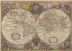
Nova Totius Terrarum Orbis Geographica Ac Hydrographica Tabula. [Karte], in: Novus atlas absolutissimus, Bd. 1, S. 14.
1 Karte aus Atlas Janssonius Offizin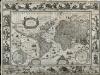
Nova Totius Terrarum Orbis Geographica Ac Hydrographica Tabula
Blaeu, Willem Janszoon; Ende, Josua van den
245-246. Atlantic Ocean. The World Atlas.
1 : 40000000 USSR (Union of Soviet Socialist Republics).
A map of South America and the adjacent islands, 1794.
from The American geography; or, A view of the present situation of the United States of America: containing astronomical geography; geographical definitions, discovery, and general description ... By Jedidiah Morse, A.M.
Neueste Karte von Australien
Grosser Hand-Atlas über alle Theile der Erde in 170 Karten Meyer, J. Verlag des Bibliographischen Instituts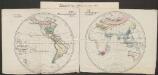
Pflanzengeographische Eintheilung der Erdoberfläche
1 : 50000000 Schouw, Joakim Frederik [Reimer?]
America
A new general atlas of modern geography, consisting of a complete collection of maps of the four quarters of the globe Wyld, James James Wyld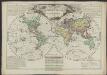
Mappemonde philosophique et politique, où sont tracés les voyages de Cook et de La Pérouse
1 : 62000000 par L. Brion, père [...] Paris : chez l’auteur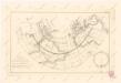
Calculus Eclipsis Solis Observatae die 19. Novemberis 1816
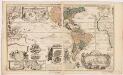
Carte nouvelle de la mer du Sud : dressée par ordre des principaux directeurs & tirée des memoires les plus recents et des relations des navigateurs les plus modernes, tant de France, que d'Espagne l'on ÿa joint, diverses remarques curieuses par raport aux decouvertes des graduations des manierres du pais que de la navigation
1 : 30000000 Leth, Andries de, 1662-1731 Donné au public, par And. & Henry de Leth ... sur le Pont de la Bourse au Pescheur
Hémisphère austral ou antarctique
1 Karte : Kupferdruck ; Durchmesser 59 cm, Bildgrösse 65 x 62 cm Robert de Vaugondy; Dussy s.n.
Hémisphère inférieur de la mappemonde
1 Karte : Kupferdruck ; Durchmesser 59 cm Chrysologue s.n.
Polynesien Und Der Grosse Ocean (Westliches Blatt).
1 : 40000000 Petermann, A.
Vorstellvng der in der Nacht zwischen den 8. u. 9. Aug; 1748
Mollova mapová sbírka Mayer, Tobias Homann, Johann Baptista - dědici
Die verfinsterte Erdkugel :
Mollova mapová sbírka Lowitz, Georg Moriz Schneider, Ruprecht Adam Homann, Johann Baptista - dědici
Polus Antarcticus. [Karte], in: Novus atlas absolutissimus, Bd. 9, S. 151.
1 Karte aus Atlas Janssonius Offizin
Oceanien
[Allgemeiner Atlas über alle Theile der Erde in 29 Blättern] Ziegler, Jakob Melchior Top. Anstalt v. J. Wurster u. Comp.
Eisverbreitung Einst und Jetzt
Atlas der Geologie Zittel, K.v. ; Berghaus, Hermann Justus Perthes
Bez titulu: Mapy kontinentů

Oceania.
1 : 50000000 Cornell, S. S. (Sarah S.)
Australien
Allgemeiner Atlas [Walch, Johannes] im Verlag bei Johannes Walch
[Recto], uit: Australië en Oceanië / [aardrijksk. medew. G.J. de Vries]
1 : 68000000 titelvariant: Australië (en Oceanië); Annotatie: Titel boven krt. en op verso: Australië (en Oceanië); Verso: statistische gegevens voornaamste staatkundige gebieden; Annotatie geografische gegevens: Inzet: Indonesië. - 1:54.000.000 Gerben Johannes de Vries 1886-1968 Sneek : Tonnema
Oceanie.
Andriveau-Goujon, J.
Mar del Zur Hispanis Mare Pacificum. [Karte], in: De Nieuwe Groote Vermeerderde Zee-Atlas ofte Water-Werelt, S. 71.
1 Karte aus Atlas Doncker, Hendrick
Australien
Neuester Schul-Atlas Walch, Johann im Verlag bei Joh. Walch
![Polus Antarcticus. [Karte], in: Novus atlas absolutissimus, Bd. 6, S. 255.](https://images-2.georeferencer.com/images/iiif/159532343232/full/,300/0/native.jpg)

