Maps of Saxony
Saxonia Superior, Cum Lusatia Et Misnia. [Karte], in: Le théâtre du monde, ou, Nouvel atlas contenant les chartes et descriptions de tous les païs de la terre, Bd. 1, S. 196.
1 Karte aus Atlas Blaeu, Willem Janszoon und Blaeu, Joan Blaeu, Willem Janszoon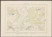
Saxonia Superior, Cum Lusatia Et Misnia. [Karte], in: Theatrum orbis terrarum, sive, Atlas novus, Bd. 1, S. 153.
1 Karte aus Atlas Blaeu, Joan Blaeu, Willem Janszoon
Saxonia Superior, Cum Lusatia Et Misnia. [Karte], in: Novus Atlas, das ist, Weltbeschreibung, Bd. 1, S. 165.
1 Karte aus Atlas Blaeu, Joan Blaeu, Willem Janszoon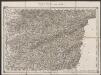
Saxoniae superioris Lusatiae Misniaeque descriptio [Karte], in: Gerardi Mercatoris Atlas, sive, Cosmographicae meditationes de fabrica mundi et fabricati figura, S. 391.
1 Karte aus Atlas Mercator, Gerhard Montanus, Petrus
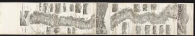
Feldzug von 1756
[Preuß. Generalstab]
A new and accurate map of Saxony, part of Brandenburg, Silesia, Poland and Bohemia
1 : 1235000 Braniborsko (Německo) Hinton, J. J. Hinton

SAXONIA SVPERIOR, CVM LVSATIA ET MISNIA.
[Amsterdam : Joan Blaeu]
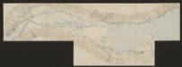
Operations-Karte, zum Feldzuge in Sachsen und Schlesien gehoerig
Saxoniae superioris Lusatiae Misniaeque descriptio [Karte], in: Gerardi Mercatoris et I. Hondii Newer Atlas, oder, Grosses Weltbuch, Bd. 1, S. 313.
1 Karte aus Atlas Mercator, Gerhard und Hondius, Jodocus Jansson, Jan
Operationen des Corps des Prinzen Heinrich, der Oestreichschen Haupt-Armee, und der Reichs-Truppen vom 13ten August bis 3ten November 1759

Karte über die Circulation der böhmischer Braunkohle während des Jähres 1869
Evropa střední Pechar, Johann C.H. Hunger
Ietziges Kriegs Theatrum in Sachsen, Böhmen, u. Schlesien

Carte Itineraire par le Pays de l'Electorat de Saxe
1 : 800000 Mollova mapová sbírka Homann, Johann Baptist Homann, Johann Baptista - dědici
Die Schlesischen Kriege
1 : 3000000 Mitteleuropa Schlesische Kriege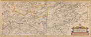
Albis. Fluvius Germaniae celebris A Fontibus Ad Ostia, Cum fluminibus ab utroque latere in illum fluentibus, descriptus. [Karte, Teil 2], in: Novus atlas absolutissimus, Bd. 2, S. 30.
1 Karte aus Atlas Janssonius Offizin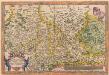
Saxoniae, Misniae, Thuringiae, Nova Exactissimaque Descriptio. [Karte], in: Theatrum orbis terrarum, S. 127.
1 Karte aus Atlas Ortelius, Abraham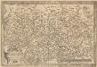
Saxoniae, Misniae, Thuringiae, Nova Exactissimaque Descriptio. [Karte], in: Theatrum orbis terrarum, S. 219.
1 Karte aus Atlas Ortelius, Abraham Vrients, Jan Baptista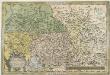
Saxoniae Misniae, Thvringiae, Nova Exactissimaque Descriptio
1 : 900000 Mollova mapová sbírka Ortelius, Abraham Plantin, Christoph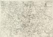
Saxonia Svperiore
1 : 800000 Mollova mapová sbírka Cosmerovius, Matthäus Cosmerovius, Matthäus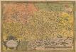
Saxoniae, Misniae, Thuringiae, Nova Exactissimaque Descriptio. [Karte], in: Theatrum orbis terrarum, S. 61.
1 Karte aus Atlas Ortelius, Abraham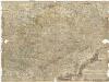
Neue und accurate Landkarte des Mittägig- Ober- Sächsischen R. Reichs- Creyß
1 : 700000 Bavorsko (Německo) Lidl, Johann Jakob Johann Jacob Lidl
Saxoniae superioris Lvsatiae Misniaeqve descriptio
1 : 785000 Lužice (Německo) Mercator, Gerhard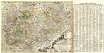
Neue und accurate Landkarte des Mittägig- Ober- Sächsischen K. Reichs- Creyß
1 : 675000 Mollova mapová sbírka Lidl, Johann Jakob Lidl, Johann Jacob
Royaume de Boheme et marquisitat de Lusace
1 : 1710000 Lužice (Německo) Bonne, Rigobert André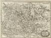
Ober Sachsen, Laussnitz und Meissen
1 : 1200000 Mollova mapová sbírka Merian, Matthaeus Merian, Matthäus
Saxoniae Electoralis, Finitimarumque Provinciarum Nova et Antea nunquam edita delineatio
1 : 730000 Mollova mapová sbírka Schenk, Pieter Schenk, Peter I
Saxonia Svperior, Cvm Lvsatia et Misnia
1 : 780000 Mollova mapová sbírka Blaeu, Joan Blaeu, Joan I.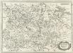
Ober Sachsen Laußnitz vnd Meissen
1 : 1200000 Mollova mapová sbírka Merian, Matthaeus Merian, Matthäus
![Saxonia Superior, Cum Lusatia Et Misnia. [Karte], in: Le théâtre du monde, ou, Nouvel atlas contenant les chartes et descriptions de tous les païs de la terre, Bd. 1, S. 196.](https://images-2.georeferencer.com/images/iiif/298386284324/full/,300/0/native.jpg)

