Maps of Slovenia
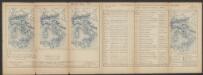
Descriptio Totius Lyridis XVI. No. Tab. [Karte], in: Claud. Ptolemaeus. Geographia lat. cum mappis [...], S. 404.
1 Karte aus Atlas Münster, Sebastian [und Ptolemaeus, Claudius]
Sclauonia oder Windisch Marck, Bossen, Crabaten, ec
1 : 1200000 1 Karte : Holzschnitt ; 29 x 34 cm Münster, Sebastian [Sebastian Henricpetri]
Tabula Ducatus Carnioliae Vindorum Marchiae et Histriae ex mente Illustr.mi quondam L. B. Valvasorii concinnata et exhibita â Io. Bapt. Homanno S. C. M. Geogr.
Krain, Istrien Valvasor, Johann Weikhard <
Strassen- und Eisenbahnkarte des oesterreichischen Kaiserthumes
1 : 864000 Blatt 10 Schaller, G. K.K. Militärisch-Geografisches Institut, Karten-Evidenthaltungs-Abteilung
Strassen und Eisenbahnkarte des oesterreichischen Kaiserthumes

Zemljovid slovenske dežele in pokrajin
Slowenien Knorr, A.
Exactissima Ducatus Carniolae Vinidorum Marchiä et Histriae
1 : 500000 Mollova mapová sbírka Seutter, Matthäus
Carte del regno d'Illiria e del ducato Stiria
1 : 860000 Ilýrie Raffelsperger, Franz nel magazeno delle carte tipografiate
Das Königreich Illyrien und das Herzogthum Steyermark
1 : 700000 Ilýrie Weiland, Karl Ferdinand im Verlage des geographischen Instituts
Tabula Ducatus Carnioliae Vindorum Marchiae et Histriae ex mente Illustr. mi quondam
1 : 250000 Mollova mapová sbírka Homann, Johann Baptist
Oesterr. Kronlander.
1 : 700000 Weiland, C. F. (Carl Ferdinand), d. 1847
Carte du royaume d'Illirie et du duché de Styrie
1 : 520000 Ilýrie Raffelsperger, Franz Rumpold, F. au Dépôt des cartes typografiées
Karte von Inner-Österreich, das ist des Königreiches Illirien und des Herzogthumes Steiermark
1 : 880000 Ilýrie Raffelsperger, Franz Rumpold, F. im Typographischen Landkarten-Verlage
Goritiae, Karstii, Chaczeolae, Carniolae, Histriae, Et Windorum Marchae Descrip. [Karte], in: Theatrum orbis terrarum, S. 186.
1 Karte aus Atlas Ortelius, Abraham
Goritiae, Karstii, Chaczeolae, Carniolae, Histriae, Et Windorum Marchae Descrip. [Karte], in: Theatrum orbis terrarum, S. 281.
1 Karte aus Atlas Ortelius, Abraham Vrients, Jan Baptista
Illyricvm
1 : 1200000 Mollova mapová sbírka Sambucus, Joannes
Herzogthümer Steiermark, Kärnten, Krain, die gefürstete Graftschaft Görz und Gradiska, die Markgraftschaft Istrien, die Stadt Triest mit Gebiet und das ungarische Littorale
1 : 600000 Steiermark, Kärnten Gräf, Carl
Die Kronländer Kärnthen, Krain, Görz und Gradisca, Istrien und die reichsunmittelbare Stadt Triest nach ihrer neuesten gerichtlichen & politischen Eintheilung
Gorice a Gradiška Bermann, Joseph Joseph Bermann
Karte der Kroländer Steyermark, Kärnthen, Krain und Istrien
1 : 1530000 Istrijský poloostrov (Slovinsko a Chorvatsko) Marco Berra
Exactissima Ducatus Carniolae vinidorum Marchiä et Histriae delineatio
1 : 500000 Chorvatsko Lotter, Tobias Conrad T. C. Lotter
Exactissima ducatus Carniolae Vinidorum Marchiä et Histriae delineatio
1 : 500000 Cirknické jezero (Slovinsko) Lotter, Tobias Conrad Tob. Conr. Lotter
Exactissima ducatus Carniolae Vinidorum Marchiä et Histriae delineatio
1 : 500000 Cirknické jezero (Slovinsko) Lotter, Tobias Conrad Tob. Conr. Lotter
Exactissima Ducatus Carniolae vinidorum Marchiä et Histriae delineatio
1 : 500000 Chorvatsko Lotter, Tobias Conrad T. C. Lotter
Das Königreiche Illyrien und das Herzogthum Steyermark
1 : 700000 Ilýrie Weiland, Karl Ferdinand Anson im Verlage des geographischen Instituts
Das Königreiche Illyrien und das Herzogthum Steyermark
1 : 700000 Ilýrie Weiland, Karl Ferdinand Anson im Verlage des geographischen Instituts
Charte von dem Königreiche Illyrien und dem Herzogthume Steyermark
1 : 690000 Ilýrie Weiland, Karl Ferdinand Bürck, A. im Verlage des Geograph. Instituts
Charte von dem Königreiche Illyrien und dem Herzogthume Steyermark
1 : 690700 Ilýrie Weiland, Karl Ferdinand Bürek, A. im Verlage des Geograph. Instituts
Strassen-Karte des Königreiches Illyrien
1 : 432000 Ilýrie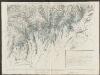
![Descriptio Totius Lyridis XVI. No. Tab. [Karte], in: Claud. Ptolemaeus. Geographia lat. cum mappis [...], S. 404.](https://images-2.georeferencer.com/images/iiif/808593717704/full/,300/0/native.jpg)

