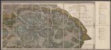
Maps of Municipality of Milos
Candia cum Insulis aliquot circa Graeciam[:] [Milo] [Karte], in: Gerardi Mercatoris Atlas, sive, Cosmographicae meditationes de fabrica mundi et fabricati figura, S. 493.
1 Karte aus Atlas Mercator, Gerhard Montanus, Petrus
Candia cum Insulis aliquot circa Graeciam[:] [Milo] [Karte], in: Gerardi Mercatoris et I. Hondii Newer Atlas, oder, Grosses Weltbuch, Bd. 2, S. 336.
1 Karte aus Atlas Mercator, Gerhard und Hondius, Jodocus Jansson, Jan
Archipelagi Insularum Aliquot Descrip., [Milo] [Karte], in: Theatrum orbis terrarum, S. 341.
1 Karte aus Atlas Ortelius, Abraham Vrients, Jan Baptista
Archipelagi Insularum Aliquot Descrip., [Milo] [Karte], in: Theatrum orbis terrarum, S. 246.
1 Karte aus Atlas Ortelius, Abraham
Die Cycladischen Inseln
1 : 1160000 Kyklady (Řecko) Anville, Jean-Baptiste Bourguinon d'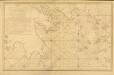
Carte des Côtes de la Grèce depuis Navarin en Morée
Carte des Côtes de la Grèce depuis Navarin en Morée, jusqu'au Cap Doro ... avec la partie de l'Archipel qu comprend les Îles Cyclades, dressée d'après les observations astronomiques et nautiques de M. de Chabert. [Paris] : Dépôt Général ... de la Marine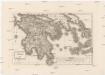
Peloponesus et Cyclades
1 : 710000 Kyklady (Řecko) Reichard, Christian Gottlieb Campius, D. a D. Campio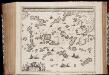
Archipelagi meridionalis, seu Cycladum insularum accurata delineatio / auctore I. Laurenbergio
1 : 650000 Annotatie: Kaart uitgegeven in de periode 1650-1662; Origineel is Blad 171 in atlas factice; Annotatie geografische gegevens: 4 schaalstokken: 8 Mill. Germ., en: 10 Mill. Gall., en: 30 Mill. Ital., en: 300 Stadia [S.l.] : [s.n.]
Graeciae pars australis.
1 : 2100000 Fenner, Rest.
Insula Creta hodie Candia
1 : 900000 Kréta (Řecko) Homann, Johann Baptist Joh. Bapt. Homannus
Graecia heroum tempore
Griechenland, Mittelmeerraum, Antike
Graeciae
1 : 730000 Peloponés (Řecko) Berra, Marco M. Berra
CYCLADES | INSVLÆ | IN MARE ÆGÆO, | hodie | ARCHIPELAGO
Auctore | I. LAVRENBERGIO Amsterdami, J. Blaeu excudit
Carte de la Morée anciennement Peloponnèse, 1785
Carte de la Morée anciennement Peloponnèse, 1785. Gravé par L.A. Dupuis ... Lieues communes de France, 20[ = 128 mm] [Paris]
Regnum Moreae accuratissime divisum in provincias Saccaniam, Tzaconiam, Caliscopium et ducatum Clarensae, una cum insulis Cephalonia, Zacyntho Cythera, AEgina et Sidra
1 : 585000 Achaia (Řecko) Lotter, Georg F. sumptibus Tobiae Conradi Lotter
Greece.
1 : 1140480 Letts, Son & Co.
[Historisch-geographischer Atlas zu den allgemeinen Geschichtswerken von C. v. Rotteck, Pölitz u. Becker] : Alt Griechenland
von Julius Loewenberg [Freiburg im Breisgau] : [Herder]
Alt Griechenland
Athény-oblast (Řecko) Loewenberg, Julius Kt., I. V.
Greece and the Ionian Islands.
1 : 1110000 Sharpe, J.
Řecko
starověké Řecko Bodenehr, Gabriel Sharland, William Karel André
Archipelagi Meridionalis seu Cycladum Insularum accurata Delineatio. [Karte], in: Novus atlas absolutissimus, Bd. 10, S. 234.
1 Karte aus Atlas Janssonius Offizin
Greece.
1 : 917000 Johnston, Alexander Keith
Greece.
1 : 950000 Fullarton, A. & Co.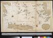
Het zuijderdeel van de Archipel Lagusche Eijlanden int groodt
Greece Gerard van Keulen
Morea
Řecko Müller, Jos. D. Šafařík, Pavel Josef
Greece.
1 : 1470000 Tanner, Henry S.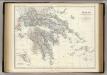
Greece.
1 : 917000 Johnston, Alexander Keith, 1804-1871
Greece.
1 : 1500000 Tanner, Henry S.
![Candia cum Insulis aliquot circa Graeciam[:] [Milo] [Karte], in: Gerardi Mercatoris Atlas, sive, Cosmographicae meditationes de fabrica mundi et fabricati figura, S. 493.](https://images-2.georeferencer.com/images/iiif/307918696666/full/,300/0/native.jpg)

