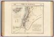
Maps of Jordan

Iudaea seu Terra Sancta quae Hebraeorum sive Israelitarum in suas duodecim Tribus divisa; secretis ab invicem Regnis Iuda, et Israel [...] [Karte], in: Atlas nouveau, contenant toutes les parties du monde [...], Bd. 2, S. 212.
1 Karte aus Atlas Sanson, Nicolas Jaillot, Alexis Hubert und Mortier, Pieter
De beyde koningryken Juda en Israël, die na Salomo's dood zig van elkanderen afgescheurt hebben; benevens de overheerde landen aan elk dier beiden behorende
1 : 1400000 afgebeeldt door W.A. Bachiene J. van Jagen mapp. sculpsit, et figur. apposit. sculpturam curavit ; S. Fokke fec. Uitgegeven te Gorinchem : by Nicolaas Goetzee
Situs Terrae Promissionis. S.S. Bibliorum intelligentiam exacte aperiens [Karte], in: Gerardi Mercatoris et I. Hondii Newer Atlas, oder, Grosses Weltbuch, Bd. 2, S. 347.
1 Karte aus Atlas Mercator, Gerhard und Hondius, Jodocus Jansson, Jan
Situs Terrae Promissionis. S.S. Bibliorum intelligentiam exacte aperiens [Karte], in: Novus atlas absolutissimus, Bd. 6, S. 108.
1 Karte aus Atlas Janssonius Offizin
La Palestine...
Syrie et Palestine. Asie 63.
1 : 1641836 Vandermaelen, Philippe, 1795-1869
Terra Sancta quae in Sacris Terra Promissionis olim Palestina [Karte], in: Novus Atlas, das ist, Weltbeschreibung, Bd. 2, S. 300.
1 Karte aus Atlas Blaeu, Joan Blaeu, Willem Janszoon
Palestinae Sive Totius Terrae Promissionis Nova Descriptio [Karte], in: Theatrum orbis terrarum, S. 117.
1 Karte aus Atlas Ortelius, Abraham
Terra Sancta quae in Sacris Terra Promissionis olim Palestina [Karte], in: Theatrum orbis terrarum, sive, Atlas novus, Bd. 2, S. 283.
1 Karte aus Atlas Blaeu, Joan Blaeu, Willem Janszoon
Syrien und die angraenzenden Laender zur Zeit der Kreuzzuge.
1 : 3000000 Spruner von Merz, Karl
[Recto], uit: Situs terrae promissionis. S.S. Bibliorum intelligentiam exacte aperiens / per Chr. Adrichom ; sculpserunt Everardus Sim. Hamers-veldt et Salomon Rogeri
1 : 830000 Annotatie: Oorspr. verschenen in: L'Appendice de l'atlas de Gerard Mercator et Iudocus Hondius ... - A Amsterdam : chez Henry Hondius, 1633; Annotatie geografische gegevens: Zuidoost boven Adrichom, Christiaan van; Hamersveldt, Everard Symonsz. van; Rogiers, Salomon Amstelodami : sumptibus Henrici Hondii
Terra Sancta quae in Sacris Terra Promissionis olim Palestina [Karte], in: Le théâtre du monde, ou, Nouvel atlas contenant les chartes et descriptions de tous les païs de la terre, Bd. 2, S. 276.
1 Karte aus Atlas Blaeu, Willem Janszoon und Blaeu, Joan Blaeu, Willem Janszoon
Canaan.
Lavoisne, M.
Palaestina seu Terra olim Sancta
Jordánské údolí (Jordánsko a Izrael) Harenberg, Johann Christoph ediderunt Heredes Homan[n]iani
PALAESTINA seu TERRA olim SANCTA
Jordánské údolí (Jordánsko a Izrael) Harenberg, Johann Christoph ediderunt Heredes Homan[n]iani
Syria.
1 : 6500000 Fenner, Rest.
Syrie et de la Palestine, 624 ans apres J.C.
1 : 3300000 Houze, Antoine Philippe
TERRA SANCTA | quae in Sacris | Terra Promissionis olim | PALESTINA
Amstelodami | Ex officina Guiljelmi Blaeuw 1629
[Recto], uit: Terra Sancta qua in Sacris Terra Promissionis olim Palestina / [Willem Jansz. Blaeu]
1 : 1000000 Annotatie: Uit: Tweede deel van 't Toonneel des Aerdriicx, ofte Nieuwe atlas. - Amsterdami : apud Guiljelmum et Iohannem Blaeu, 1635 [of latere editie]; Annotatie geografische gegevens: Noordwest boven Blaeu, Willem Jansz. Amstelodami : ex officina Guiljelmi Blaeu
Palestine - Physical Geography.
Milner, Thomas
La nvova et esatta descrittione della Soria, e della Terra Santa
Kypr Forlani, Paolo da Paulo Furlani Veronese
Terre Sainte, pendant la premiere croisade de 1096 a 1144.
1 : 3300000 Houze, Antoine Philippe
Terra Sancta XXIII. Nova Tabula. [Karte], in: Claud. Ptolemaeus. Geographia lat. cum mappis [...], S. 431.
1 Karte aus Atlas Münster, Sebastian [und Ptolemaeus, Claudius]
Palaestina
Grosser Hand-Atlas über alle Theile der Erde in 170 Karten Meyer, J. Verlag des Bibliographischen Instituts
Terra Sancta XVI. Nova Tab. [Karte], in: Geographia universalis vetus et nova complectens Claudii Ptolemaei Alexandrini enarrationis libros VIII, S. 344.
1 Karte aus Atlas Münster, Sebastian [und Ptolemaeus, Claudius]
PALAESTINA in XII. TRIBVS divisa, CVM TERRIS ADIACENTIBVS denuo revisa & copiosior reddita
1 : 1060000 Izrael Harenberg, Johann Christoph curantibus Homannianis Heredibus
Palaestina in XII. tribvs divisa, cvm terris adiacentibvs
1 : 1028000 Izrael Harenberg, Johann Christoph curantibus Homannianis Heredibus
Palaestina in XII. tribvs divisa, cvm terris adiacentibvs denuo revisa & copiosior reddita
1 : 1060000 Izrael Harenberg, Johann Christoph curantibus Homannianis Heredibus
![Iudaea seu Terra Sancta quae Hebraeorum sive Israelitarum in suas duodecim Tribus divisa; secretis ab invicem Regnis Iuda, et Israel [...] [Karte], in: Atlas nouveau, contenant toutes les parties du monde [...], Bd. 2, S. 212.](https://images-2.georeferencer.com/images/iiif/615409622332/full/,300/0/native.jpg)

