Maps of Zurich

<<Das>> Zürichgebiet nach Murdochs Entwerfungsart
1 : 300000 1 Karte
<<Der>> Canton Zürich
1 : 230000 1 Karte J.J. Scheurmann sc.
Tabula topographica parochiarum synodo Tigurinae obstrictarum opera
1 : 190000 1 Karte Joh. Heinr. Freytag
Militärkarte der Nordostschweiz
1 : 52000 Originaltitel: Der Uralten Loblichen Statt Zürich Graffschaften, Herrschaften, Stett und Land diser zyt von ihnen beherrschet, auch derselben benachbarte verbündet und angehörige, und inen sonst mit Burgrecht und Eigenschafft zugethan als Appenzell, Apt und Statt S. Gallen, die Grafschafften Turgow, Baden, Toggenburg, Sargans, Windegg, Werdenberg und das Rhynthal. So by uralten Zyten in pagum Tigurinum gedient, an ietzo aber in andrem stand und wesen sind, ihr allerseits orth und glegenheit in grund gelegt und lebendig vor augen gestelt. Anno 1620. Die Karte und ausführliche Erläuterungen, das Defensional von Hans Haller, wurden am 11.10.1620 dem Rat von Zürich übergeben. Aufnahme: Nüscheler, Christoph (1589-1661), Glas- und Flachmaler sowie Quartiermeister, von Zürich; Nüscheler, Hans Jakob (1583-1654), Glas- und Flachmaler sowie Quartiermeister, von Zürich; Oeri, Hans, Quartiermeister; Ringgli, Gebhard, Quartiermeister; Haldenstein, Hans Ulrich, Quartiermeister; Gyger, Hans Conrad, andere Schreibweisen: Geiger, Geyger, (1599-1674), Kartograf, Ingenieur und Quartiermeister, von Zürich; Haller, Hans, Stadtingenieur; Bürkli, Jakob, Stadtingenieur Zeichnung: Gyger, Hans Conrad, andere Schreibweisen: Geiger, Geyger, (1599-1674), Kartograf und Ingenieur, von Zürich
<<Das>> Zürichgebiet nach Murdochs Entwerfungsart
1 : 300000 1 Karte
<<Das>> Zürichgebiet nach Murdochs Entwerfungsart
1 : 300000 1 Karte
Karte vom Canton Zürich 1795
1 : 600000 1 Karte M.P. f.
Canton Zürich
1 : 230000 1 Karte gezeichnet und herausgegeben von Hch. Keller ; gest. v. J. Scheurmann
Canton Zürich sive illustris Helvetiorum respublica Tigurina cum subditis suis et confinibus
1 : 275000 1 Karte [Gabriel Walser?]
Zürich Gebiet
1 : 250000 1 Karte J.H. Streulinus inv. ; J.G. Seiller sculpsit
Darstellung von Stadt und Landschaft Zürich nach Kapiteln der Zürcher Synode
1 : 250000 Originaltitel: Tabula topographica parochiarum synodo Tigurina. Mit farbigen Wappen der innern und äussern Vogteien, einer Nebenkarte der Herrschaft Sax-Forstegg, zwei angeklebten Ergänzungskarten (Thurgau/Bodensee und Rheintal) sowie Legende. Ohne Datumsangabe (Datierung gemäss Angabe von Hans Jakob Holzhalb in: Supplement zu dem allgemeinen helvetisch-eidgenössischen oder schweizerischen Lexicon, so von weiland Herrn Hans Jakob Leu, Bürgermeister Löbl. Freystaats Zürich, in alphabetischer Ordnung behandelt worden, Band 2, S. 360). Freytag, Johann Heinrich, Kupferstecher
Tabula topographica parochiarum synodo Tigurinae obstrictarum opera
1 : 190000 1 Karte Joh. Heinr. Freytag
<<Der>> Canton Zürich nach seinen Oberämtern
1 : 300000 1 Karte
<<Der>> Kanton Zürch [i.e. Zürich]
1 : 250000 1 Karte [hrsg. von Franz Johann Joseph von Reilly]
<<Der>> Canton Zürich nach seinen Capituls und Bezirks Abtheilungen
1 : 300000 1 Karte CE.
Tabula topographica parochiarum synodo Tigurinae obstrictarum
1 : 200000 1 Karte opera Joh. Heinr. Freytag, Chalcogr.
Tabula topographica parochiarum synodo Tigurinae obstrictarum
1 : 200000 1 Karte opera Joh. Heinr. Freytag, Chalcogr.
Zürich Gebiet
1 : 250000 1 Karte J.H. Streulinus inv. ; J.G. Seiller sculpsit
Tabula topographica parochiarum synodo Tigurinae obstrictarum
1 : 200000 1 Karte opera Joh. Heinr. Freytag, Chalcogr.
Tabula topographica parochiarum synodo Tigurinae obstrictarum opera
1 : 700000 1 Karte cura Joh. Hofmeister ; Tobias Lobeck sculp., Aug. Vin. [Johannes Hofmeister], [Zürich]
Karte des Kantons Zürich
1 : 250000 1 Karte
Cantone Zürich & Schaffhausen
1 : 410000 1 Karte R. Nick ft.
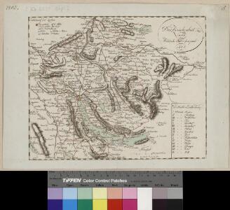
Tigurini sive Tigurinus pagus in Helvetiis
1 : 240000 1 Karte par Sanson chez l'autheur aux galleries du Louvre, [Paris]
Canton Zürich sive illustris Helvetiorum respublica Tigurina cum subditis suis et confinibus
1 : 275000 1 Karte [Gabriel Walser?]
<<Der>> Canton Zürich
1 : 230000 1 Karte H. Keller del. ; J.J. Scheurmann sc.
Carte de la Suisse avec les plans des cheflieux des 22 cantons
1 : 200000 1 Karte auf 8 Bl. dessinée et publié par Henri Keller ; Lithogr. von J. Schweizer = Charte der Schweiz mit den Grundrissen der Hauptorte der 22 Cantone Keller, Zürich
Tabula topographica parochiarum synodo Tigurinae obstrictarum
1 : 700000 1 Karte cura Joh. Hofmeister ; Tobias Lobeck sculp., Aug. Vin. [Johannes Hofmeister], [Zürich]
Wandkarte der Schweiz
1 : 200000 1 Karte auf 8 Blättern J.M. Ziegler Wurster, Winterthur
Nouvelle carte geographique dela Suisse, contenant les cantons de Zurich, Lucerne, Schwitz, Zug, Glaris, Schafhouse, Underwald, Appelzell
1 Karte : Kupferdruck ; 19 x 27 cm Scheuchzer; Wetstein; Wetstein; Smith chez R. et J. Wetstein et G. Smith