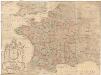
Maps of Metropolitan France
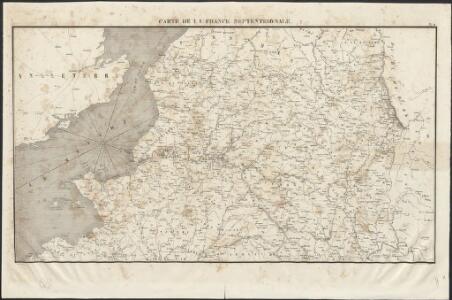
Carte de la France septentrionale
1 : 1000000 Collon delin. lith. de Jobard Frères [Bruxelles] : Jobard Frères
Gallia Antiqua.
1 : 2500000 Anville, Jean Baptiste Bourguignon d, 1697-1782

Galliae Veteris Typus. [Karte], in: Theatrum orbis terrarum, S. 374.
1 Karte aus Atlas Ortelius, Abraham
[Kaart], uit: Grandes routes : la France en 2 cartes
1 : 1000000 Annotatie: De zuidelijke helft ontbreekt Paris : Services de Tourisme Michelin
Gallia transalpina in suas quatuor provincias, Narbonensem, Aqvitaniam, Lvgvdensem et Belgicam descripta
1 Karte : Kupferdruck ; 30 x 37 cm Weigel excudit C. Weigelius
Gallia vetus
1 Karte : Kupferdruck ; 30 x 38 cm Weigel ap. Chri. Weigel
TYPVS | GALLIÆ | VETERIS
Ex conatibus Geograp. | ABRAH. ORTELII. Excudebat | Guiljelmus Blaeu.
Galliae Veteris Typus. [Karte], in: Theatrum orbis terrarum, S. 462.
1 Karte aus Atlas Ortelius, Abraham Vrients, Jan Baptista
Galliae Veteris Typus. [Karte], in: Novus atlas absolutissimus, Bd. 4, S. 8.
1 Karte aus Atlas Janssonius Offizin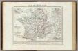
Gallia Transalpina e le sue successive divisioni.
1 : 3030000 Picquet, C.
France, departments.
1 : 2300000 Robert Laurie & James Whittle
Typus Galliae Veteris [Karte], in: Theatrum orbis terrarum, sive, Atlas novus, Bd. 2, S. 178.
1 Karte aus Atlas Blaeu, Joan Blaeu, Willem Janszoon
Galliae Veteris Typus. [Karte], in: Gerardi Mercatoris et I. Hondii Newer Atlas, oder, Grosses Weltbuch, Bd. 2, S. 155.
1 Karte aus Atlas Mercator, Gerhard und Hondius, Jodocus Jansson, Jan
France.
1 : 4550000 Darton, William
Typus Galliae Veteris [...] [Karte], in: Novus Atlas, das ist, Weltbeschreibung, Bd. 2, S. 174.
1 Karte aus Atlas Blaeu, Joan Blaeu, Willem Janszoon
Carte de la Gaule
1 Karte : Kupferdruck ; 34 x 41 cm Mentelle; Tardieu; Anville Mentelle
Frankreich
1 : 5000000 Francie Kocen, Blaž Eduard Hölzel
Typus Galliae Veteris. [Karte], in: Le théâtre du monde, ou, Nouvel atlas contenant les chartes et descriptions de tous les païs de la terre, Bd. 2, S. 171.
1 Karte aus Atlas Blaeu, Willem Janszoon und Blaeu, Joan Blaeu, Willem Janszoon
Carte de la Republique Francaise Apres la paix d'Amiens
1 : 1000000 Herbin de Halle, Etienne de.
Gallia Antiqua ex aevi Romani monumentis eruta
1 : 5400000 gravé d'aprés Danville par Tardieu [Paris] : [s.n.]
France in provinces.
1 : 3450000 Society for the Diffusion of Useful Knowledge (Great Britain)
Ancient France.
1 : 3500000 Society for the Diffusion of Useful Knowledge (Great Britain)
GALLIA | VETVS, | Ad Iul Cæsaris Commentaria
ex | Conatibus Geographicis | Abrah Ortelii. [Amsterdam : Joan Blaeu]
[Historisch-geographischer Atlas zu den allgemeinen Geschichtswerken von C. v. Rotteck, Pölitz u. Becker] : Frankreich eine Uebersicht der Bildung und der Hauptbegebenheiten dieses Staates
von Julius Loewenberg Lithographie von B. Herder in Freiburg im Breisgau [Freiburg im Breisgau] : [Herder]

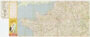
France.
1 : 1964160 Stanford, Edward
Gallia Antiqua. (1826)
1 : 5200000 Tanner, Henry S.