Maps of Lyon County

Wichman Canyon
1 : 24000
Pine Grove Hills
1 : 62500
Pine Grove Hills
1 : 62500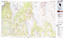
Smith Valley
1 : 100000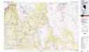
Smith Valley
1 : 100000
Walker Lake
1 : 250000
Walker Lake
1 : 250000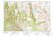
Walker Lake
1 : 250000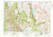
Walker Lake
1 : 250000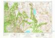
Walker Lake
1 : 250000
Walker Lake
1 : 250000
Walker Lake
1 : 250000
Walker Lake
1 : 250000
57. Parts Of Southern Nevada And Eastern California.
1 : 506880 Wheeler, G.M.
Topographical Map of Central California Together With a Part of Nevada, Sheet IV.
1 : 380160 Whitney, J.D.
Topographical Map of Central California Together With a Part of Nevada, Sheet I.
1 : 380160 Whitney, J.D.
Topographical Map of Central California Together With a Part of Nevada, Sheet II.
1 : 380160 Whitney, J.D.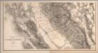
Composite: Topographical Map of Central California Together With a Part of Nevada, Sheets III-IV.
1 : 380160 Whitney, J.D.
Composite: Topographical Map of Central California Together With a Part of Nevada, Sheets I-IV.
1 : 380160 Whitney, J.D.
Topographical Map of Central California Together With a Part of Nevada, Sheet III.
1 : 380160 Whitney, J.D.
Topographic Map of the Los Angeles Aqueduct and Adjacent Territory
1 : 1316800 [California? : s.n.]
Map Of The San Joaquin, Sacramento And Tulare Valleys.
1 : 760320 United States. Congress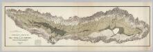
Topographical and Irrigation Map of the Great Central Valley of California.
1 : 380000 California State Engineering Department
Irrigation map of southern California.
1 : 506880 U.S. Dept. of Agriculture, Bureau of Public Roads, Irrigation Investigations.|~|"Revised and redrawn 1920 in cooperation with California State Dept. of Engineering; College of Agriculture, University of California; California State Water Commission."|~|Covers the area from Owens Lake over to Santa Barbara County, south to the Mexican border.|~|Includes location map and inset of Owens Valley.|~|Relief represented by shading.|~|Shows agricultural areas, irrigated areas, irrigation canals, boundaries of irrigation districts, principal hydroelectric plants, U.S. Geological Survey and private stream gauging stations, and rainfall stations.|~|UCLA Catalog Record United States. Bureau of Public Roads. The Bureau
Pageant of history in Northern California
"Published on its 100th anniversary by American Trust Company, San Francisco." "Lithogravure in U.S.A." Sheets, Millard San Francisco : American Trust Co
DeGroot's Map Of Nevada Territory.
1 : 776160 Holt, Warren
Nevada.
1 : 3100000 Holdredge, Sterling M.
Nevada.
1 : 2200000 Cram, George Franklin; Davis, Ellis Arthur
Nevada.
1 : 1750000 Rand McNally and Company
State Of Nevada.
1 : 1013760 U.S. General Land Office

