Maps of Central Valley

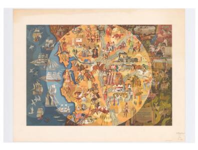
Pageant of history in Northern California
"Published on its 100th anniversary by American Trust Company, San Francisco." "Lithogravure in U.S.A." Sheets, Millard San Francisco : American Trust Co
Map Of The San Joaquin, Sacramento And Tulare Valleys.
1 : 760320 United States. Congress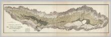
Topographical and Irrigation Map of the Great Central Valley of California.
1 : 380000 California State Engineering Department
Irrigation map of southern California.
1 : 506880 U.S. Dept. of Agriculture, Bureau of Public Roads, Irrigation Investigations.|~|"Revised and redrawn 1920 in cooperation with California State Dept. of Engineering; College of Agriculture, University of California; California State Water Commission."|~|Covers the area from Owens Lake over to Santa Barbara County, south to the Mexican border.|~|Includes location map and inset of Owens Valley.|~|Relief represented by shading.|~|Shows agricultural areas, irrigated areas, irrigation canals, boundaries of irrigation districts, principal hydroelectric plants, U.S. Geological Survey and private stream gauging stations, and rainfall stations.|~|UCLA Catalog Record United States. Bureau of Public Roads. The Bureau
Topographical Map of Central California Together With a Part of Nevada, Sheet IV.
1 : 380160 Whitney, J.D.
Topographical Map of Central California Together With a Part of Nevada, Sheet I.
1 : 380160 Whitney, J.D.
Topographical Map of Central California Together With a Part of Nevada, Sheet II.
1 : 380160 Whitney, J.D.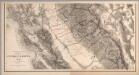
Composite: Topographical Map of Central California Together With a Part of Nevada, Sheets III-IV.
1 : 380160 Whitney, J.D.
Composite: Topographical Map of Central California Together With a Part of Nevada, Sheets I-IV.
1 : 380160 Whitney, J.D.
Topographical Map of Central California Together With a Part of Nevada, Sheet III.
1 : 380160 Whitney, J.D.
Bancroft's New Map Of Central California.
1 : 760320 Knight, W.H.
Composite: Sheets Nos. 1-4, Irrigation Map of the San Joaquin Valley, California.
1 : 190000 California State Engineering Department
California, Nevada (NW)
1 : 633600 United States. Post Office Dept.
California, Nevada (NW)
1 : 633600 United States. Post Office Dept.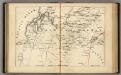
Central California.
1 : 2471040 Holdredge, Sterling M.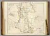
The Colony of Western Australia.
1 : 980000 Arrowsmith, John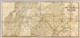
The Central Part of the State of California.
1 : 253440 Poett, A.
San Francisco Bay to N. boundary of California.
1 : 760320 Williamson, R.S.
Coast Ranges showing San Andreas Rift.
1 : 760320 California. State Earthquake Investigation Commission
Northern California.
1 : 2150000 Holdredge, Sterling M.
Mining District of California.
1 : 595000 Jackson, William A.
Coast Range Middle California distribution of earth movement.
1 : 640000 California. State Earthquake Investigation Commission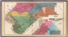
Fresno County, Calif.
1 : 380160 Thompson, Thos. H.
Map Fresno County.
1 : 278000 McKay, Scott
Map of the Valley of the Sacramento including the Gold Region.
Larkin, Thomas Oliver, 1802-1858
San Francisco and vicinity.
1 : 300960 Standard Oil Company of California
Shell San Francisco and Vicinity.
1 : 300960 Shell Oil Company
Sacramento, Amador, Calaveras, San Joaquin, Tuolumne, Stanislaus, Merced, and Mariposa Counties.
1 : 443529 Blum, George W.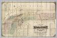
Nevada County, California.
1 : 79200 Hartwell, J.G.