Maps of Todd County

Sharon Grove
1 : 24000
Sharon Grove
1 : 24000
Sharon Grove
1 : 24000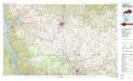
Hopkinsville
1 : 100000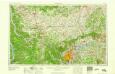
Nashville
1 : 250000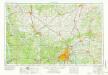
Nashville
1 : 250000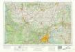
Nashville
1 : 250000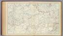
Gen. map XV.
1 : 633600 United States. War Department
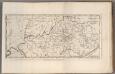
S.W. Territory.
1 : 4171860 Scott, Joseph
Western Battle-Ground. Western Naval Expedition Map
Western Battle-Ground. Western Naval Expedition Map. Published by Prang, Western Naval Expansion Map, Showing Tennessee & Mississippi Rivers details the middle states of the Confederacy and the Border State of Kentucky and highlights forts, railroads and cities in the region. The portrait at the corner of the map is Commander Andrew Hull Foot who commanded navy gunboats in the region and aided General Ulysses S. Grant in Union victory at For Henry in February 1862. The fort is labelled on the top right of the map. L. Prang & Co.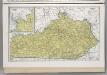
Kentucky.
1 : 1183000 Hammond, C.S.
New Map Of Kentucky.
1 : 2000000 Mitchell, Samuel Augustus
Kentucky.
1 : 2050000 Meyer, Joseph, 1796-1856
New Map Of Kentucky.
1 : 2050000 Tanner, Henry S.
Kentucky.
1 : 1850000 Goodrich, S.G.
Kentucky.
1 : 1900000 Bradford, Thomas G.
New Map Of Kentucky.
1 : 2050000 Tanner, Henry S.
Kentucky.
1 : 2200000 Finley, Anthony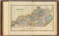
Kentucky.
1 : 1300000 Lucas, Fielding Jr.
Kentucky.
1 : 4752000 Henshaw, Frances A.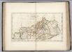
Kentucky.
1 : 1475000 Carey, Mathew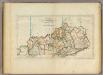
Kentucky.
1 : 1520640 Carey, Mathew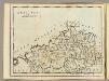
Kentuckey.
1 : 3674880 Carey, Mathew
A map of Kentucky, drawn from actual observations by John Filson.
from The American geography; or, A view of the present situation of the United States of America: containing astronomical geography; geographical definitions, discovery, and general description ... By Jedidiah Morse, A.M.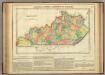
Map Of Kentucky.
1 : 1393920 Lea, I.
Kentucky.
1 : 2400000 Lewis, Samuel
Kentucky.
1 : 2400000 Lewis, Samuel
Tennessee.
1 : 1750000 DeSilver, Robert
Tennessee.
1 : 1550000 Cram, George Franklin; Davis, Ellis Arthur
Kentucky.
1 : 1393920 Carey, Mathew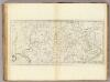
Kentucky.
1 : 1393920 Carey, Mathew
Kentucky.
1 : 1710720 Carey, Mathew